Showing posts with label Mount Momotombo. Show all posts

Monday, 4 January 2016

Second eruptive episode on Mount Momotombo.

Mount Momotombo in Nicaragua underwent a series of explosive eruptions on Sunday 3 December 2015, with an initial eruption that produced incandescent (glowing) material slightly after 4.20 am local time, and two further explosions in the afternoon, slightly before and after 2.30 pm. The volcano also underwent a series of explosive eruptions on 1 December last year (2015), the first such events since 1905.

Webcam image of Mount Momotombo slightly after 2.30 pm on Sunday 3 December 2015. Instituto Nicaragüense de Estudios Territoriales.

Although the 1 December eruption was the first explosive eruption on the volcano since 1905, a small lava flow was recorded in 1980 and Earthquakes and gas emissions have been recorded on several occasions since.Eruptions on Momotombo are rare, they can be severe and are a cause for concern. In 1610 an eruption on the volcano led to the destruction of the city of León on the shore of Lago de Managua, and while it was rebuilt as the modern city of León about 30 km to the west, the modern town of Puerto Momotombo has grown around the ruins.

 The location of the Mount Momotombo. Google Maps.

Nicaragua is located on the southern edge of the Caribbean Plate, which underlies Central America as well as the Caribbean Sea. To the south the Cocos Plate, which underlies part of the eastern Pacific, is being subducted beneath the Caribbean Plate along the Middle American Trench, passing under Central America as it is sinks into the Earth. As it is subducted the Cocos Plate is being partially melted by the heat of the planet's interior and the friction caused by its dragging under the Caribbean Plate, producing liquid magma, which then rises through the overlying plate fueling the volcanoes of Central America.

 Diagrammatic representation of the Cocos Plate passing beneath the Central American Plate, showing how it fuels the volcanoes of Central America. VCS Mining.

See also...

http://sciencythoughts.blogspot.co.uk/2015/12/eruption-on-mount-momotombo-nicaragua.htmlEruption on Mount Momotombo, Nicaragua. Authorities in Nicaragua have reported an eruption on Mount Momotombo, a volcano in the east of the country, on Tuesday 1 December 2015. The eruption produced a column of gas and ash that rose about a kilometer over the summit of the volcano, and people in several...
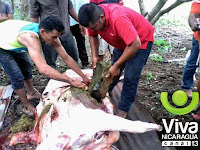
http://sciencythoughts.blogspot.co.uk/2015/11/cattle-killed-by-eruption-on-mount.htmlCattle killed by eruption on Mount Telica, Nicaragua.                                                 Mount Telica, an active volcano in northwest Nicaragua, underwent an eruptive episode on Sunday 22 November 2015, with two rapid explosions reported shortly after 8.45 am, which threw fragments of rock up to 900 m from the crater, resulting in the deaths of several... 
http://sciencythoughts.blogspot.co.uk/2014/10/one-dead-after-central-american.htmlOne dead after Central American Earthquake.                                                   The United States Geological Survey recorded a Magnitude 7.3 Earthquake at a depth of 40 km, roughly 67 km offshore of the Nicaraguan coastal resort...

Follow Sciency Thoughts on Facebook.
 

Tuesday, 1 December 2015

Eruption on Mount Momotombo, Nicaragua.

Authorities in Nicaragua have reported an eruption on Mount Momotombo, a volcano in the east of the country, on Tuesday 1 December 2015. The eruption produced a column of gas and ash that rose about a kilometer over the summit of the volcano, and people in several nearby villages have reported ill effects caused by gasses from the event. This is the first explosive eruption on the volcano since 1905. Though a small lava flow was recorded in 1980 and Earthquakes and gas emissions have been recorded on several occasions since. Although eruptions on Momotombo are rare, they can be severe and are a cause for concern. In 1610 an eruption on the volcano led to the destruction of the city of León on the shore of Lago de Managua, and while it was rebuilt as the modern city of León about 30 km to the west, the modern town of Puerto Momotombo has grown around the ruins.

Ash column over Mount Momotombo on 1 December 2015. ACAN-EFE.

Nicaragua is located on the southern edge of the Caribbean Plate, which underlies Central America as well as the Caribbean Sea. To the south the Cocos Plate, which underlies part of the eastern Pacific, is being subducted beneath the Caribbean Plate along the Middle American Trench, passing under Central America as it is sinks into the Earth. As it is subducted the Cocos Plate is being partially melted by the heat of the planet's interior and the friction caused by its dragging under the Caribbean Plate, producing liquid magma, which then rises through the overlying plate fueling the volcanoes of Central America.

Diagrammatic representation of the Cocos Plate passing beneath the Central American Plate, showing how it fuels the volcanoes of Central America. VCS Mining.

See also...

Cattle killed by eruption on Mount Telica, Nicaragua.                                                 Mount Telica, an active volcano in northwest Nicaragua, underwent an eruptive episode on Sunday 22 November 2015, with two rapid explosions reported shortly after 8.45 am, which threw fragments of rock up to 900 m from the crater, resulting in the deaths of...
One dead after Central American Earthquake.                                                 The United States Geological Survey recorded a Magnitude 7.3 Earthquake at a depth of 40 km, roughly 67 km offshore of the Nicaraguan coastal resort...
At least 23 injured after Magnitude 6.1 Earthquake strikes Nicaragua.                    The United States Geological Survey recorded a Magnitude 6.1 Earthquake at a depth of 13 km on the northern shore of Lago de Managua in Nicaragua, slightly before 5.30 pm local time (slightly before 11.30...
Follow Sciency Thoughts on Facebook.

Wednesday, 3 July 2013

Seismic activity on Mount Momotombo in western Nicaragua.

The Instituto Nicaragüense de Estudios Territoriales recorded a sharp increase in seismic activity on Mount Momotombo, a volcano in the east of the country, on Monday 1 July 2013, which persisted over the next 24 hours, and included several Earthquakes with Magnitudes in excess of 3.0. Such bouts of seismic activity can mean that fresh magma os moving into chambers beneath a volcano, an can hereld an eruption, though this is not always the case. Momotombo is considered an active volcano having erupted 15 times since it was first encountered by Spanish explorers in the sixteenth century, but has not undergone a significant confirmed eruption since 1905 (there may have been one in 1918, but this is uncertain).

Mount Momotombo seen from the south, Lake Managua in the foreground. University of California Santa Cruz.

Nicaragua is located on the southern edge of the Caribbean Plate, which underlies Central America as well as the Caribbean Sea. To the south the Cocos Plate, which underlies part of the eastern Pacific, is being subducted beneath the Caribbean Plate along the Middle American Trench, passing under Central America as it is sinks into the Earth. As it is subducted the Cocos Plate is being partially melted by the heat of the planet's interior and the friction caused by its dragging under the Caribbean Plate, producing liquid magma, which then rises through the overlying plate fueling the volcanoes of Central America.


Follow Sciency Thoughts on Facebook.