Showing posts with label Panama. Show all posts

Wednesday, 6 March 2024

Archaeologists uncover tomb of a Gran Coclé lord in southern Panama.

Archaeologists from the El Caño Foundation have uncovered a tomb which they interpret as belonging to a lord or other important figure from the Gran Coclé culture within the El Caño Archaeological Park in Coclé Province, southern Panama, according to a press release issued by the Panamanian Ministry of Culture. The tomb is thought to date to between 750 AD and 800 AD, and contains a variety of gold and ceramic objects, as well as an elaborate funerary trousseau (burial costume) comprising five pectorals (large medallions work on a necklace in the centre of the breast), two belts of spherical gold beads, four bracelets, two earrings in the shape of human figures (a man and a woman), an earring in the shape of a double crocodile, a necklace of small circular beads, five earrings made with sperm whale teeth with gold covers, a set of circular gold plates, two bells, bracelets and skirts made with dog teeth and a set of bone flutes.

Gold items recovered from the tomb of a Gran Coclé lord excavated within the El Caño Archaeological Park. Panamanian Ministry of Culture.

Most notably, and in common with other burials associated with important people of the Gran Coclé culture, the main occupant of the tomb was not buried alone, but with a number of companions. Previous excavations of such tombs have found between eight and thirty two people buried in addition to the main occupant, who were presumably either sacrificed at the time of the tomb owner's death, or had died previously and been stored elsewhere until the main burial. The tomb has not yet been completely excavated, so it is unclear how many additional bodies there are. What is noteworthy is that the  main  occupant of the tomb was buried face down (common for important Gran Coclé figures) on top of the body of a woman.

An earing in the shape of a man uncovered during the excavation of the tomb of a Gran Coclé lord. Panamanian Ministry of Culture.

The El Caño Archaeological Park contains a series of funerary sites associated with the Gran Coclé culture, dated to between 700 AD and 1000 AD. The site has been excavated intermittently since it was discovered in 1925, and is considered to be Panama's most important archaeological site as well as a major tourist attraction, making an important contribution to the economy of the region.

Further gold items excavated from the tomb of a Gran Coclé lord. Panamanian Ministry of Culture.

See also...

Saturday, 17 February 2024

Oil spill on the coast of Tobago, following wreck of mystery barge.

An oil slick has spread over 160 km on the Caribbean Sea following the wreck of a barge off the coast of the island of Tobago on 7 February 2024. The wreck was not reported by the barge's owners, but instead was spotted by beachgoers who reported it to the Tobago Emergency Management Authority. The barge has capsized on Cove Reed, off the southern coast of the island, and oil from it has spread over reefs and beaches along the southern tip of the island, as well as spreading across the Caribbean Sea towards Grenada and Venezuela.

An aerial image of the capsized barge. Office of the Chief Secretary of Tobago.

The barge appears to have been an unmanned and unpowered vessel, and has the word 'Gulfstream' painted on its side. As an unmanned, unpowered vessel it would not have been required to register with the International Maritime Organization, nor to carry an Automatic Identification System tracker, although it would have been partnered with a manned tugboat, which should (in theory) have complied with both of these requirements.

Before and after satellite images from the Copernicus Sentinel-1 mission show the scale of the oil spill that occurred off the shores of Trinidad and Tobago’s coastline earlier this week. The vessel, identified as the Gulfstream, ran aground and overturned off the southern shores of Tobago Island. The final image of the animation, captured at 10.18 pm GMT on 14 February, shows the oil spill has travelled over 160 km westwards. The spill is moving out of Trinidad and Tobago’s marine area and into Grenada’s southernmost marine area – which could affect neighbouring Venezuela. Satellite radar is particularly useful for monitoring the progression of oil spills because the presence of oil on the sea surface dampens down wave motion. Since radar basically measures surface texture, oil slicks show up well – as black smears on a grey background. European Space Agency.

An investigation by the Trinidad and Tobago Coast Guard found that a barge identified as the Gulfstream left Panama en route for Guyana coupled to a tug called the Solo Creed on 12 January 2024, and that authorities in Guyana reported that neither vessel arrived there. The Solo Creed, identified by the Vessel Finder website as a Tanzanian registered towing vessel, which visited Aruba on 20 January, and was last detected off the coast of Venezuela on 4 February.

An image of the capsized barge on 10 February 2023. Tobago House Assembly/AFP.

The Bellingcat investigative agency has identified a double-hulled barge capable of carrying 60 000 barrels of oil (i.e. 9.5 million litres) called the Gulfstream which was coupled to a tugboat called the Marlin, operating within the United States until 2012, which appears to be a good physical match for the vessel off the coast of Tobago. The Marlin was sold to the Panamanian San Martin Group in 2014, and while there are no official records of the Gulfstream after this, Bellingcat has found photographic evidence of the two vessels operating together between Panama and Venezuela between 2015 and 2020. The Marlin was sold on to another Panamanian company, Star Goods Petroleum, in 2021, and has not transmitted its position since. The Gulfstream was observed in the Astinave shipyard in Ecuador in February 2022, but has not been sighted since. Bellingcat suspect that the renamed Marlin and Gulfstream may still be operating together, as part of a 'ghost fleet' carrying embargoed Iranian oil to Venezuela. Many oil-carrying vessels operating out of Venezuela are considered to be poorly maintained to the point of being dangerous, and the Marlin and Gulfstream, if still operating together, would be 60- and 58-years-old respectively; both vessels would have been built with a planned lifetime of 30 years.

Oil spills are potentially harmful to marine life in a variety of ways. Most obviously it can coat the outside of organisms, causing damage to external structures such as the feathers of Birds and fur of Mammals, as well as smothering many marine invertebrates and plants. It also contains a variety of chemicals which can be directly toxic upset the hormonal balance of many animals. Oil also impedes the feeding of marine organisms, coating both food and feeding organs, but provides an excellent food source for Bacteria, which can lead to Eutrophication events - dramatic increases in Bacteria numbers, which then use all the oxygen in the water, leading other organisms to asphyxiate.

Workers from state own Heritage Petroleum Oil and Gas Company, the state oil company of Trinidad and Tobago, clean up an oil spill that reached Rockly Bay beach, in Scarborough, south western Tobago. Akash Boodan/AP.

Many fishermen on the southern part of Tobago are reporting vessels and equipment damaged by exposure to oil, and beaches across the southern part of the island being forced to close to tourists at the height of the tourist season. Volunteers and local specialists have recovered about 2000 barrels of oil from beaches on Tobago, but the vessel is still leaking and will probably need to be emptied of oil before it can be refloated and the damage repaired.

See also...

Sunday, 28 May 2023

Magnitude 6.5 Earthquake off the northern coast of Panama and Colombia.

The United States Geological Survey recorded a Magnitude 6.5 Earthquake at a depth of 13.0 km, off the Caribbean coasts of Panama and Colombia, about 50 km to the northeast of the border between the two countries, slightly after 10.05 pm local time on Wednesday 24 May 2023 (slightly after 3.05 am on Thursday 25 May, GMT). There are no reports of any damage or casualties associated with this event, though it was felt across much of northern Colombia, Panama and parts of Costa Rica.

The approximate location of the 24 May 2023 Pananma/Colombia Earthquake. USGS.

The event happened close to the triple junction between the Panama, Caribbean, and South American plates. All three plates are drifting to the northwest, being pushed by the expansion of the Atlantic Ocean, and to a lesser extent the eastward movement of the Nazca Plate, which is being subducted beneath the South American Plate along the west coast of South America. However, the South American Plate is moving somewhat faster than the other two plates, causing the Panama Plate to be pushed to the west, creating a transform plate margin, as the Panama Plate moves west relative to the Caribbean Plate, along the northern coast of Panama, and a subductive plate margin, as the Caribbean Plate is forced under the advancing South American Plate, along the northern coast of Colombia. 

The tectonic plates underlying Central America and the surrounding areas. Wikimedia Commons.

See also...


Follow Sciency Thoughts on Facebook.

Follow Sciency Thoughts on Twitter


Saturday, 22 October 2022

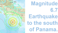
Magnitude 6.7 Earthquake to the south of Panama.

The United States Geological Survey recorded a Magnitude 6.7 Earthquake at a depth of 10.0 km, about 62 km off the south coast of Chiriquí Province on the Pacific Coast of Panama, slightly before 7.00 am local time (slightly before midday GMT) on Thursday 20 October 2022. There are no reports of any damage or casualties associated with this event, though it was felt across much of Panama and Costa Rica.

The approximate location of the 20 October 2022 Pananma Earthquake. USGS.

Panama lies on a tectonic microplate known as the Panama Plate or Panama Block, which has broken away from the North American Plate within the last 20 million years, and is now caught between the Caribbean, Cocos, Nazca and South American Plates. The southern margin of this is both a convergent and a transform margin, as the Nazca Plate moves past the Panama plate in a westerly direction, but is also being partially subducted beneath Panama. This is not a smooth process; the two plates continually stick together, then break apart once the pressure builds up sufficiently, causing Earthquakes in the process.

The tectonic plates underlying Central America and the surrounding areas. Wikimedia Commons.

See also...

Follow Sciency Thoughts on Facebook.

Follow Sciency Thoughts on Twitter.


Sunday, 16 January 2022

Pristimantis gretathunbergae: A new species of Rain Frog from Panama, named in honour of Swedish climate activist Greta Thunberg.

Tropical forests are noted for their high biodiversity and species richness, with a wide range of ecological variables which favour the emergence of numerous species with limited distributions among some groups of Animals and Plants. One such group are the Anurans (Frogs), of which very high species numbers are found in many tropical regions. One particularly notable group of Frogs are the Rain Frogs, Pristimantis spp., of the Caribbean and Central and South America. The genus Pristimantis currently contains at least 574 species (possibly the highest number of species in any Vertebrate genus), distributed primarily in Tropical Andes of Colombia, Ecuador, and Peru, yet is considered to be understudied, with many more species likely to exist (124 species have been described within the past decade), and many of the currently described species having uncertain relationships to other members of the group. The species richness within this genus is driven by its ability to breed away from water, enabling them to colonise environments closed to other Frogs, while the taxonomic uncertainty is caused by the high variability of many species, with members of different species often resembling one-another than they do members of their own species. This is slowly being unravelled with modern genetic methods, although this is showing an even greater diversity within the genus than previously supposed, apparently caused by a recent radiation event, resulting in the genus now comprising 7.4% of all known Anuran species, and 6.7% of all Lisamphibians.

In a paper published in he journal ZooKeys on 10 January 2022, a team of scientists led by Konrad Mebert of the Programa de Pós-graduação em Zoologia at the Universidade Estadual de Santa Cruz, Global Biology, and Los Naturalistas, describe a new species of Rain Frog from Panama.

The new species is named Pristimantis gretathunbergae, in honour of Swedish climate activist Greta Thunberg, for her 'authentic voice that exposes the motivations behind the diplomatic curtain of politicians and business stakeholders'. The species is described upon the basis of a series of specimens collected on the top of Cerro Chucantí in the Maje Mountains of Darién Province, Panama, though the species was later shown to be found across a wider area.

   
Colouration in life of specimens of Pristimantis gretathunbergae sp. nov. and Pristimantis cruentus from eastern Panama. (A) Holotype male (MHCH 3082), Cerro Chucantí. (B) Paratype female (SMF97520), Cerro Chucantí. (C) :eft, paratype female (MHCH 3081), right Pristimantis cruentus female (MHCH3034). (D) Female from Cerro Chucantí, not collected. (E) Female (MHCH3115) La Javillosa. (F) Female, Cerro La Javillosa, Ambroya, Maje Mountain Range (SMF97517). (G) Female (MHCH3079), Rio Tuquesa. Coloured lines point to some diagnostic characters as follow: red: blackish iris; yellow: single spine-like tubercle; turquoise: light-coloured upper lip; pink: cream, yellow to red groin. Mebert et al. (2022).

Pristimantis gretathunbergae has a slightly blotchy brown colouration, more notable on the darker upper surface than the paler lower side, this is accentuated by a scattering of tubercles on the dorsal surface. The tympanum (ear) is invisible, or at least hard to distinguish, the snout is short and slightly rounded, and the upper eyelid has a spine-like tubercle. Each vomer (bone in the roof of the mouth, behind the jaw, bears 5-10 teeth. The groin and inner thighs are white, yellow or orange-red, some with flecks matching the dorsal ground colour or red. The iris is black, though some individuals have a very dark red iris, or a black iris with red-golden speckling.

 
Habitat, mating, and parental care in females of Pristimantis gretathunbergae from Cerro Chucantí. (A) Habitat on Cerro Chucantí at about 1300 m above sealevel. (B) Understory Bromeliad with a Pristimantis gretathunbergae in situ (blue line) and zoomed in on inset (MHCH 3115). (C) Amplectant pair on axillary part of Bromeliad leaf (not collected). (D) Same female after amplexus guarding eggs. (E) Female of Pristimantis gretathunbergae taking care of its eggs with a male Pristimantis cruentus holding on the female in reverse position (not collected). (F) Female with eggs about to hatch, note the transparency of the egg membrane (not collected). Mebert et al. (2022).

Wider sampling, combined with genetic profiling of collected specimens, found that Pristimantis gretathunbergae is present across much of eastern Panama, and could potentially be present in adjacent areas of Colombia. The species was found in the Darien Mountains within Embera Comarca and the Maje Mountains within Darien and Panama Provinces, including the type locality at Cerro Chucantí. The species was also found to be present in parts of western Panama, including the Piedras-Pacora Mountains in Panama Province, and Cerro Bruja in Colon Province, both within the Chagres National Park. Beyond the Panama Canal Pristimantis gretathunbergae is present in the Altos del Maria region of the Gaita Hills in Panama Oeste Province, and in the region of El Cope within the Omar Torrijos National Park in Coclé Province.

Pristimantis gretathunbergae has been recorded at altitudes of between 718 and 1439 above sealevel, predominantly within montane forest (cloud forest consisting predominantly of trees covered with Moss and a large variety of understory and midstory Bromeliads). During the nights the Frogs were found from 50 cm to 3 m above the ground on tree bark and in the Bromeliad foliage; in the day they hid between Bromeliad leaves. In the rainy season the males make a sporadic 'chack' call. Females have been observed guarding clusters of eggs in Bromeliads and on Moss-covered tree branches. The species has not been observed eating, but other members of the genus Pristimantis feed primarily on small Arthropods, such as Ants, Orthopterans, and Spiders.

Despite its widespread distribution, Mebert et al, believe that Pristimantis gretathunbergae is likely to face decline of many populations due to habitat destruction caused by anthropogenic pressure. Only a few areas where the species is found are within National Parks or other protected areas, and the species is known only from patches of primary forest and slightly disturbed areas, many of which are surrounded by agriculture and pastures. The species is also found close to areas where Amphibian populations have been decimated by the Chytrid Fungus, Batrachochytrium dendrobatidis, which the species must also be presumed to be threatened by. For this reason, Mebert et al. recommend that Pristimantis gretathunbergae be classified as Vulnerable under the terms of the International Union for the Conservation of Nature’s Red List of Threatened Species

See also...


Follow Sciency Thoughts on Facebook.

Follow Sciency Thoughts on Twitter.


Friday, 6 November 2020

Landslides kill more than 50 in Guatemala, as Hurricane Eta sweeps across Central America.

More than fifty people are thought to have died in a series of landslides in Guatemala, with around half the deaths associated with a single event in the town of San Cristobal Verapaz, where a mudslide swept away about 20 houses. Elsewhere, another ten people were killed in a landslide in Huehuetenango Department, two children died when their home was destroyed by a landslide in Santa Barbara Department in the north of the country and a second pair of children died in another landslide incident in Quiche Department, also in the north, while a third pair of children died in a separate landslide in the south of the country. Another landslide in the south has left one person dead and another two missing, while another person died in a landslide close to Guatemala City. All of these landslides have been brought on by heavy rains associated with Hurricane Eta. Landslides are a common problem after severe weather events, as excess pore water pressure can overcome cohesion in soil and sediments, allowing them to flow like liquids. Approximately 90% of all landslides are caused by heavy rainfall. Despite not being directly hit by the storm, Guatemala has suffered badly because of it, with flooding across much of the country, and at least five major bridges, and numerous roads, swept away.


Flooding in Guatemala City associated with Hurricane Eta. Johan Ordonez/AFP.

Across central America about 70 people are thought to have died in incidents related to Hurricane Eta, which was a Category 4 Hurricane when it made landfall, bringing with it winds of up to 225 km per hour, to the south of the city of Puerto Cabezas. Two people are known to have died in Nicaragua as a result, and two in Honduras. In Panama, five people were killed when a landslide buried their homes in Chiriqui Province, close to the border with Costa Rica, while in Costa Rica a 71-year-old American citizen and his 51-year-old Costa Rican wife died in a landslide at Coto Brus in Puntarenas Province. El Salvador has also reported a number of landslides, though no fatalities at the current time.

 
The aftermath of a landslide in Chiriqui Province, Panama, caused by heavy rainfall associated with Hurricane Eta. AFP.

Hurricane Eta has lost energy as it has passed over Central America, and been downgraded from a hurricane to a tropical storm, but it is expected to travel northwest over the next few days, gaining strength again as it passes over the Caribbean, and potentially threatening the populations of Cuba and Florida. The casualty rate was probably been kept down by the evacuation of about 20 000 people from its path in Nicaragua, and Honduras.

 
The path and strength of Hurricane Eta. Thick line indicates the past path of the storm (till 3.00 am GMT on Friday 6 August 2020), while the thin line indicates the predicted future path of the storm, and the dotted circles the margin of error 9, 21, 33, 45, 69, 93 and 117 hours ahead. Colour indicated the severity of the storm. Tropical Storm Risk.

Tropical storms are caused by solar energy heating the air above the oceans, which causes the air to rise leading to an inrush of air. If this happens over a large enough area the inrushing air will start to circulate, as the rotation of the Earth causes the winds closer to the equator to move eastwards compared to those further away (the Coriolis Effect). This leads to tropical storms rotating clockwise in the southern hemisphere and anticlockwise in the northern hemisphere. These storms tend to grow in strength as they move across the ocean and lose it as they pass over land (this is not completely true: many tropical storms peter out without reaching land due to wider atmospheric patterns), since the land tends to absorb solar energy while the sea reflects it.

 
The formation of a tropical cyclone. Natural Disaster Management.

Despite the obvious danger of winds of this speed, which can physically blow people, and other large objects, away as well as damaging buildings and uprooting trees, the real danger from these storms comes from the flooding they bring. Each drop millibar drop in air-pressure leads to an approximate 1 cm rise in sea level, with big tropical storms capable of causing a storm surge of several meters. This is always accompanied by heavy rainfall, since warm air over the ocean leads to evaporation of sea water, which is then carried with the storm. These combined often lead to catastrophic flooding in areas hit by tropical storms. 

 
The formation and impact of a storm surge. eSchoolToday.

See also...


Follow Sciency Thoughts on Facebook.

Follow Sciency Thoughts on Twitter.