Showing posts with label Quebec. Show all posts

Sunday, 29 March 2020

Magnitude 3.6 Earthquake near Montreal, Quebec.

Natural Resources Canada recorded a Magnitude 3.6 Earthquake at a depth of 18 km, about 39 km to the north of the city of Montreal in Quebec, slightly after 3.20 am local time (slightly after 7.20 am GMT) on Sunday 29 March 2020. There are no reports of any damage or injuries associated with this event, though it was felt across much of southern Quebec as well as in the US state of Vermont.

The approximate location of the 29 March 2020 Montreal Earthquake. USGS.

The quake took place within the Western Quebec Seismic Zone, an area of intraplate seismic activity underlying part of southwest Quebec and southeast Ontario. The precise cause of tectonic activity here is unclear, with different opinions being held by geologists in the area. The area is underlain by a number of ancient deep faults associated with ancient mountain-building episodes, though it is unclear how these relate to the quakes. Alternatively the activity may be related to the Great Meteor Hot Spot an area of magmatic upwelling that originates deep beneath the Earth's tectonic plates, and therefore moves separately of them. The hotspot is currently located to the south of the Azores, though it has been active for at least 125 million years, moving across southwest Canada and the eastern United States before crossing the Atlantic Ocean. Finally the events could be the result of glacial rebound; until about 10 000 much of northern North America was covered by a thick layer of glacial ice, which pushed the rocks of the lithosphere down into the underlying mantle. The ice as now long since melted, but the rocks are still springing back into their original position, causing the occasional Earthquake in the process.
 
Witness reports can help geologists to understand the processes going on in Earthquakes and the structures in the rocks that cause them. If you felt this quake you can report it to Natural Resources Canada here.

See also...
https://sciencythoughts.blogspot.com/2015/03/three-people-hospitalized-following.htmlhttps://sciencythoughts.blogspot.com/2014/05/magnitude-38-earthquake-beneath-st.html
https://sciencythoughts.blogspot.com/2014/04/cottages-destroyed-by-tsunami-on-lac.htmlhttps://sciencythoughts.blogspot.com/2013/09/magnitude-46-earthquake-beneath-st.html
https://sciencythoughts.blogspot.com/2013/07/massive-oil-explosions-in-quebec.htmlhttps://sciencythoughts.blogspot.com/2013/05/quebec-earthquake-felt-in-new-york.html
Follow Sciency Thoughts on Facebook.

Sunday, 12 November 2017

Eddianna gaspiana: A new species of Rhyniopsid Plant from the Early Devonian Battery Point Formation of Quebec.

The first Vascular Plants appeared some time in the Silurian, but the group did not apparently become a significant part of terrestrial ecosystems until the Early Devonian, when they underwent a major radiation, with a number of new groups appearing. One of these groups was the Rhyniopsids, simple Plants which lacked roots or leaves, but which did have simple stems with some vascular tissue.

In a paper published on the bioRxiv beta database at Cold Spring Harbour Laboratory on 9 October 2017, Kelly Pfeiler and Alexandru Tomescu of the Department of Biological Sciences at Humboldt State University describe a new species of Rhyniopsid Plant from the Early Devonian Battery Point Formation of Quebec.

The new species is named Eddianna gaspiana, where 'Eddianna'  honours Dianne Edwards of Cardiff University, for her work on Silurian and Devonian Plants, and 'gaspiana' refers to the Gaspé Peninsula in Quebec, where the Battery Point Formation outcrops and the specimens from which the new species is named were collected. The species is described from eighteen specimens, all preserved as calcareous cellular permineralizations within four cobbles. The stems of the plant are up to 2 mm in diameter, possibly larger, with a central xylem strand that takes up about 80% of the area, surrounded by layer of phloem 1-3 cells thick, then a ridged cortex.

Eddianna gaspiana gen. (A), (B) Axis cross sections exhibiting large primary xylem with potential centrarch maturation cylinders separated from thin, irregular sclerenchymatous cortex by a thin layer of phloem; note incomplete preservation of xylem at centre in (B). (C), (D) same images as in A and B, respectively, colourised to emphasise concentric zonation of the metaxylem, with larger tracheids in the outer zone (yellow) and narrower tracheids in the inner zone (brown); a thin discontinuous layer of very fine tracheids (more conspicuous in (B) and (D)) marks the border between the two zones; note subtle radial patterning of tracheids, locally, in the outer zone, and pattern of decreasing tracheid diameter toward xylem periphery. Scale bars are 300 μm. Pfieler & Tomescu (2017).

The thick cortex of Eddianna gaspiana suggests that these stems were not able to photosynthesise, while the high proportion of xylem suggests that they had a high capacity for water transport, which in turn suggests that these stems are the lower part of a larger plant that has not been preserved, used to convey water up to the photosynthetic part.

Eddianna gaspiana. (A), (B) Longitudinal sections of axis showing (right to left in (A) and left to right in (B)) metaxylem tracheids (light brown) with conspicuous helical wall thickenings; phloem layer (light brown) with narrow cells and fine, straight vertical cell walls; and incompletely preserved sclerenchymatous cortex (dark brown). Scale bars are 50 μm. (C) Longitudinal radial section of axis with large xylem strand (protoxylem compressed, distorted at centre); sclerenchymatous cortex (dark brown, at left and right); and thin phloem sandwiched between xylem and cortex; note conspicuous helical thickenings of metaxylem tracheids and fine band of much narrower tracheids (between arrowheads) between the two concentric zones of the metaxylem. Scale bar is 150 μm. (D) Scanning electron micrograph of tracheids with helical wall thickenings, note spongy structure of the thickenings, characteristic of Sennicaulis-type tracheids. Scale bar is 10 μm. Pfieler & Tomescu (2017).

See also...

http://sciencythoughts.blogspot.co.uk/2016/02/lycopsid-trees-from-earliest-late.htmlhttp://sciencythoughts.blogspot.co.uk/2013/05/the-first-leaves-leafy-plant-fossils.html
http://sciencythoughts.blogspot.co.uk/2012/12/two-new-species-of-moss-from-permian-of.htmlhttp://sciencythoughts.blogspot.co.uk/2012/02/permian-forest-preserved-in-volcanic.html
http://sciencythoughts.blogspot.co.uk/2012/02/did-first-land-plants-cause-ordovician.html
Follow Sciency Thought on Facebook.

Sunday, 22 March 2015

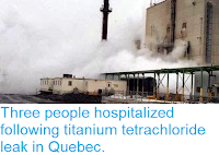
Three people hospitalized following titanium tetrachloride leak in Quebec.

Three people required hospital treatment and three factories and about fifteen homes were evacuated following an incident in which about a ton of the chemical titanium tetrachloride was spilled at a factory in Varennes, Quebec, on Saturday 21 March 2015. The incident occurred at about 10.00 am local time at the Kronos owned Varennes Plant, and resulted in the production of a large cloud of toxic gas as the chemical reacted with the atmosphere. People were allowed to return to their homes early on Sunday, after the majority of the spilled chemical was transfered to a secure area, though a 400 m exclusion zone around the site is still in place, and nearby roads remain closed.

Toxic fumes issuing from the Kronos Varennes Plant on Saturday 21 March 2015. TVA News.

Titanium tetrachloride is an intermediate product in the production of titanium metal and titanium dioxide. It is produced by passing chlorine gas over crushed titanium ores at high temperatures (typically in excess of 900°C). It can then be reacted with magnesium to produce pure titanium or converted to titanium dioxide by a process of hydrolysis. However it needs to be kept out of contact with the atmosphere, as it will react with any humidity in the atmosphere forming clouds of hydrochloric acid, which appears to have been the case at the Varennes Plant, although the speed at which this reaction occurs is largely governed by temperature, so the scale of the incident may have been minimized by the low temperatures prevalent in the area at the moment.

See also...

Residents of five towns in the Province of Barcelona, Spain, were forced to stay inside for much of the morning of Thursday 12 February 2015, after an explosion at the Simarsa chemicals plant  resulted in...

Methane (CH₄) is considered to be a serious atmospheric pollutant, both for its role as a greenhouse gas and its immediate effect on the area where it is released, where it can contribute to raised ozone levels at ground level, which is harmful to human health. It is currently calculated that methane is present in...

The Bushveld Igneous Complex is the world’s most productive area for platinum group metals, responsible for about 80% of global production, as well as having significant reserves of many other metals. It covers an area of 66 000 km² across the North West, Gauteng, Mpumalanga and Limpopo Provinces of South...


Follow Sciency Thoughts on Facebook.

Tuesday, 27 May 2014

Magnitude 3.8 Earthquake beneath the St Lawrence River Estuary.

Natural Resources Canada recorded a Magnitude 3.8 Earthquake beneath the St Lawrence River Estuary in Quebec, slightly before 5.35 pm local time (slightly before 9.35 pm GMT) on Monday 26 May 2014. There are no reports of any damage or injuries associated with this event, though it was felt in the city of Baie-Comeau on the north side of the estuary.

The approximate location of the 26 May 2014 St Lawrence River Estuary. Google Maps.

The Lower St. Lawrence Seismic Zone lies largely beneath the St. Lawrence River Estuary. Small quakes are very common here, averaging roughly one per week, but larger quakes are all but unheard of, with only two quakes in excess on a Magnitude 5.0 ever being recorded. The Seismic Zone is thought to be connected to a graben-structure (area of tectonic plate expansion) beneath the river, the formation of which relates to the opening of the Iapetus Ocean in the late Proterozoic to early Paleozoic, which has become reactivated during the breakup of Pangea and the formation of the Atlantic Ocean, around 150 million years ago. In a graben structure the Earth's crust is stretched and becomes thin, then faulting occurs allowing the central part to sink.

Witness reports can help geologists to understand the processes going on in Earthquakes and the structures in the rocks that cause them. If you felt this quake you can report it to Natural Resources Canada here.

See also...


Natural Resources Canada recorded a Magnitude 4.6 Earthquake...


A Magnitude 4.4 Earthquake occurred at a depth of 9 km in southern...


At about 2.25 am on Saturday 27 August 2011, the Canadian province of Quebec suffered a minor earthquake. The quake measured 3.0 on the Richter Scale and occurred at a depth of about 12.8 km, just about large and shallow enough to have been felt, but unlikely to have caused any damage. The epicenter of the quake was about 40 km to the east of Quebec City.


Follow Sciency Thoughts on Facebook.

Wednesday, 16 April 2014

Cottages destroyed by tsunami on Lac-des-Seize-Îles, Quebec.

Two cottages and four boathouses have been destroyed after a landslide triggered a tsunami on Lac-des-Seize-Îles in southern Quebec. The incident happened at about 12.20 pm local time on Tuesday 15 April 2014, when a combination of heavy rainfall and a the spring thaw triggered a mudslide on a hill overlooking the lake, triggering a large wave (tsunami) that struck properties on the far side of the lake. Landslides are a common problem after severe weather events, as excess pore water pressure can overcome cohesion in soil and sediments, allowing them to flow like liquids. Approximately 90% of all landslides are caused by heavy rainfall.

One of the properties struck by the 15 April 2014 Lac-des-Seize-Îles tsunami. Montreal Gazette.

The properties affected are understood to be holiday homes not used in the winter, and there are no reports of any injuries associated with this event, although emergency services have reported difficulty reaching all the properties in the area, as the tsunami also washed out several roads around the lake. Quebec is currently suffering from a number of flooding-related incidents, due to the combination of heavy rainfall and a sudden spring thaw.

The approximate location of Lac-des-Seize-Îles. Google Maps.

See also...


Follow Sciency Thoughts on Facebook.

Sunday, 22 September 2013

Magnitude 4.6 Earthquake beneath the St Lawrence River Estuary.

Natural Resources Canada recorded a Magnitude 4.6 Earthquake slightly before 10.50 am local time (slightly before 2.50 pm GMT) on Saturday 21 September 2013. This was a moderately large quake, and was felt on both sides of the estuary, though there are no reports of any damage or casualties.

The approximate location of the 21 September 2013 St Lawrence River Estuary Earthquake. Google Maps.

The Lower St. Lawrence Seismic Zone lies largely beneath the St. Lawrence River Estuary. Small quakes are very common here, averaging roughly one per week, but larger quakes are all but unheard of, with only two quakes in excess on a Magnitude 5.0 ever being recorded. The Seismic Zone is thought to be connected to a graben-structure (area of tectonic plate expansion) beneath the river, the formation of which relates to the opening of the Iapetus Ocean in the late Proterozoic to early Paleozoic, which has become reactivated during the breakup of Pangea and the formation of the Atlantic Ocean, around 150 million years ago. In a graben structure the Earth's crust is stretched and becomes thin, then faulting occurs allowing the central part to sink.

Witness reports can help geologists to understand the processes going on in Earthquakes and the structures in the rocks that cause them. If you felt this quake you can report it to Natural Resources Canada here.


Follow Sciency Thoughts on Facebook.

Sunday, 7 July 2013

Massive oil explosions in Quebec.

A runaway train carrying crude oil derailed and exploded in the Quebec town of Lac-Megantic, at about 1.00 am local time (4.00 am GMT) on Saturday 6 July 2013, causing a series of massive explosions that destroyed much of the center of the settlement. At the time of writing one person has been confirmed dead, though local authorities are warning this is likely to rise sharply, and around 2000 people (from a total population of 6000) have been evacuated. Between 40 and 80 people are thought to be missing.

Fires burning in the center of Lac-Megantic. Edmonton Journal.

The train was operated by Montreal, Maine & Atlantic Railway and was comprised of 72 cars, each carrying 113 600 liters of North Dakotan crude oil and five locomotives. Four of the oil-cars are believed to have exploded, and several others appear to have leaked, with an unknown amount of oil entering the Chaudiere River, as well as spreading through the towns storm sewers leading to secondary explosions and fires in other parts of the settlement. The train had been parked uphill of the town, and the breaks applied to all five locomotives and a 'sufficient' number of oil cars, according to a spokesman from Montreal, Maine & Atlantic Railway.

Trains carrying crude oil have become an increasingly important part of the distribution system in North America as both production of and demand for oil has exceeded the capacity of the pipeline network. There have been a number of incidents involving derailments and oil spills, but this incident is unprecedented in nature.

Map showing the location of Lac Megantic, 250 km east of Montreal and 16 km from the border with Maine. Google Maps.


Follow Sciency Thoughts on Facebook.

Friday, 17 May 2013

Quebec Earthquake felt in New York, Vermont.

A Magnitude 4.4 Earthquake occurred at a depth of 9 km in southern Quebec, roughly 67 km northwest of Ottawa slightly before 9.45 am local time (slightly before 1.45 pm GMT) on Friday 17 May 2013, according to the United States Geological Survey. This is a large Earthquake for the region, and while no damage or injuries were recorded, it was felt as far away as New York and Vermont States.

The location of the 17 May 2013 Quebec Earthquake. Google Maps.

The quake took place within the Western Quebec Seismic Zone, an area of intraplate seismic activity underlying part of southwest Quebec and southeast Ontario. The precise cause of tectonic activity here is unclear, with different opinions being held by geologists in the area. The area is underlain by a number of ancient deep faults associated with ancient mountain-building episodes, though it is unclear how these relate to the quakes. Alternatively the activity may be related to the Great Meteor Hot Spot an area of magmatic upwelling that originates deep beneath the Earth's tectonic plates, and therefore moves separately of them. The hotspot is currently located to the south of the Azores, though it has been active for at least 125 million years, moving across southwest Canada and the eastern United States before crossing the Atlantic Ocean. Finally the events could be the result of glacial rebound; until about 10 000 much of northern North America was covered by a thick layer of glacial ice, which pushed the rocks of the lithosphere down into the underlying mantle. The ice as now long since melted, but the rocks are still springing back into their original position, causing the occasional Earthquake in the process.


Follow Sciency Thoughts on Facebook.