
In November 2013-January 2014 the United States Geological Survey
recorded a series of 27 Earthquakes to the north of Azle and Reno in northeast
Texas, the largest two of these events had Magnitudes of 3.6 and were widely
felt across the region. This compares to one single recorded Earthquake in the
previous 150 years in the area, and was widely linked to the practice of
hydraulic fracturing (fracking) which has been used in the Newark East Gas
Field since 2008. Geologists have known that hydrocarbons extraction can lead
to seismic movements since at least the 1960s, and hydraulic fracturing, which
involves blasting impermeable rocks with high pressure water, chemicals and
sand to free oil and gas has been connected to a rise in Earthquake activity in
Texas and other parts of the US. However correlation does not necessarily imply
causation, and while in some cases fracking has been associated with a rise in
seismic activity, in other instances the method has failed to produce any such
affect. This has led many within the industry have strenuously denied that any
connection between fracking and earthquakes, particularly as no mechanism by
which the process could be causing the events has been established.
In a paper published in the journal Nature Communications on 21
April 2015, Matthew Hornbach and Heather DeShon of the Huffington Department ofEarth Sciences at Southern Methodist University, William Ellsworth of the
United States Geological Survey, Brian Stump and Chris Hayward of the Huffington
Department of Earth Sciences at Southern Methodist University, Cliff Frohlich
of the Institute for Geophysics at the The University of Texas at Austin,
Harrison Oldham, also of the Huffington Department of Earth Sciences at
Southern Methodist University, Jon Olson of the Department of Petroleum and Geosystems Engineering at The University of Texas at Austin, Beatrice Magnani
and Casey Brokaw, again of the Huffington Department of Earth Sciences at
Southern Methodist University and James Luetgert, also of the United States
Geological Survey, discuss the causes of the 2013-14 Azle Earthquakes, and the
likelihood that these quakes were caused by hydrocarbons extraction in the
region.
The study area forms part of the Fort Worth Basin, and is underlain
by the deeply buried Newark East Fault Zone within the basement crystalline
rocks (i.e. ancient volcanic rocks, underlying all sedimentary units in the
basin), which comprises a primary fault dipping to the northwest at an angle of
~66˚-70˚, and a shallower conjugate fault dipping to the southeast at an angle
of ~70˚-80˚. However there is no reason to believe that there has been any
activity on this fault zone for millions of years. Only a single Earthquake had
been recorded in the region prior to 2008 (and this is regarded as a somewhat
unreliable record), and while there are some surface features in the region
that appear to have been caused by ancient Earthquakes, they appear to be
related to karstification (limestone being dissolved by percolating water) in
the Ellenburger Aquifer.
The area has also been subject to increased changes in water level,
both within Eagle Mountain Lake, a large local reservoir, and the shallow
Trinity Aquifer. Both of these had suffered sharp drops in water level prior to
the onset of seismic activity, and such changes have been linked to Earthquakes
on other areas. However both of these are very shallow sources of geologic
stress, and could not have caused significant pressure changes at the depths of
the 2013-14 Earthquakes.

Natural and anthropogenic stress changes that may
trigger earthquakes in the Azle area. Several natural and anthropogenic
(man-made) factors can influence the subsurface stress regime resulting in
earthquakes. Natural stress changes that promote earthquakes include intraplate
stress changes related to plate tectonics and natural water table or lake
levels variations caused by changing weather patterns or water drainage
patterns with time, and in some instances (not pictured) the advance or retreat
of glaciers. Anthropogenic stress changes that promote earthquakes include
human generated changes to the water table (including dam construction) and
industrial activities involving the injection or removal of fluids from the
subsurface. The figure is not to scale. Hornbach et al. (2015).
Hydraulic fracturing is carried out from two wells in the area. Both
pump fluids into the hydrocarbons-bearing deposits in bursts, then pump out a
mixture comprising both the injected fluids and the desired hydrocarbons. The
process generates a considerable amount of briny wastewater, which is disposed
of by injection into the underlying Ellenburger Salt-water Aquifer. No
correlation was found between pumping times and seismic activity, implying that
the process was not directly causing the events.
However Hornbachet al. found
that the closeness of the pumping activity to the inclined Principle Newark
East Fault resulted in a situation that while the majority of the extraction
was occurring to the northwest of the fault, the wastewater was being injected
on the opposite, southeastern side of the fault, despite originating at the
same point on the surface. This resulted in a steady increase in pressure
across the fault zone, from the onset of drilling in 2008, which eventually
expressed itself as a series of Earthquakes in 2013-14, as the fault moved to
accommodate the changes in pressure.

Modelled pressure changes in the Ellenburger caused by
injection and production. Map view of modelled excess pressures at a depth of ~2,500m
for May 2009 (a), January 2010 (b), January 2011 (c) and December 2013 (d,e).
The model uses average monthly reported water injection rates and the
Dupuit–Theim equation to estimate bottom-hole pressure values. Pressure above
hydrostatic averages 0.58MPa for injector well #1 and 0.28MPa for injector well
#2 during injection.Ellenburgerpermeability is assumed constant at 5 ´ 10-14m2;
boundary conditions are open along the side and closed at the top and bottom.
We apply an average rate of brine production based directly on reported Texas
Railroad Commission G-10 waterproduction values for the 70 largest water producing
production wells in the region. The images show the system before injection (a)
through the onset of seismicity (e). Black lines, the Newark East Fault Zone
location at the top of the Ellenburger Formation; red squares, injector
locations; pink arrows, approximate location of two large brine production
wells that are located both near the faults and near reported earthquakes
swarms within the Ellenburger (grey circles with white outlines). Note that the
most significant amount of brine removal occurs along the fault trend (a). Hornbach et al. (2015).
This study therefore for the first time establishes a direct
connection between the process of hydraulic fracturing and seismic activity in
the Fort Worth Basin, and in addition establishes a method by which the
industry could be seen to be directly causing Earthquake events. However by
demonstrating how the events were being caused it also creates the potential to
avoid such problems in future, through a better understanding of how the
process is impacting the regional geology.
See also…
 Magnitude 3.1 Earthquake in Snyder County, Texas. The United States Geological Survey
recorded a Magnitude 3.1 Earthquake at a depth of 4.5 km, roughly 7 km
north of the city of Snyder in Scurry County..
Magnitude 3.1 Earthquake in Snyder County, Texas. The United States Geological Survey
recorded a Magnitude 3.1 Earthquake at a depth of 4.5 km, roughly 7 km
north of the city of Snyder in Scurry County.. 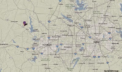 Two Magnitude 3.3 Earthquakes in Parker County, Texas. The United States Geological Survey
recorded a Magnitude 3.3 Earthquake at a depth of 5 km, in northeastern
Parker County, Texas, roughly 30 km...
Two Magnitude 3.3 Earthquakes in Parker County, Texas. The United States Geological Survey
recorded a Magnitude 3.3 Earthquake at a depth of 5 km, in northeastern
Parker County, Texas, roughly 30 km...
Follow Sciency Thoughts on Facebook.