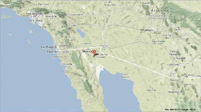
The United States Geological Survey recorded a Magnitude 4.1 Earthquake at a depth of 12.4 km in northeast Baja California, north of the Gulf of California and roughly 50 km southeast of Mexicali, at 3.25 am local time (10.25 am GMT) on Saturday 14 September 2013. There are no reports of any damage or casualties arising from this quake, although it is likely to have been felt locally.
The approximate location of the 14 September 2013 Baja California Earthquake. Google Maps.
The boundary between the Pacific and North American Plates runs beneath the Gulf of California, with Beja California lying on the Pacific Plate and the Mexican mainland on the North American. The Pacific Plate is moving northwest with regard to the North American Plate, while the North American Plate is moving southeast relative to the Pacific Plate. This creates a transform plate margin along the center of the Gulf of California, as the two plates slide past one-another, a margin that continues northward under California as the San Andreas Fault. The plates do not move past one-another smoothly, but continuously stick together then break apart as the pressure builds up, leading to regular Earthquakes beneath the Gulf of California and in the surrounding area.
See also Magnitude 4.2 Earthquake in Chihuahua State, Mexico, Magnitude 2.8 Earthquake in Baja California, Magnitude 3.1 Earthquake to the north of the Gulf of California, Magnitude 3.2 Earthquake in southern California and Magnitude 6.3 Earthquake off the coast of Baja California.
Follow Sciency Thoughts on Facebook.

