
The United States Geological Survey recorded
a Magnitude 5.4 Earthquake at a depth of 43.4 km, roughly 48 km to the north of the town
of Athmuqam in Khyber Pakhtunkhwa Province, Pakistan, slightly after 1.00 pm local time (slightly after 8.00 am) on Saturday 1 October 2016. There are no reports of any damage or casualties associated with this event, but people have reported feeling it across northern Pakistan.

The approximate location of the 1 October 2016 Khyber Pakhtunkhwa Earthquake. Google.
Northern Pakistan lies close to the boundary between the Indian and Eurasian
tectonic plates, which runs through northern Afghanistan. The Indian
Plate is moving northward relative to the Eurasian Plate, causing
folding and uplift along this boundary, which has led to the formation
of the Hindu Kush Mountains of Afghanistan, the Himalayas and the other
mountain ranges of Central Asia., and which makes the nations in this
boundary zone prone to Earthquakes.

Plate boundaries and movements beneath southern Pakistan, Iran and the Arabian Sea. University of Southampton.
Witness
accounts of Earthquakes can help geologists to understand these events,
and the structures that cause them. The international non-profit
organization Earthquake Report is interested in hearing from people who may have felt this event; if you felt this quake then you can report it to Earthquake Report here.
See also...
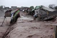 Flash floods and landslides kill at least 65 in northern Pakistan. At least sixty five people have died folowing a series of flash floods
and landslides in Khyber Pakhtunkhwa, Azad Kashmir and Gilgit Baltistan
Provinces in northern Pakistan on Sunday 3 April 2016...
Flash floods and landslides kill at least 65 in northern Pakistan. At least sixty five people have died folowing a series of flash floods
and landslides in Khyber Pakhtunkhwa, Azad Kashmir and Gilgit Baltistan
Provinces in northern Pakistan on Sunday 3 April 2016... Flooding and landslides kill over 30 people in northern Pakistan. Thirty four people have been confirmed dead and many more are still
missing as heavy rain falls across northern Pakistan. The rainfall has
led to flooding which has affected many communities, as well...
Flooding and landslides kill over 30 people in northern Pakistan. Thirty four people have been confirmed dead and many more are still
missing as heavy rain falls across northern Pakistan. The rainfall has
led to flooding which has affected many communities, as well... Hundreds known to have died following massive deep Earthquake in northeast Afghanistan. Four hundred and forty people are known to have died and thousands more
are missing or injured following...
Hundreds known to have died following massive deep Earthquake in northeast Afghanistan. Four hundred and forty people are known to have died and thousands more
are missing or injured following...
Follow Sciency Thoughts on Facebook.