Showing posts with label Appalachian Mountains. Show all posts

Friday, 5 November 2021

How coal worker’s pneumoconiosis resurfaced in American mines.

Dust associated with mining operations is known to be a major cause of lung disease and other serious health problems. The impact of inhaled dust is cumulative, and can lead to a variety of medical conditions, including coal worker’s pneumoconiosis, silicosis, mixed dust pneumoconiosis, dust-related diffuse fibrosis, and progressive massive fibrosis. In response to this, the US introduced strict laws on the control of dust in coal mines in the 1970s, which resulted in a substantial decline in the number of cases of lung disease among mine workers. However, since the mid 1990s the number of miners with lung disease has risen again steadily, with many cases appearing in younger miners, who have worked their entire working lives in mines working with the new, tighter, regulations on dust control.

This re-appearance of mining-related lung diseases has been particularly prevalent in the Appalachian Region, and is thought to be linked to the practice of targeting thin coal seems, which involves cutting a larger amount of non-coal rock, primarily silica (i.e., quartz) and silicate minerals (cyclosilicates, phyllosilicates, tectosilicates, etc.), which are closely associated with lung disease (the body has no way to remove silica once it gets into the lungs, so that even tiny amounts of these minerals build up over time leading to severe health problems). A variety of other factors have also been suggested as possible caused of or contributers to this re-emergence, including duration and level of exposure, mine operation type, coal and rock-strata geological conditions, dust characteristics (i.e., size, shape, mineralogy, elemental content), dust mitigation techniques, mine size, coal rank, and advancements in cutting technologies. 

The rising number of lung disease case appearing in coal miners has raised concerns with regulators and the scientific community, and in 2014 the Mine Safety and Health Administration brought in a number of new regulations, aimed at reducing exposure limits and improving measurement technology and sampling protocols. However, it is unclear if these measures actually tackle the roots of the problem, and the National Academies of Sciences, Engineering, and Medicine have called for research into a number of factors that are likely to be contributing to the problem.

In a paper published in the International Journal of Coal Science Technology on 13 October 2021, Younes Shekarian and Elham Rahimi of the Department of Mineral Engineering at the New Mexico Institute of Mining and Technology, and the Department of Information Systems at the University of Colorado Denver, Naser Shekarian of the John and Willie Leone Family Department of Energy and Mineral Engineering at Pennsylvania State University, Mohammad Rezaee, also of the Department of Information Systems at the University of Colorado Denver, and Pedram Roghanchi, also of the Department of Mineral Engineering at the New Mexico Institute of Mining and Technology, publish the results of a study which aimed to assess five separate hypotheses about the prevalence of coal worker’s pneumoconiosis in American mines, namely (1) that workers in underground mines are more likely to developing coal worker’s pneumoconiosis than those in other operations, (2) that geographical location is a contributing factor to the prevalence of coal worker’s pneumoconiosis, (3) that size of mine could influence the prevalence of coal worker’s pneumoconiosis among coal miners, (4) that coal rank contributes to the coal worker’s pneumoconiosis incidence rate, and (5) that coal seam thickness could influence the prevalence of coal worker’s pneumoconiosis among coal miners.

Shekarian et al. extracted data from Mine Safety and Health Administration accident/injury and employee/production records. This enabled them to determine the number of cases of coal worker’s pneumoconiosis at each mine, the type of mining caried out there, the number of workers at the mine, the coal production rate, the location of the mine, the coal seem thickness, and the rank of the coal. Each site where at least one instance of coal worker’s pneumoconiosis was recorded was classified as either underground, surface, or other (i.e. augur, milling and preparation plant, office, culm banks, independent shops and yards, surface at underground mine). A total of 21 396 operations were included in the study.

For the purpose of the study, the size of the mines was determined by their number of employees, with mines with less than 50 employees being classified as small, those with between 50 and 100 employees being classified as medium-sized, and those with more than 100 employees being classified as large. Seem width was classified as thin if it was less than 40 inches (101.6 cm) thick, medium if it was between 40 inches and 75 inches (190.5 cm) thick, and thick if it was greater than 75 inches thick. Coal rank was classified as either bituminous or anthracite.

Shekarian et al. found that 93% of the cases of coal worker’s pneumoconiosis recorded in workers at underground mines occurred in the Appalachian Region, with 4% occurring in the Interior Region and 3% in the Western Region. Furthermore, 80% of the mined where cases of coal worker’s pneumoconiosis were recorded were classified as small. At a county level, he highest number of coal worker’s pneumoconiosis cases recorded in underground miners occurred in Boone County, Wet Virginia, where there were 946 reported cases. 

The situation at surface mines followed a similar pattern, with 86% of the cases of coal worker’s pneumoconiosis recorded at surface mines occurring in the Appalachian Region, 9% in the Interior Region, and 5% in the Western Region. This time 86% of the mines where ases of coal worker’s pneumoconiosis were recorded were classified as small. The highest number of coal worker’s pneumoconiosis recorded at surface mines in a single county was in Logan County, West Virginia, where there were 175 recorded cases.

Exposure to respirable coal mine dust varies greatly with the type of mining being carried out. Workers at underground mines are at much greater risk of coal worker’s pneumoconiosis due to the limitations of artificial ventilation systems and the confined spaces in which they are working, which typically means they are exposed to much higher levels of respirable coal mine dust. This was reflected in Shekarian et al.'s study, where 76% of cases of coal worker’s pneumoconiosis reported occurred in underground mineworkers, with 11% of cases reported in workers at surface mines and 13% in workers in other mine operations, mainly mills or preparation plants. Examination of the data chronologically confirmed the drop in the number of cases following the introduction of new tighter regulations in the 1970s, with a sunsequent rise in the number of cases from the 1990s onwards.

 
Number of coal worker’s pneumoconiosis cases as function of (a) mine operation type and (b) year in Unites States during 1986–2018 (total number of cases is 7337). Shekarian et al. (2021).

Geography is known to be a major factor when assessing exposure to respirable coal mine dust, as clusters of mines in different areas are targeting rocks with different geology, that produce different amounts and types of dust. The mines of Central Appalachia, for example, are known to produce more dust sources from non-coal rock strata than mines elsewhere in the US. Correspondingly, previous studies have shown that mineworkers in the eastern region of Appalachian coal field, which includes West Virginia and Pennsylvania, suffer higher rates of coal worker’s pneumoconiosis than miners in other parts of America. 

Shekarian et al. found that, between 1986 and 2018, 106 counties in 16 states reported cases of coal worker’s pneumoconiosis, with the highest number of cases being reported in West Virginia, Kentucky, Virginia, and Pennsylvania. There are thought to be a number of contributing factors behind this, including a higher proportion of silica in respirable coal mine dust, caused by the mines in this region targeting thin coal seems in host rocks with high quarz contents, the smaller size of mining operations here, and a culture of working longer shifts in these mines, resulting in a higher daily exposure to dust.

 
Distribution of coal worker’s pneumoconiosis per state (a) and county (b) for underground, surface, and total data during 1986–2018 in the U.S. Shekarian et al. (2021).

Previous studies have found that mine size is a significant predictor of health issues in mineworkers in the US, with workers at smaller mines having higher rates of coal worker’s pneumoconiosis and abnormal lung functions, and that this is particularly true in Kentucky, Virginia, and West Virginia. It has been suggested that this is because smaller mining operations have fewer resources to invest in health and safety measures, and that concentrations of respirable coal mine dust will tend to be higher in smaller mines.

Shekarian et al. found that most mines in the US, both surface and above ground, are small in size (i.e. have less than 50 employees), but that most miners work at large mines (i.e. mines with more than 100 employees). Simply split by size category, a greater number of cases of coal worker’s pneumoconiosis occurred in miners working at large mines, but that individual miners were more likely to contract coal worker’s pneumoconiosis at smaller mines. 

 
Percentage of underground and surface mines (a) and rate of coal worker’s pneumoconiosis (%) (b) per mine size in the U.S. during 1986–2018. Shekarian et al. (2021).

Coal seam thickness is considered to be another contributing factor for a high instance of coal worker’s pneumoconiosis, and varies from region to region depending on the local geology. The average coal seam thickness in the Central Appalachian Region is lower than in other regions in the US, and mines in this region which target thin coal seams are known to have a high instance of coal worker’s pneumoconiosis.

Shekarian et al. found that only 11% of US mines targeted thick coal seams, with medium seems being the type most often targeted by underground mines (44%) and thin seams the type most often targeted by surface mines (50%). Furthermore, more underground mines targeting medium coal seams reported cases of coal worker’s pneumoconiosis than underground mines targeting either thick or thin seams, while more overground mines targeting thick seams recorded cases than mines targeting medium or thin mines, but in both cases the greatest number of cases were reported at mines targeting thin seams.

 
Rate of coal worker’s pneumoconiosis (%) by seam thickness and mine size in the U.S. underground (a) and surface (b) mines during 1986–2018. Shekarian et al. (2021).

A connection between coal rank (the carbon content of coal, with anthracitic coals having a higher carbon content and therefore yielding more energy than bituminous or sub-bituminous coals) and the occurrence of coal worker’s pneumoconiosis. It has been suggested that the incidence of coal worker’s pneumoconiosis is higher among miners working with bituminous coals than those working with anthracitic coals, even where the levels of respirable coal mine dust remain the same. In the Appalachian Region bituminous coals typically have a high quartz content, which may account for this, although it has been suggested that the surface charge of coal dust particles may be different in mines working anthracitic and bituminous coals.

Examination of the available data by Shekarian et al. revealed that the vast majority (95%) of US coal mines target bituminous coals, with only 9 underground and 59 surface mines targeting anthracites in 2018. Around 95% of cases of coal worker’s pneumoconiosis occurred in mines targeting bituminous coals.

 
Number of underground and surface mines (a), and rate of coal worker’s pneumoconiosis (%) (b), (c) per coal rank in the U.S. during 1986–2018. Shekarian et al. (2021).

The re-appearance of coal worker’s pneumoconiosis among mineworkers in the US in the 1990s caused alarm among many medical workers and scientists studying the field. A number of studies have looked at different factors which might have led to this resurgence, but until Shekarian et al.'s work, no single study had attempted to look at all the possible causes together. Shekarian et al. collated 33 years of mine safety statistics collected by the Mine Safety and Health Administration. Their findings suggest that mine operation, geographic location, mine size, coal seam thickness, and coal rank all contribute to the health risks for underground mineworkers, while at surface mines the picture is less clear, with mine size, geographic location, coal rank, and seam height playing a role, but the correlation between instances and these factors being somewhat more complicated.

See also...


Follow Sciency Thoughts on Facebook.

Follow Sciency Thoughts on Twitter. 


Sunday, 8 November 2020

Magnitude 3.6 Earthquake off the coast of Massachusetts.

The United States Geological Survey recorded a Magnitude 3.6 Earthquake at a depth of 10 km off the south coast of Massachesetts, at about 9.10 am local time (about 2.10 pm GMT) on Sunday 8 November 2020. Events of this size are not usually dangerous, but are unusual in the eastern US, and people have reported feeling it across much of the northeasten United States and eastern Canada.

 
The approximate location of the 8 November 2020 Massachusetts Earthquake. USGS.

Earthquakes in New England are rare, which makes it hard to asses their precise origins, though most are thought to be associated with tectonic stresses in the Appalachian Mountains. The region is cross-cut from north-to-south by a number of ancient faults associated with the formation and breakup of the ancient supercontinent of Pangea, between 300 and 200 million years ago, though no sign of modern movement on these faults has been discovered. 

Witness accounts of quakes can help geologists to understand these events and the rock structures that cause them. If you felt this quake you can report it to the USGS here.

See also...


Follow Sciency Thoughts on Facebook.

Follow Sciency Thoughts on Twitter.
 

Friday, 7 December 2018

Buenellus chilhoweensis: An Olenelline Trilobite from the Early Cambrian Murray Shale of Tennessee.

The Chilhowee Group outcrops in the Appalachian Mountains from Alabama to Pennsylvania, and comprises a series of sedimentary units of Late Ediacaran to Early Cambrian sedimentary deposits laid on the southern margin of the continent of Laurentia, along the shores of the newly opened Iapetus Ocean. Due to the time period covered by these rocks, they are of great interest to geologists and palaeontologists, but unfortunately they produce very few fossils, making the deposits hard to date and of little value in understanding the biotic changes of this period. Trilobites were first recorded from the Chilhowee Group by Charles Doolittle Walcott in a series of papers between 1890 and 1910. Walcott found Trilobites at two levels within the Chilhowee Group, the Murray Shale on Chilhowee Mountain, Blount County, Tennessee, and the somewhat younger Antietam Formation at several locations in Virginia, Maryland, and Pennsylvania. Unfortunately Walcott referred to all of his specimens as members of the genus Olenellus, which was used for almost all early Trilobites at the time, and his recording of locations and horizons was somewhat vague, making it hard to understand the nature and origin of his specimens.

In a paper published in the Journal of Paleontology on 26 March 2018, Mark Webster of the Department of the Geophysical Sciences at the University of Chicago, and Steven Hageman of the Department of Geology at Appalachian State University describe the rediscovery of the Trilobite-bearing horizon of the Murray Shale on Chilhowee Mountain, and describe the Trilobites found there as a new species.

The new species is placed in the genus Buenellus, and given the specific name chilhoweensis, meaning ‘from Chilhowee’. The species is described from a cephalon (head section) at least 18.8 mm in length, and a series of similar specimens preserved as internal and external moulds. Given the known age range for the genus, Webster and Hageman suggest that the horizon that produced the fossils must be between 518 and 515.5 million years old.

Buenellus chilhoweensis from the Murray Shale, Chilhowee Mountain, Blount County, Tennessee, U.S.A. (1) Internal mould of cephalon; (2) internal mould of cephalon; (3), (4) internal and external mould, respectively, of cephalon from; (5), (6) internal and external mould, respectively, of cephalon; (7) external mould of cephalon; (8) latex peel of external mould of incomplete cephalon found by Walcott in 1889, dorsal view. (1)–(7) from upper part of Murray Shale; (8) from Little River Gap area. Scale bars are 5 mm. Webster & Hageman (2018).

See also...

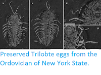
https://sciencythoughts.blogspot.com/2018/10/dipleura-dekayi-north-american.htmlhttps://sciencythoughts.blogspot.com/2017/01/preserved-trilobte-eggs-from-ordovician.html
https://sciencythoughts.blogspot.com/2015/02/five-new-species-of-proetoid-trilobites.htmlhttps://sciencythoughts.blogspot.com/2012/03/preserved-trilobite-digestive-tracts.html
Follow Sciency Thoughts on Facebook.

Sunday, 26 June 2016

Flooding kills 26 in West Virginia.

Twenty six people have been confirmed dead in West Virginia after the state suffered its worst flooding in a century this week. 250 mm or rain was recored in parts of West Virginia on Thursday 23 June 2016, roughly a quater of the expected annual rainfall for the state, and leading to flash floods that swept away many houses and other buildings. The worst hit areas are reported to be in the southeast of the state, notably Greenbrier County, where sixteen people are reported to have died and Kanahwa County, where another six fatalities occured.

Floodwaters near White Sulphur Springs in Greenbrier County, West Virginia, on 24 June 2016. AP.

At least a hundred homes are thought to have been destroyed, while across the state about  32 000 homes and businesses are thought to be without electricity. A State of Emergency has been declared by President Barack Obama following a request from State Governor Earl Ray Tomblin, meaning that residents of the worst affected areas will be able to apply for federal aid to help them rebuild.

Flooding in Richwood in Nicholas County, West Virginia, on 23 June 2016. Jeremy Rose/Charleston Gazette-Mail.
Richwood
Richwood

West Virginia has a warm subtropical climate with rainfall largely driven by evaporation in the North Pacific rather than the (nearer) Atlantic, with prevailing winds predominantly carrying moist air from the West that is pushed upwards by the Appalachian Mountains, causing it to cool and lose its capacity to cary as much water, resulting in rainfall. However Atlantic storms can reverse this process, bringing warm moist air from the Atlantic, which also tends to deposit its water content on encountering the Appalachians.

See also...

http://sciencythoughts.blogspot.co.uk/2016/05/magnitude-35-earthquake-in-ballard.htmlMagnitude 3.5 Earthquake in Ballard County, Kentucky.                                                      The United States Geological Survey recorded a Magnitude 3.5 Earthquake at a depth of 16 km...
http://sciencythoughts.blogspot.co.uk/2015/03/elderly-woman-dies-after-falling-into.htmlElderly woman dies after falling into sinkhole in Louisville, Kentucky.                                    An elderly woman has died after falling into a sinkhole in the Pleasure Ridge Park district of Louisville, Kentucky at about 7.30 pm local time on Tuesday...
http://sciencythoughts.blogspot.co.uk/2015/03/one-dead-and-two-injured-following-roof.htmlOne dead and two injured following roof collapse at West Virginia mine.                   One worker has died and another two have been injured following a collapse at the Marshall County Mine in Cameron, West Virginia, which occurred at about 10.00 pm local time on Sunday 8 March 2015. Earlier reports suggested that more miners...
Follow Sciency Thoughts on Facebook.

Saturday, 21 February 2015

A new subspecies of Polygyrid Snail from West Virginia.

The Appalachian Mountain of eastern North America are considered to be a hotspot for Land Snail biodiversity. There are currently at least ten described species of Polygyrid Snails in the genus Triodopsis in West Virginia alone, although there is considerable doubt about the validity of some of these species. The species Triodopsis juxtidens, Triodopsis discoidea, Triodopsis neglecta and Triodopsis pendula are currently collectively known as the ‘Triodopsis juxtidens subgroup’, though there are no clear morphological traits that separate these species, while a recent genetic study which included several specimens of Triodopsis juxtidens strongly suggested that these were not all member of the same species, strongly suggesting that the group is in need of revision.

In a paper published in the journal Zootaxa on 29 January 2015, Kenneth Hotopp of Appalachian Conservation Biology describes a new and distinctive population of Triodopsis Snails from the Bluestone River Valley in Mercer and Summers Counties, West Virginia. In the absence of a solid genetic or morphological foundation for the classification of Triodopsis Snails he takes a conservative approach, and assigns this population subspecies rank within the species Triodopsis juxtidens.

The new subspecies is named Triodopsis juxtidens robinae, in honour of Hotopp’s wife Mary ‘Robin’ Robertson Gorrell, on the occasion of their 25th wedding anniversary. The shells are 7.0-9.0 tall and 13.1-17.6 mm wide, have 4.75-5.5 whorls and are light or reddish brown in colour. The aperture of the new population is roughly triangular in shape, as opposed to rounded as seen in other specimens assigned to Triodopsis juxtidens.

Specimen of Triodopsis juxtidens robinae from Brush Creek in Mercer County, West Virginia. Charles Sturm in Hotopp (2015).

See also…

Omalogyrid Snails are among the smallest known Gastropods, with adult body sizes often comparable with larger Protozoans (single-celled ‘animals’). As such they tend only to be collected in surveys which directly target them, rather than general surveys of Mollusc...


Toxoplasma gondii is a protozoan parasite that affects humans, and many other animals, across the globe. While it causes disease in many organisms, it reproduces only in Felids, particularly in Domestic Cats, with oocysts (egg-like cysts) being shed in Cat...


The Mobile River Basin in Alabama and Georgia is considered to contain the most diverse Mollusc faunas of the entire North American continent. Unfortunately the area is also heavily urbanized and industrialized, with waterways channelized to allow shipping...


Follow Sciency Thoughts on Facebook.

Tuesday, 13 January 2015

Magnitude 3.3 Earthquake in eastern Connecticut.

The United States Geological Survey recorded a Magnitude 3.3 Earthquake at a depth of 6.5 km near Mooseup in Windham County in eastern Connecticut, slightly after 6.35 am local time (slightly after 11.35 am GMT) on Monday 12 January 2015. Events of this size are not usually dangerous, but are unusual in the eastern US, and people have reported feeling it across much of eastern Connecticut, plus Rhode Island and parts of Massachusetts.

 The approximate location of the 12 January 2015 Connecticut Earthquake. Google Maps.

Earthquakes in New England are rare, which makes it hard to asses their precise origins, though most are thought to be associated with tectonic stresses in the Appalachian Mountains. The region is cross-cut from north-to-south by a number of ancient faults associated with the formation and breakup of the ancient supercontinent of Pangea, between 300 and 200 million years ago, though no sign of modern movement on these faults has been discovered.
Witness accounts of quakes can help geologists to understand these events and the rock structures that cause them. If you felt this quake you can report it to the USGS here.
See also...
http://sciencythoughts.blogspot.co.uk/2013/07/earthquake-shakes-cleveland-ohio.htmlEarthquake shakes Cleveland, Ohio.                 The United States Geological Survey recorded a magnitude 3.2 Earthquake at a depth of 6.0 km beneath Lake Erie, roughly 6 km northwest of Fairport or 40 km northeast of Cleveland, lightly before 3.50 am local...
http://sciencythoughts.blogspot.co.uk/2013/05/quebec-earthquake-felt-in-new-york.htmlQuebec Earthquake felt in New York, Vermont.                                                                      A Magnitude 4.4 Earthquake occurred at a depth of 9 km in southern Quebec, roughly 67 km northwest of Ottawa slightly before 9.45 am local time (slightly before 1.45...
http://sciencythoughts.blogspot.co.uk/2012/10/earthquake-under-maine-shakes-new.htmlEarthquake under Maine shakes New England.                                                                     On Tuesday 16 October 2012, slightly after 7.10 pm local time (slightly after 11.10 pm, GMT) the United States Geological Survey recorded a Magnitude 4.0 Earthquake 5 km underground, roughly 30 km...
Follow Sciency Thoughts on Facebook.

Monday, 6 May 2013

Railworker killed in North Carolina mudslide.

A railworker was killed by a mudslide in McDowell County, North Carolina, in the early hours of the morning of 6 May 2013. He has been named as Joseph Drewnoski (33) an assistant foreman with rail company Norfolk Southern, who had been inspecting the site of an earlier mudslide on Old Fort Mountain, when their track vehicle was hit by a second slide. A second worker was trapped inside the vehicle for some time, but was rescued unharmed, however Drewnoski, who was outside the vehicle at the time of the mudslide  was buried and killed. 

Arial photograph of the buried Norfolk Southern vehicle. 7.wspa.

 The western North Carolina area has suffered several days of exceptional rainfall (as has much of the American Midwest), including about 12 cm of rain over the previous two days, causing localized flooding, power outages and a number of road closures due to mudslides. High levels of precipitation in the Appalachian Mountains are generally associated with warm temperatures over the Gulf of Mexico and western Atlantic Ocean, and can be a precursor of hurricane events.


Follow Sciency Thoughts on Facebook.

Wednesday, 17 October 2012

Earthquake under Maine shakes New England.

On Tuesday 16 October 2012, slightly after 7.10 pm local time (slightly after 11.10 pm, GMT) the United States Geological Survey recorded a Magnitude 4.0 Earthquake 5 km underground, roughly 30 km southwest of Portland, Maine. This is not an especially large quake, but it was quite shallow and is far larger than the area is used to, leading the USGS estimate that there was a 24% chance of the quake resulting in at least one fatality. There have not been any reports of damage or casualties, but the quake appears to have caused widespread alarm over much of New England.

The location of the 16 October 2012 Earthquake. Google Maps.

Earthquakes in Maine are an uncommon occurrence, but they do occur, with six Earthquakes of Magnitude 4.0 or greater being recorded in the twentieth century, the largest being the Magnitude 4.8 Bowmantown quake of 1973. The precise cause of these quakes is unclear, though they are thought to be associated with tectonic stresses in the Appalachian Mountains. The state is cross-cut from north-to-south by a number of ancient faults associated with the formation and breakup of the ancient supercontinent of Pangea, between 300 and 200 million years ago, though no sign of modern movement on these faults has been discovered.

Witness accounts of quakes can help geologists to understand these events and the rock structures that cause them. If you felt this quake you can report it to the USGS here.


Follow Sciency Thoughts on Facebook.

Thursday, 7 June 2012

Protest group Appalachia Rising occupy the offices of four US Representatives.

On Wednesday 6 June 2012 activists from the protest Group Appalachia Rising occupied the offices of four US Representatives from states in the Appalachian Region. The group were protesting against the increased used of open-pit mining in the Appalachian Mountains, and in particular the process known as mountaintop removal, in which the entire top of mountain ridges are removed in order to expose coal seems, which can then be completely removed. The process has been linked to extreme environmental degradation, and severe health impacts on local communities.

Mountaintop removal at Oven Fork, near Whitesburg (Letcher County, Kentucky). The Mountaintop Removal Road Show.

The representatives affected were Congressman John Duncan (Republican), representing Tennessee's 2nd District, Congressman Nick Rahall (Democrat), representing the 3rd District of West Virginia, Congressman Hal Rogers (Republican), representing Kentucky's 5th District, and Congressman Morgan Griffith (Republican), representing Virginia's 9th District. Each was targeted by a group from their own state. A total of 22 activists were arrested in Washington, two in Representative Duncan's office, six in Representative Griffith's office, seven in Representative Rogers' office and seven in Representative Rahall's Office. All four Congressmen have been accused of having a poor record on environmental issues, and of supporting the interests of extraction companies over those of their constituents.

Protesters from Kentucky inside the office of Representative Hal Rogers. Appalachia Rising.

The protests come a week after Memorial Day protests in which Appalachian women shaved their heads in morning for mountains which have been removed, and protests on the first of this month in which members of the Earth Quaker Action Team and the Sierra Club organized mass withdrawals from the PNC Bank in protest at its investment in mountaintop removal projects.

Mountaintop removal has been linked to severe environmental problems, including loss of biodiversity and toxification of water resources. It has also been linked to severe health issues; communities close to mountaintop removal projects have been shown to suffer sharp increases in levels of cancer and birth defects, placing a severe strain on local healthcare providers. The process has also caused more direct disruption to communities, with homes, churches and graveyards being removed or relocated against the will of the local populations.

See also Daw Mill Colliery threatened with closure, The effects of oil sands mining on wetlands in northern Alberta, Greenpeace activists occupy drilling ship in New Zealand, Protestors object to the expansion of the Conga Mine in Peru and Acid spill from gold mine adds to Edith River's woes.

Follow Sciency Thoughts on Facebook.

Tuesday, 23 August 2011

Virginia Earthquake shakes Washington, New York. 23 August 2011.

A few minutes before 2.00 pm on 23 August 2011 the eastern coast of the United States was shaken by a rare earthquake. The quake was centered 14 km south of Mineral (141 km southwest of Washington DC), Virginia, and was felt as far south as South Carolina, as far north as New Hampshire and as far east as Oregon (this is slightly dubious). The quake was measured as 5.9 on the Richter Scale by the US Geological Survey, and was at a depth of about 0.1 km - very shallow and therefore potentially very dangerous, particularly in an area like the eastern US where buildings have limited earthquake protection. As yet there have been no reports of any casualties, but there has apparently been considerable damage to property in and around Mineral and there are reports of damage to the central spire of the National Cathedral in Washington DC. In addition the North Anna Nuclear Power Plant in Virginia was taken off line while it was checked for any damage, and buildings were briefly evacuated in several East Coast cities.

A magnitude 2.8 aftershock was felt locally at 2.46 pm. This was also a very shallow quake (~0.1 km) to the south of Mineral, although with slightly less than one thousandth of the energy this is much less likely to have caused any significant damage.

Virginia is a long way from any active tectonic margin, and is not known for its earthquakes. However the state does have two potentially hazardous faults, associated with the origins of the Appalachian Mountains during the Palaeozoic. This occurred when the ancient Iapetus Ocean closed, causing a collision between North America and Europe. When this happened the rocks that form the modern Blue Ridge Mountains were pushed up over the older rocks to the east. This lead to the formation of a fault on the eastern margin of the Blue Ridge Mountains, between the Blue Ridge rocks and the older sediments they overlay. In the West the rocks of the overlying Piedmont Province were also forced upwards, but have been slipping back, away from the Blue Ridge Province (this is a simplified explanation), creating a second major fault, between the Piedmont and Blue Ridge Provinces. It is on this fault that the earthquake occurred.

A cross section through the rocks of Virginia.

Earthquakes were reported in Virginia in 1774, 1811, 1812, 1828, 1833, 1852, 1861, 1875, 1897, 1898, 1908, 1910, 1918, 1919, 1929, 1959, 1977, 1978, 1980, 1981, 1983, 1983, 1984, 1985, 1986, 1987, 1988, 1989, 1991, 1992, 1993, 1994, 1994, 1995, 1996, 1997, 1998, 2000, 2001, 2003, 2004, 2006, 2007, 2009 and 2010. While many of these caused damage and alarm, only two fatalities have ever been attributed to an earthquake in Virginia, when a quake in 1833 caused a mine collapse at Brown's Coal Pits, near Dover Mills in the north of the state.