Showing posts with label Carbon Dating. Show all posts

Wednesday, 6 September 2023

Changing burial practices across the Neolithic/Iron Age boundary at the MARP-79 Cemetary in Karnataka State, southern India.

Between 2010 and 2018 the Maski Archaeological Research Project (MARP) searched for further signs of Neolithic activity around the Maski Neolithic settlement, which had been excavated in the nineteenth century. One of the most important finds of this survey was the MARP-79 Cemetery, a large funerary complex beneath an elongated prominence in the southern Deccan region, which appears to have been used for more than a thousand years, from the middle Neolithic into the early Iron Age, showing patterns of both continuity and change across this time interval.

In a paper published in the journal Antiquity on 27 June 2023, Peter Johansen of the Department of Anthropology at McGill University, and Andrew Bauer of the Department of Anthropology at Stanford University present new radiocarbon dates for a number of graves at the MARP-79 Cemetery, and discuss the implications of these for our understanding of the Neolithic/Iron Age cultural transition in southern India.

Map showing the location of the MARP-79 Cemetery and related archaeological sites. Johansen & Bauer (2023).

Archaeologists studying the prehistory of southern India have built up a picture in which the Neolithic/Iron Age transition is an abrupt boundary, probably with an imigrant population or culture completely supplanting the previous one. However, at MARP-79 a more gradual transition can be perceived, with a long-standing Neolithic culture adopting new cultural and technological practices in a more gradual way.

A range of different mortuary practices appear at the MARP-79 Cemetery by the beginging of the second millennium BC, probably indicating social distinctions within the community. These innovations include the nature if grave goods, with ceramic vessels with slip-coatings and polished surfaces appearing and then being replaced by first copper and then iron items, differing materials being used to construct coffins, notably terracotta and burnt organic material, a mixture of singular and shared graves, and different forms of stone grave markings.

The Neolithic of southern India has been studied since the nineteenth century. Initial studies found a wide range of ground and pecked stone tools across the southern Deccan region, which became known as the Stone Axe Culture. As well as Neolithic stone tools, this culture also produced a variety of course, handmade ceramics, notably the Burnished Grey and Dull Red Ware traditions. Studies at sites such as  Brahmagiri and Piklihal enabled archaeologists to build up a picture of changing ceramic styles and settlement patterns over the span of the southern Indian Neolithic, which was later refined by the addition of radiocarbon dating and the study of macrobotanical remains.

This Neolithic culture appears to have farmed domesticated Sheep and Goats, along with a number of locally domesticated crops known as the South Indian Crop Package, which includes a selection of pulses and millets. By the beginging of the second millennium BC, northern Indian crops such as Wheat and Barley begin to appear, and become increasingly important over time, and from about 1600 BC, African crop Plants begin to appear. These crop introductions coincide with the appearance of new types of ceramics, notably necked jars. 

This appearance of crops Plants which were domesticated in other regions are indicative of this culture being part of an expanding exchange network, which makes it highly likely that they were also exchanging cultural ideas with other areas. This is further supported by the appearance of materials such as carnelian and lapis lazuli, neither of which occur in the region. These changes coincide with the decline and abandonment of the cities of the Indus Valley Civilization in northern India, the adoption of the earliest copper technologies, and the importation of some funrrary practices from the northern Deccan region.

Settlements in the southern Deccan region during the Neolithic typically comprised small villages or camps made up of circular wattle and daub houses, with sites outside the boundary of the settlement used for stone tool preparation, butchery, and the holding of Animals. Some of these settlements had distinctive ash mounds, large piles of ash and vitrified Cattle dung, which may have been associated with periodic feasting.

The area covered by the Maski Archaeological Research Project covers an area of 64 km², and contains four Neolithic settlements. These are the original Maski settlement (MARP-97), a multi-period site 1.5 km to the north of the cemetery, which was first excavated in the 1950s, MARP-64, a newly discovered small settlement running across several adjacent hill terraces which lies 6 km to the northwest of MARP-79,  and MARP-155 and MARP-203, which are both interpreted as small hilltop herding camps, which have produced scatterings of stone tools and ceramic fragments, and which lie to the north and south of MARP-79.

Map of the MARP study area, illustrating the relationship of MARP-79 with Neolithic settlements. Areas in black outline represent survey blocks; the site area at MARP-97 represents the surface area of the multi-component site and not the extent of Neolithic settlement, which is unknown. Johansen & Bauer (2023).

The Neolithic burial practices of the southern Deccan region include a number of infant urn burials, and adult pit graves, found both within and outside settlements. The most common of these are infants and sub adults buried in urns withing settlements, although some of these are buried in simple pits without urns. Urn burials typically contain a single individual, although sometimes two individuals are found within the same urn. Burial goods are extremely rare. The form of the urns varies considerably.

Where sites can be established to have gone through several phases of settlement, then burial practices can be shown to have changed over time. Most adults are buried in extended pits, with ceramic grave goods including examples of Burnished Grey Ware and plain terracotta. There is limited variation between these sites, although the orientation of the body can differ, both primary and secondary burials have been found (secondary burials occur when a body is buried, then dug up and buried again), the covering of part or all of the grave with stones, and the presence and variety of grave goods, which can include ceramic vessels, with bowls and spouted jars being the most common, as well as chipped and ground stone tools. 

At the Tekkalakota and Ramapuram, where a succession of burial styles can be seen, later graves can be observed to contain a greater quantity of grave goods, including polished ceramics with slip coatings, conforming to the Black-and-Red Ware, Slipped and Polished Black Ware, and Slipped and Polished Red Ware styles, which are otherwise associated with Iron Age Megalithic burials. At Ramapuram later burials comprise stone cairns and cists, and use burned organic material coffins. Here grave goods from these late burials include up to 29 vessels, made from a mixture of styles including Burnished Grey Ware and Black-and-Red Ware, and in some cases copper and iron artefacts. Burned organic coffins and a mixture of ceramic styles were also found during the Maski excavations in the 1950s, as well as Neolithic and Iron Age settlement phases.

However, all of this is based upon a very small number of burials in and around settlements; the known number of burials in the area has long been observed to be much lower than would be expected given the other archaeological remains found, leading to speculation that burials were occurring at other, undiscovered sites. One possible solution to this was presented by the discovery of a possible Neolithic cemetery at Nagarjunakonda in Andhra Pradesh, although this site, which included remains dating from the Lower Palaeolithic to the sixteenth century, including a significant Buddhist temple complex, was flooded by the construction of a dam in the early 1960s, preventing any further investigations.

The MARP-79 Cemetery was discovered in 2012 during a foot-survey of the area by archaeologists from the Maski Archaeological Research Project. A number of burial sites had been exposed by gravel quarrying activities, with graves visible in plan and section within gravel pits. A total of 21 partially exposed burials were found, and it is believed that hundreds more may have been lost due to the quarrying activities, while others may lie undisturbed in other portions of the site. The exposed graves were carefully photographed and drawn, and surface materials were collected. Three graves were excavated in 2018-19.

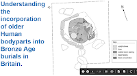
Map of MARP-79, with the location of recorded burial. Johansen & Bauer (2023).

Thirteen pieces of charcoal, obtained from seven of the graves, yielded radiocarbon dates of between 2472-2335 BC and 1222–1117 BC, enabling Johansen and Bauer to track changes in mortuary practices within the cemetery for over a thousand years. The oldest grave, Burial 12, dates from the Neolithic IB stage, and is a simple pit burial with modest furnishings, including broken micaceous dark grey ceramic fragments, observed in section (from the side).

MARP-79 Burials 1, 2, 3 and 12 exposed in section. Johansen & Bauer (2023).

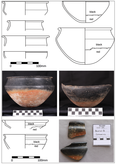
Simple pit burials like this persist past the turn of the second millennium BC, with examples such as Burial 7, which is dated to between 1895 and 1756 BC, and which is another simple pit burial observed in section, containing fragments of slipped and unpolished ceramic. However, by this time other types of burial are also being practiced, including terracotta sarcophagus burials, such as Burial 8, which has been dated to between 1934 and 1700 BC, which in addition had grave goods including Black-and-Red Ware slipped and polished serving vessels and a dolerite ground stone axe. Also present by this stage are burials in which coffins made of combusted organic material contain defleshed coffins, such as Burial 11, which also had grave goods, including five short-necked, globular, red slipped ware jars and seven slipped and polished Black-and-Red Ware serving vessels. Both of these burial types are common in the Iron Age of southern India, and have previously been taken as evidence of a separate, Iron Age culture with more sophisticated burial customs, which was thought to have abruptly replaced the simpler Neolithic culture.

Burial 11 excavated, with burned organic coffin exposed in plan. Johansen & Bauer (2023).

A number of further combusted coffin burials (burials 1, 6, and 19) were dated to the e fifteenth and twelfth centuries BC, apparently continuing the funeral tradition first seen in Burial 11 some centuries previously. Again, the remains within the coffins have been defleshed prior to burial, and the grave goods include slipped and polished serving vessels and globular slipped jars, although Burial 6 also contains four carnelian beads and a copper bangle, and Burial 19 contains a bladed iron tool and some Animal remains (Sheep and/or Goat), and was covered by stone slabs. Similar graves to this have been found at Thapar and Maski, and have been interpreted as evidence of a funerary feasting tradition at the Neolithic/Iron Age transition.

Burial 19: unexcavated burned organic coffin, with overlying capstones (A); partially excavated coffin, with excarnated skeletal remains exposed (B). Johansen & Bauer (2023).

Simple pit burials, and terracotta sarcophagus burials also persist into later phases at MARP-79. For example, Burial 2, which has not been directly dated, contains a terracotta sarcophagus covered by stone slabs, with grave goods including a slipped and polished ware serving vessels and an iron blade, indicating that it must be of Iron Age origin. Iron artefacts and evidence of iron working are known in southern India from at least the fourteenth century BC, while terracotta sarcophagi, including variants with legs and other embellishments are known from elsewhere in the Deccan region, and in wider southern India, with examples dating to as late as the Early Historic Period (300 BC-500 AD). 

Chronological chart documenting the development of burial practices and grave inclusions at MARP-79. Johansen & Bauer (2023).

The use of stone slabs appears to be a progressive development, eventually developing into the megalithic graves of the southern Indian Iron Age. Such slabs are seen in conjunction with a variety of burial types, for example, Burial 3, an otherwise simple pit burial, which has not been dated but which contained a single slipped and polished red ware bowl, was covered by a layer of granite boulders. Burial 20 is an undated pit burial where the pit has been capped with two granite slabs, and these have in turn been covered by a circular cairn of boulders and cobbles, a style reminiscent of Iron Age and Early Historic Period burials elsewhere in southern India, although the grave goods consist only of a copper bracelet and a bone pendant. A similar burial was found at Terdal, with an apparently Iron Age burial containing typically Neolithic ceramics and a copper bangle. This suggests that instead of an abrupt replacement of Neolithic simple pit burials with Iron Age stone circles, cairns, and dolmens, these structures evolved from the pit burials, starting with the capping of the graves with stone slabs.

Burial 20: partially exposed in section prior to excavation (above), bone pendants in situ (left below), exposed skeletal remains (below centre) and excavated copper bracelet (below right). Johansen & Bauer (2023).

The MARP-79 Cemetery provides a record of changing funerary practices in the southern Deccan region dating back to at least the Neolithic IIB stage (defined as approximately 2000-1800 BC in southern India), showing that the dead were commemorated in a variety of ways within a single cemetery setting.  The site provides the earliest known examples of slipped and polished fine ware serving vessels and terracotta sarcophagi, with later burials also incorporating copper and iron objects. As well as greatly expanding our knowledge of Neolithic burial customs in the region, this is informative about the society carrying out these burials, with more sophisticated burial customs suggesting a larger population, with more people able to put resources into, and participate in a more elaborate burial, and evidence of funerary feasting, which again suggests a larger number of participants, and a population with sufficient resources to arange commemorative ceremonies, probably including feasting. The variety of different burial styles emerging from the Neolithic IIB onwards also suggests a more stratified society, with an uneven distribution of resources.

Notably, these findings challenge the perception that the Iron Age was notably different from the Neolithic in the southern Deccan region, and that this might reflect an incoming, more advanced, society displacing the Neolithic residents of the area, and introducing a new megalithic tomb-building style, at around 1200 BC. Johansen and Bauer's findings suggest a more gradual change-over between the two burial styles, and, importantly, provides radiocarbon dating evidence to support this. The MARP-79 Cemetery also provides the oldest known examples of slipped and polished fine ware serving vessels, dating from several centuries earlier than previously documented examples, further undermining the idea of an Iron Age, megalithic culture invading the area, and bringing this ceramic style with it. Instead this type of pottery appeared at MARP-79 in the Neolithic and persisted for hundreds of years into the Iron Age.

Early slipped and polished serving vessels from Burials 11 (above) and 8 (below). Johansen & Bauer (2023).

Terracotta sarcophagi, burned organic coffins, stone capped, burials, and cairns, all generally associated with Iron Age and Early Historic Period burials in southern India, appear in the Neolithic at MARP-79, with some of these elements also present at the undated Ramapuram and Tekkalakota burials. This sequential appearance of 'Iron Age' elements in Neolithic burials at MARP-79 runs against the previous interpretation of a static Neolithic culture being replaced by a very different Iron Age culture in southern India. Instead, the picture emerging from MARP-79 is one of a gradually changing culture adopting new technologies sequentially, including metal-working. 

MARP-79 records burial customs over a period of about 1500 years, from the Neolithic IIB stage into the early Iron Age. This site is the first Neolithic cemetery in southern India to have yeilded radiocarbn dates. The sequence begins with simple pit burials, later diversifying to include two different burial styles, intact remains being buried within terracotta sarcophagi, and defleshed skeletons placed within burned organic coffins. This suggests a degree of social partitioning within the living community, with different political or social groups with different funurary customs living in the same community. The radiocarbon ages obtained show that these different customs developed in parallel, through the Late Neolithic and into the Early Iron Age. Without the radiocarbon data, this progression would probably not have been identified, with the differing burials more likely to have been identified as coming from different periods. Johansen and Bauer observe that this demonstrates the danger of placing archaeological remains into broad cultural boxes, such as 'Neolithic' or 'Iron Age', which can hide more subtle, gradual changes.

See also...

Follow Sciency Thoughts on Facebook.

Follow Sciency Thoughts on Twitter


Sunday, 11 June 2023

Log uncovered during construction work in Berkshire confirmed to be the UK's oldest decorative carving.

A carved log uncovered during construction work at Boxford in Berkshire for years ago has been confirmed to be the oldest known piece of decoratively carved wood discovered in the UK, following radiocarbon dating caried out at Historic England's Fort Cumberland research establishment in Portsmouth. The log has been dated to between 4640 and 4605 BC, placing it within the Mesolithic period. The log is only the second piece of carved wood known from the Mesolithic of the UK, the other being another carved log uncovered at a Maerdy Wind Farm in Rhondda Cynon Taf in 2012, which is about 500 years younger than the Berkshire.

The Boxford Log shortly after its excavation. Historic England.

The log is a piece of carved Oak, measuring about a metre in length, 42 cm in width, and 20 cm thick. It was preserved within a layer of peat about 1.5 m beneath the ground surface. The log will go on display at the West Berkshire Museum, following the completion of conservation work at Fort Cumberland.

The log undergoing conservation work at Fort Cumberland in Portsmouth. Historic England.

See also...

Follow Sciency Thoughts on Facebook.

Follow Sciency Thoughts on Twitter


Wednesday, 1 April 2020

Cutting the Gordian Knot of tree-ring timelines in the East Mediterranean Bronze Age, and looking for a date for the Santorini/Thera eruption that destroyed the Minoan civilization.

Tree-ring records constructed from ancient wooden timbers can provide calendar-dated frameworks to underpin archaeological and palaeoenvironmental chronologies beyond the reach of written evidence. They can provide securely dated records of construction, abandonment, and trade across different cultural regions while simultaneously providing calendar-dated, annual resolution records of contemporary climatic variability. As such, they represent an invaluable resource for studies of past human and environmental interactions and for the resolution of complex chronological issues. However, for certain key geographic regions and time periods, the only tree-ring records preserved are not calendar dated to the exact year but rather, 'float' in time, dated with less precision and accuracy by radiocarbon wiggle-match dating (a dating method that uses the non-linear relationship between Carbon¹⁴ age and calendar age to match the shape of a series of closely sequentially spaced Carbon¹⁴ dates with the Carbon¹⁴ calibration curve). While this approach can produce excellent results for certain time periods, limitations of the method include multiyear error ranges and the fact that calibrated date ranges may shift forward or backward in time depending on which iteration of the international radiocarbon calibration curve is used for calibration. The full benefits of the annually derived tree-ring record for establishing rigid archaeological chronologies for cultural interaction plus the impacts of climatic or geological events on ancient civilizations can be fully realized only by securely fixing such records in a precise and accurate calendar-dated range.

In a paper published in the Proceedings of the National Academy of Sciences of the United States of America on 30 March 2020, Charlotte Pearson of the Laboratory of Tree-Ring Research, Geosciences, and the School of Anthropology at the University of Arizona, Matthew Salzer, also of the Laboratory of Tree-Ring Research at the University of Arizona, Lukas Wacker of Ion Beam Physics at Eidgenössische Technische Hochschule Zurich, Peter Brewer, again of the Laboratory of Tree-Ring Research at the University of Arizona, Adam Sookdeo, also of Ion Beam Physics at Eidgenössische Technische Hochschule Zurich, and of the Chronos ¹⁴Carbon-Cycle Facility at the University of New South Wales, and Peter Kuniholm, once again of the Laboratory of Tree-Ring Research, and the School of Anthropology at the University of Arizona, present the results of an attempt to resolve a Bronze Age floating tree-ring record in the Eastern Mediterranean, using using timbers taken from a chamber surrounding the grave of a predecessor of King Midas in the Phrygian capital city of Gordion (modern day Yassihöyük, Turkey).

Map to show the proximity of the Gordion site to Thera, the main direction of fallout of the Thera ash, and other locations. Pearson et al. (2020).

This record is one of a group of interlocking tree-ring series from the ancient East Mediterranean, which when first published as a dated sequence, ncluded wooden timbers from 22 archaeological sites in central Anatolia (Turkey) spanning the years from approximately 2220 to 718 BC. The Gordion part of this sequence was subsequently redated multiple times, with each redate necessitating a reevaluation of the associated archaeological evidence. Aside from being the key to dating a number of critical archaeological sites in the East Mediterranean, the tree-ring series from Gordion has an extra relevance in that it is the only tree-ring record from the ancient Mediterranean that fully spans the period during which all scholars would agree that the Minoan eruption of Thera occurred. This event provides a pivotal marker horizon through which the chronologies of ancient Egypt, the Levant, Greece, and Anatolia could be linked. Dating this tree-ring series to a fixed point in time rather than a shifting calibrated range would, therefore, offer significant new opportunities for dating the eruption and the synchronization point that it offers because it is possible that the tree rings hold an anatomical or chemical marker for the event, which could be used to further refine the dating. This is particularly important as radiocarbon dating for Thera is impeded by a plateau in the radiocarbon calibration curve between about 1620 and 1540 BC.

In particular, if a chemical response related to environmental changes brought about by the eruption could be identified in the wood, as has been observed in both the lake environment at Gölhisar and in the Speleothem record (deposits of secondary minerals that can be dated from their isotope content) in Sofular cave on the Black Sea coast, then it might be possible to suggest a more exact date for the event. While there are many factors that can lead to disturbances in the anatomy of tree rings, there are only a few that can lead to major chemical changes in the environment.

In an earlier attempt to trace the Thera eruption, Pearson et al., published in a paper in the Journal of Archealogical Science in 2009, conducted elemental analysis on a wide growth-ring anomaly from one of the tree-ring site chronologies overlapping with the Gordion record (Porsuk in southern central Turkey). In that study, they found significant changes in elemental chemistry associated with a wide growth-ring anomaly, which was then dated to about 1650 BC; at the time, this was within the possible radiocarbon range suggested for the Thera eruption, at odds with certain lines of archaeological evidence. The elemental response was consistent with what might be expected from a volcanic event but as noted at the time, also consistent with what might be expected following a forest fire. The date for this elemental change and growth response is now outside the possible range for the Thera eruption, although it may originate from some other unidentified eruption; such as the Yali-Nisyros volcano, at the eastern edge of the Aegean volcanic arc. The revised radiocarbon ranges for Thera-relevant materials suggested by Pearson et al. in the earlier study indicate that the majority of the 16th century BC should now be searched for evidence of the eruption.

Left: The 854 anomaly in sample C-TU-POR-3, from Porsuk in southeast Turkey; right: a similar (though extended) growth-ring anomaly from a tree which grew about 30 km from Katmai Volcano, Alaska. The tree in question was inundated with a few feet of pumice following the 1912 AD eruption of Novarupta, attributed to Katmai. The pumice killed or suppressed low vegetation cover, enhancing conditions for established trees. Inset: a short growth anomaly from a single application of fertilizer to a tree in an experimental forest. Pearson et al. (2009).

In the new study, a combination of two approaches was used for improving and securing the date range for the floating tree-ring series from Gordion. First, Pearson et al. compared a sequence of annual Carbon¹⁴ measurements from single rings of the Gordion series with a contemporary time series of annual Carbon¹⁴ from absolute, calendardated Bristlecone Pine, Pinis spp., and Irish Oak, Quercus spp., across the period 1700 to 1500 BC.

Similar applications have relied on detecting the presence of significant rapid excursions in the annual tree-ring Carbon¹⁴, in particular the largest of these discovered so far an approximate 1.2% change between the years 774 and 775 AD. This event has also been used to provide an independent verification of the calendar dating for established multiregional tree-ring records and to synchronize tree-ring Carbon¹⁴ with Berylium¹⁰ (which forms by spallation of nitrogen and oxygen in the atmosphere and precipitates onto and into surface layers) in the ice cores. In the case of the 774/775 AD marker event, the potential is clear, but for time periods where no such dramatic markers are present, like 1700 to 1500 BC, a different strategy has to be applied. Pearson et al. make use of less pronounced and consequently, less secure Carbon¹⁴ time markers for a proposed annual Carbon¹⁴ pattern-matching approach..

Second, this is tested using an anticorrelation between tree growth response to the same volcanic forcing events in both the Mediterranean Juniper, Juniperus spp., trees and calendar-dated North American Bristlecone Pine. This test uses a well-established temporal association between high-elevation Bristlecone Pine frost rings and large-scale volcanic eruptions. It has been clearly demonstrated that latewood frost rings in Bristlecone Pine occur the year of or the year following a volcanic event, and this causal connection has been strongly confirmed across the last 2500 years. Beyond this period, Bristlecone tree-ring chronologies are accurately dated to the calendar year for over 5000 years, and therefore, the record of precisely dated Bristlecone response to volcanism covers the period across which the Juniper sequence lies according to both conventional radiocarbon wiggle matching and the annual Carbon¹⁴ pattern-matching approach used by Pearson et al.

In western Turkey, the years of or following many of the same major volcanic eruptions that affected Bristlecone growth in the more recent period are marked by wide growth rings in Austrian Pine, Pinus nigra. This indicates that an increase in May–June precipitation caused more favorable growth in this region as part of a chain of climatic disturbances associated with Northern Hemisphere cooling following major mid- or northern latitude volcanic eruptions. Assuming that similar climatic forcing prevailed during the Bronze Age and knowing that Pine and Juniper tree-ring chronologies from this region show strong interspecies correlation, Pearson et ai. hypothesised that wide rings in the floating Juniper sequence should correlate with calendar-dated frost events in Bristlecone Pine and that, if so, this could provide a means to test the annual Carbon¹⁴-matching approach and to refine to a fixed tree-ring date based on synchronization with the calendar-dated Bristlecone record (in a similar approach to previous studies that used Bristlecone Pine frost rings as fixed date volcanic markers to refine dating for volcanic acidity layers in ice cores).

Finally, Pearson et al. report the chemical study of this newly secured tree-ring sequence with the objective of seeing if any chemical indicator could be found that might help to further constrain the dating possibilities for the Thera eruption.

Annual Carbon¹⁴ measurements were made on 186 consecutive years (relative years 834 to 1019) of the 1028-year Gordion Juniper sequence (which starts with relative year 737). These measurements into the IntCal13 Radiocarbon Age Calibration Curve using the OxCal 4.3 radiocarbon calibration program to provide an end date for the entire calibrated tree-ring chronology, within an 8-year range: 758 to 751 BC at 95.4% confidence level. This was in good agreement with previous wiggle matching of 128 decadal or 11-year blocks spaced over 987 years of the same Juniper sequence, which placed the end of the tree-ring sequence at 751 BC +6/–8 at a 95.4% confidence level. A chi-squared (χ²) test (used to determine whether there is a statistically significant difference that is unlikely to be due to chance alone between expected frequencies and observed frequencies) for the Mediterranean Carbon¹⁴ time series vs. the weighted mean of the annually resolved combined Oak and Pine data placed the last ring of the Mediterranean sequence at a more precise date of 745 ± 4 BC (95.4% confidence level); this is statistically slightly younger (10 ± 6 years) than when the same data are wiggle matched to IntCal13. Pearson et al. considered the position using the annual Carbon¹⁴ data as significantly more reliable as it is a result of comparing fine structure that is not available in IntCal13, which is primarily based on decadal data. Using the fine structure yields dating results free from the regional or laboratory offsets that may be combined in the coarser-resolution calibration data. The reasonably close agreement of the results via the different methods does, however, demonstrate that, for wiggle matches spanning multiple decades, the improved curve shape offered by the annual Carbon¹⁴ data may have a relatively small effect on the final calibrated date range.

Positioned relative to an end date of 745 ± 4 BC the visual correlation of the annual data around the increased production event of circa 1528 BC is clearly evident. The Gordion data more closely agree with the annual Oak and Pine data than with IntCal13 and show the same offset from the curve as shown by the other annual data between 1650 and 1540 BC. They are also valuable in providing an annually based record of Carbon¹⁴ fluctuation from the Mediterranean region in this time period relevant for the Thera eruption. While no large-scale localized offsets in Carbon¹⁴ are evident, for the years where contemporary Oak, Pine, and Juniper measurements from the same laboratory can be directly compared (1680 to 1580 BC), the Mediterranean Juniper is offset from the Irish oak by +9.0 ± 3.5 Carbon¹⁴ years, whereas they are only +3.4 ± 2 Carbon¹⁴ years different from the North American Pine. While this slight difference is within the stated measurement errors, it is possible that the closer agreement between the Pine and Juniper may reflect a shared, more southerly latitude than the Irish Oak. These data agree with previous findings that there is no major regional offset in the period. Pearson et al. also note that the data indicate that, around the period of lower solar activity (around 1600 BC) and during the period of more rapid Carbon¹⁴ production (roughly 1540 to 1528 BC), there is no significant difference between the multiregional annual Carbon¹⁴ data, which might be related to growth season. Pearson et al. do, however, note the possibility of a localized excursion in Carbon¹⁴ around 1548 BC. This requires further investigation as, if it is not an analytical outlier, it could represent an influx of  'old carbon' into the environment, potentially consistent with a volcanic eruption such as Thera.

The validity of the dated position produced by chi squared analysis (745 ± 4 BC at a 95.4% confidence level) and supported by annual Carbon¹⁴ pattern matching around the 1528 BC Carbon¹⁴ excursion was then independently tested using the previously described correlation between years of known eruptions, calendar-dated Bristlecone Pine frost-ring years, and wide tree rings in Mediterranean sequences. Pearson et al. hypothesised that, if their temporal placement of the Juniper chronology was correct at 745 ± 4 BC, then it should show wide rings in the year of or following a Bristlecone Pine frost ring. On this basis, superposed epoch analysis (a statistical tool used in data analysis either to detect periodicities within a time sequence or to reveal a correlation, usually in time, between two data sequences) was used to test the significance of the effects of a mean tree-ring response to the proxy record of volcanic forcing across the full Bronze–Iron Age Juniper chronology in the adjusted position suggested by this study. In this position, the superposed epoch analysis analysis showed significantly wider rings than would be expected by chance in the Mediterranean chronology in the year following a Bristlecone frost ring. This nonrandom association provides strong corroborative evidence for the annual Carbon¹⁴ position to, in fact, be correct to the year. Within the 4 years on either side of the 745 BC dating placement, no other positions provide this strong association. This provided additional support that the position of the Gordion chronology determined by the chi-squared analysis is indeed correct to within 1 year and allowed Perason et al. to derive an exact calendar-dated position for the tree-ring series.

Having arrived at a secure date range for the tree-ring series, Pearson et al. made multiple scans using a desktop ATLAS Micro-X-ray Fluorescence unit across the transverse surface of a subsample of GOR-76. The scans covered the period from circa 1630 to 1500 BC. These revealed a single major disturbance of the element Calcium around 1560 BC. The exact onset of the change may be as early as 1562/1 BC, and the effect appears to last until around 1557 BC. Other analytical techniques will be used to refine this temporal association. Calcium is an essential element in wood that is needed to support fundamental biological functions, including cell membrane stability and stress response. Declines in tree-ring Calcium have previously been associated with drought; however, in this case, the growth rings that feature the depletion are not unusually narrow (as would indicate drought). A forest fire response is also a possible explanation, and this can manifest as either an increase of Calcium as it becomes more available for uptake after burning or as a depletion where areas of the sample are scarred but again, the tree-ring growth pattern does not indicate a growth release or scar typical of fire impact.

A high-resolution X-ray fluorescence scan of the transverse section of GOR-76 featuring an unusual depletion of the element Calcium. The mapped area was identified as the only significant elemental anomaly in the 16th century BC growth rings from this sample. This scan shows that a calcium depletion occurs from around 1562 to 1558 BC and is centered on an unusually wide, slightly pale in colour growth ring at 1560 BC. A similar wide, pale ring occurs in 1550 BC but does not indicate the same degree of depletion. Pearson et al. (2020).

Alternatively, Calcium can be reduced in tree rings following foliar exposure to acid mist or other such precipitation. Therefore, the finding of a Calcium depletion is consistent with the impact of volcanically induced acid deposition [reported in lake sediments as a result of the Thera eruption. On its own, this Calcium response in a single tree might not be worth reporting; however, the date around which it occurs makes it worthy of further discussion because 1560 BC also coincides with evidence for volcanic impact indicated in two other records. Subfossil Pine trees from a calendar-dated record in Finnish Lapland indicate a possible eruption immediately preceding 1560 BC in the form of a negative departure in Carbon¹³ (drop in the proportion of Carbon¹³ relative to Carbon¹²), which has been shown to correlate with periods of reduced visibility due to volcanic acid fog. The high-altitude Bristlecone pine record also includes an indicator year at 1560 BC along with 4 other years in the 16th century BC when unusually narrow growth or frost-damaged cells are recorded. These dates (1597, 1560, 1546, 1544, and 1524 BC) are all indicative of major volcanic eruptions, the origins of which are not yet known. The coincidence of these two additional records around 1560 BC makes further investigation essential. The apparent increase in old carbon around 1558 BC also requires further exploration as, although the tree grew several 100 km from the eruption, this too could hypothetically connect with the Thera eruption, and all potential indicators should be explored. We note, however, that 1560 BC is more recent than indicated likely for the chemical change associated with the Thera eruption at Sofular cave and older than is indicated likely for the event via certain lines of archaeological evidence Nevertheless, these findings clearly merit further careful investigation to define better the onset and duration of the response and to see if it can be replicated in other trees and expanded via the detection of other more clearly volcanogenic (or otherwise) elemental markers.

Pearson et al.'s study shows that, even in the absence of a large-scale interannual Carbon¹⁴ excursion (such as at 774/775 AD), comparing the fine structure in annually derived Carbon¹⁴ time series via a range of approaches can offer a way to improve the dating precision and accuracy possible for floating tree-ring sequences previously dated by conventional radiocarbon wiggle matching to the IntCal calibration curve. First, critically, matching based on two annual Carbon¹⁴ time series (one of which is calendar dated via dendrochronology) offers a dated position for the floating sequence, which is fixed. This differs from modeled dates via conventional radiocarbon wiggle matching, which may change with new iterations of the calibration curve. Second, chi-squared testing of longer annually based time series can refine dating for floating tree-ring sequences to a precise year within a ± 4-year range, and this can be visually tested and confirmed across small-scale Carbon¹⁴ features (such as at 1528 BC). Third, as is the case in this study, additional proxy information can be used to refine the dating further. We found that other tree-ring associations strongly suggested that the dating indicated by the annual Carbon¹⁴-matching approach yielded a result that was in fact accurate to within 1 year. This combination of methods opens up opportunities to anchor floating tree-ring sequences in time outside the capacity of standard dendrochronological techniques, demonstrating potential to fill in a range of critical temporal and geographic gaps in the tree-ring record.

Anchoring the Gordion tree-ring series more securely in time is an important contribution to improving timelines in the ancient East Mediterranean and maximizing the potential of this record as a paleoenvironmental resource. The first step toward this is the identification of the calcium anomaly around 1560 BC, which while clearly requiring replication and much further substantiation, opens up potential that may now be pursued toward finding an exact date for Thera.

See also...

https://sciencythoughts.blogspot.com/2020/03/deciphering-metal-content-of-objects.htmlhttps://sciencythoughts.blogspot.com/2019/07/london-auction-house-sells-busk-of.html
https://sciencythoughts.blogspot.com/2015/06/interpreting-life-history-of-egtved-girl.htmlhttps://sciencythoughts.blogspot.com/2014/05/the-death-of-ramesses-iii.html
https://sciencythoughts.blogspot.com/2012/02/new-study-of-santorini-eruption-that.html

Follow Sciency Thoughts on Facebook.

Monday, 4 November 2019

Looking for the origin of the Neolithic Megalith-building culture of Europe.

There are about 35 000 presently extant European megaliths, a term which is derived from Greek μέγας (mégas), 'big', and λίϑoς (líthos), 'stone'. These include megalithic tombs, standing stones, stone circles, alignments, and megalithic buildings or temples. Most of these were constructed during the Neolithic and the Copper Ages and are located in coastal areas. Their distribution is along the so-called Atlantic façade, including Sweden, Denmark, North Germany, The Netherlands, Belgium, Scotland, England, Wales, Ireland, northwest France, northern Spain, and Portugal, and in the Mediterranean region, including southern and southeastern Spain, southern France, the Islands of Corsica, Sardinia, Sicily, Malta and the Balearics, Apulia, northern Italy, and Switzerland. Interestingly, they share similar or even identical architectonic features throughout their distribution. Megalithic graves were built as dolmens and as passage or gallery graves. Thousands of anthropogenic erected stones either stand isolated in the landscapes or were arranged as circles or in rows. There is evidence all across Europe for an orientation of the graves toward the east or southeast in the direction of the rising Sun. The question therefore arises whether there was a single, original source from which a megalithic movement spread over Europe or regional phenomena developed independently due to a similar set of conditions.

Many archaeologists in the nineteenth and early twentieth centuries supported the idea of a single origin for the Megalith-building culture, but this was overturned by the development of carbon-dating techniques in the 1970s did not support this, with dates obtained in this way suggesting that Megalith building started in several different parts of Europe more-or-less simultaneously, and the idea of a single point of origin was largely forgotten. However, since this time many more dates have been collected from Megalithic sites, and sites with related cultural items, creating the potential for a more detailed timeline to be developed for these structures.

In a paper published in the Proceedings of the National Academy of Sciences of the United States of America on 11 February 2019, Bettina Schulz Paulsson of the Department of Historical Studies at the University of Gothenburg, describes the results of a review of 2410 available radiocarbon dates taken from premegalithic, megalithic, and nonmegalithic but contemporaneous contexts, and develops a timeline for the spread of the Megalith-building culture  based upon this.

Dolmen de las Ruines, Catalonia. Schulz Paulsson (2019).

The radiocarbon dates suggest that the first megalithic graves in Europe were closed small structures or dolmens built above ground with stone slabs and covered by a round or long mound of earth or stone. These graves emerge in the second half of the fifth millennium BC within a time interval of 4794 to 3986 BC, which can be reduced most probably to 200 to 300 years, in northwest France, the Channel Islands, Catalonia, southwestern France, Corsica, and Sardinia. Taking the associated cultural material into consideration, megalithic graves from Andalusia, Galicia, and northern Italy presumably belong to this first stage. There are no radiocarbon dates available from the early megalithic graves in these regions, or their calibrated ranges show an onset extending into the fourth millennium BC, as is the case for Galicia. 

Of these regions, northwest France is the only one which exhibits monumental earthen constructions before the megaliths. The Passy graves in the Paris Basin have no megalithic chamber yet, but are impressive labour-intensive structures with a length of up to 280 m. These graves seem to be the earliest monumental graves in Europe; the first individual buried in the Passy necropolis died in 5061 to 4858 BC.

Somewhat later, the first monumental graves emerge in Brittany, and especially in the region of Carnac, in the form of round tumuli covering pit burials, stone cists, and dry-wall chambers. The first building phase of the tumulus St. Michel in Carnac is dated to the time interval 4782 to 4594 BC. The earliest megalithic grave chambers in Brittany, such as Tumiac, Kervinio, Castellic, St. Germain, Manio 5, Mané Hui, and Kerlescan. emerge within this horizon as an architectonic feature of monumental long and round mounds. For these early megaliths, no radiocarbon determinations are available. It is only possible to limit the time interval of construction to the Ancient Castellic horizon based on the typochronological considerations of the grave goods and according to Ancient Castellic contexts with associated radiocarbon results ranging from 4794 to 3999 BC.

In Catalonia, in the Tavertet region, early megalithic graves emerged during the same time interval, even contemporaneous with the graves in Brittany. A reevaluation of the available radiocarbon results yielded a dating of the construction of these graves not before 4722 to 4068 BC. On the northeastern side of the Pyrenees in southern France, early megaliths are either isolated in the landscape or arranged in necropolises as at Najac and Camp del Ginèbre. The unmodeled ranges of three radiocarbon results for Human bones from the necropolis of Najac 4328 to 3979 BC suggest burials within this time horizon.

Along the central Mediterranean coasts and north Mediterranean islands of Sardinia and Corsica, small necropolises are found with early megalithic graves. The grave goods from the Li Muri necropolis on Sardinia are attributed to the Late Neolithic San Ciriaco horizon, and, according to the radiocarbon results from the San Ciriaco layers in the settlement of Contraguda, it is possible to limit the emergence of these graves to a time interval from 4733 to 3986 BC.

There are further clusters with potential early megalithic graves documented in the central Mediterranean in northern Italy, for example, in La Vela-Trento, or Maddalena di Chiomonte-Torino and possibly Apulia. However, for these, there are no radiocarbon dates available yet. Based on the archaeological material, they are likely dated to the second half of the fifth millennium BC. From the southwest Iberian Peninsula in Andalusia, the Algarve, and the Alentejo, Schulz Paulsson found more of these possible early megaliths.

In the northern half of the western Iberian Peninsula, there are early megaliths, concentrated mainly in Galicia. So far, these have been dated to the very end of the fifth millennium cal BC, if not later. Most of these dates are from charcoal, and many represent latest possible values due to the inbuilt age of the wood or unsure contexts. From Chan de Cruz 1, a possible construction or usage date from about 4080 BC is available.

Haväng dolmen, Scania. Strikingly, the architectonic concepts of megaliths are similar or even identical all over Europe. Schulz Paulsson (2019).

Small stone chambers with no access and single or double inhumations are diagnostic for the early megalithic stage in the fifth millennium BC. In the last third of the fifth millennium, the earliest chambers with access are attested as dolmens and passage graves. These graves could be reopened for repeated burials, and this marks the beginning of a new practise for the whole of Europe: the construction of graves for successive depositions of human remains over centuries. The earliest known accessible megalithic grave with reliable radiocarbon dates is located in central western France in the necropolis of Prissé-la-Charrière, Deux-Sèvres. The beginning of burial activities at this dolmen is calculated at 4371 to 4263 BC.

Structures transitional to passage graves are documented for Brittany and for the long tumulus or tertre of Lannec er Gadouer with a radiocarbon sequence which pinpoint this transition to 4503 to 4103 BC. Contemporaneous accessible megalithic graves are known from northern Corsica on the Monte Revincu dated at 4327 to 4266 BC.

On the western Iberian Peninsula, date ranges for the onset of accessible structures are calculated for the Estremadura at 3844 to 3383 BC, for the Alentejo at 3743 to 3521 BC, and for Beira at 3883 to 3782 BC. Similarly, the earliest megaliths with entrance in Britain and Ireland are also calculated to the first half of the fourth millennium BC. The earliest known megalithic grave in southeast England, Coldrum in Kent, is calculated at 3971 to 3805 BC, and Parknabinnia on the Burren in Ireland at 3885 to 3440 BC.

The subsequent centuries are a time of megalithic stasis and reuse of ancient megalithic graves. With the exception of the gallery graves in Belgium, there is no evidence for movements or new megalithic regions added at this time. 

Finally, an even later megalithic expansion occurred in the second half of the fourth millennium in northern Germany and southern Scandinavia. In the Mediterranean, there is a megalithic revival in the second millennium BC in the Balearic Islands, Apulia, and Sicily. These are associated with the Bronze Age and/or with the Bell Beaker phenomena.

Schulz Paulsson concludes that the radiocarbon results suggest that megalithic graves emerged within a time interval of 200  to 300 years in the second half of the fifth millennium BC in northwest France, the Mediterranean, and the Atlantic coast of the Iberian Peninsula. Northwest France is, so far, the only megalithic region in Europe which exhibits a premegalithic monumental sequence and transitional structures to the megaliths, suggesting northern France as the region of origin for the megalithic phenomenon. For the remaining regions with an early megalithic proliferation in the fifth millennium BC (such as Catalonia, southern France, Corsica, Sardinia, and probably the western Iberian Peninsula and Italian mainland), megaliths are found occurring in small clusters. These are exceptional grave forms for this period in their respective regions, at a time when subterranean cists, pit burials and hypogea (dug-out subterranean burial chambers) were still the most common burial rites. A fresh expansion occurred during the first half of the fourth millennium BC when thousands of passage graves were built along the Atlantic coast of the Iberian Peninsula, Ireland, England, Scotland, and France. Their distribution emphasizes the maritime linkage of these societies and a diffusion of the passage grave tradition along the seaway. The passage graves mark a radical change of burial rites, along with other economic and social changes in Europe. In the second half of the fourth millennium BC, the passage grave tradition finally reaches Scandinavia and the Funnel Beaker areas. Again, there is evidence for the spread of megalithic architecture along the seaway. The first known passage graves in Scandinavia were built on the western coasts of the Swedish Islands Oland and Gotland, which are both situated in the Baltic.

She thus feels able to demonstrate that the earliest megaliths originated in northwest France and spread along the sea routes of the Mediterranean and Atlantic coasts in three successive principal phases. Their expansion coincided with other social and economic changes of Neolithic and Copper Age societies beyond the scope of this article. The older generation of archaeologists were correct concerning a maritime diffusion of the megalithic concept. They were wrong regarding the region of origin and the direction of the megalithic diffusion. The megalithic movements must have been powerful to spread with such rapidity at the different phases, and the maritime skills, knowledge, and technology of these societies must have been much more developed than hitherto presumed. This prompts a radical reassessment of the megalithic horizons and invites the opening of a new scientific debate regarding the maritime mobility and organisation of Neolithic societies, the nature of these interactions through time, and the rise of seafaring.

See also...

https://sciencythoughts.blogspot.com/2018/08/using-strontium-isotope-analysis-to.htmlhttp://sciencythoughts.blogspot.com/2016/08/identifying-cloths-of-otzi-iceman.html
http://sciencythoughts.blogspot.com/2016/08/determining-diets-of-late-mesolithic.htmlhttp://sciencythoughts.blogspot.com/2016/01/animal-remains-from-middle-neolithic.html
http://sciencythoughts.blogspot.com/2014/08/the-first-dairy-farmers-in-finland.htmlhttp://sciencythoughts.blogspot.com/2014/06/does-catalhoyuk-mural-depict-volcanic.html
Follow Sciency Thoughts on Facebook.

Wednesday, 8 February 2012

Were a string of volcanic eruptions responsible for the Little Ice Age.

The 'Little Ice Age' was a prolonged cooling of the climate from roughly 1650 till roughly 1850 (estimates vary). It is well documented in Europe, but does not appear to be global in extent; evidence from glaciers in North and South America and New Zealand suggests that these areas were effected to some extent, but the literate cultures of East Asia have no record of such a chilling. It was clearly not a true Ice Age, which involve glaciers covering large parts of the temperate continents for tens of thousands of years, but was too long for most short term climate effects; for example cooling caused by major volcanic eruptions seldom lasts more than a decade.

Skaters on Venice Lagoon in 1708. Gabriele Bella.

In a paper published in the journal Geophysical Research Letters on 31 January 2012, a team lead by Gifford Miller of the Institute of Arctic and Alpine Research and the Department of Geological Sciences at the University of Colorado at Boulder, in which they describe a new study of the onset of the Little Ice Age.

They first examined frozen plants recently exposed by retreating glaciers on Baffin Island in the Canadian Arctic. These were carbon dated, to find out the time at which they had died. The largest cluster of plant deaths occurred between 1275 and 1300, considerably before the traditional date for the onset of the Little Ice Age. There was a second cluster of deaths at around 1450, later, but closer to the onset of the European cold spell.

The team then compared this to ice cores from the Langjökull Ice Cap in central Iceland. Ice cores are made up of annual layers of ice, similar to the rings in trees. In cold years the layers are thicker and in warmer years the layers are thinner, giving a good proxy for temperature. The Langjökull Ice Cap cores produced a cluster of thick years in the late thirteenth century, and another in the mid-fourteenth century, matching the Baffin Island plant samples.

Landsat image of the Langjökull Ice Cap. From the United States Geological Survey.

Based upon these findings Miller et al. came up with a scenario by which a major volcanic eruption (from an unknown volcano) in the late thirteenth century caused a drop in temperature over the North Atlantic for long enough for the Arctic Sea Ice to expand. Before this ice had time to melt another major eruption occurred, extending the cold spell and preventing the ice from melting. If this happened for long enough it would have altered the flow of currents in the North Atlantic, causing the cold spell experienced in Europe.

Volcanoes have a complex relationship with climate. They spew out CO₂ and H₂O, which are greenhouse gasses, and therefore can have a warming effect on the climate, but they also produce large volumes of sulphurous aerosols, which act as coolants in the atmosphere. As a rule of thumb major eruptions have a localized cooling effect on the atmosphere, but prolonged eruptive episodes can cause global warming.

The scenario of a freeze in the North Atlantic predating the European Little Ice Age is an interesting one, and ties in with some other evidence for climate change in the North Atlantic, for example the abandonment of the Norse Settlement in Western Greenland in the mid-fourteenth century. However without direct evidence of volcanic eruptions, preferably from named volcanoes, the idea does remain highly speculative. The logical next step in this research would be, therefore, to seek out volcanoes that underwent major eruptions at the appropriate times.