Showing posts with label Hydroelectric Dams. Show all posts

Sunday, 28 June 2026

Three dead and two missing following flash flood in Arunachal Pradesh.

Three people have been confirmed dead and another two are missing following a flash flood in the Keyi Panyor District of Arunachal Pradesh State, India, on Wednesday 24 June 2026. A further 54 families have been displaced by the incident, in which waters from the Rangandani River Dam Lake over-topped a wall surrounding a residential camp for employees of the North Eastern Electric Power Corporation working on the Panyor Lower Hydroelectric Project (also known as the Rangandani Dam), following days of heavy rain associated with the Summer Monsoon. 

Damage caused by a flash flood which swept through a residential block for workers at a hydroelectric dam in Arunachal Pradesh, India, on 24 June 2026. ANI.

About thirty houses were destroyed at the dam workers colony, with another ten houses destroyed and fourteen damaged in related incidents in neighbouring communities, which have also been hit by flooding and landslide events caused by heavy rains in the area. Landslides are a common problem after severe weather, as excess pore water pressure can overcome cohesion in soil and sediments, allowing them to flow like liquids. Approximately 90% of all landslides are caused by heavy rainfall. Several major roads in the area have also been damaged, and the heavy rains are making air transport difficult, hampering the efforts of rescue workers.

Arunchal Pradesh has a monsoon season that begins around the end of April or beginning of May and ends around September, bringing 2-4000 mm of rain to the region each year. In the twenty four hours prior to the incident, 74 mm of rainfall had fallen in the area, which is high, but should not have been sufficient to cause flooding at a camp with flood defences on a dam lake where the water level can be controlled to some extent by releasing water from the dam. This has led to speculation that an earlier incident, such as a landslide, may have temporarily blocked the flow of the river upstream of the dam lake, and that when this temporary blockage failed, a large amount of water surged downstream overcoming the colony's flood defences.

Monsoons are tropical sea breezes triggered by heating of the land during the warmer part of the year (summer). Both the land and sea are warmed by the Sun, but the land has a lower ability to absorb heat, radiating it back so that the air above landmasses becomes significantly warmer than that over the sea, causing the air above the land to rise and drawing in water from over the sea; since this has also been warmed it carries a high evaporated water content, and brings with it heavy rainfall. In the tropical dry season the situation is reversed, as the air over the land cools more rapidly with the seasons, leading to warmer air over the sea, and thus breezes moving from the shore to the sea (where air is rising more rapidly) and a drying of the climate. 

Diagrammatic representation of wind and rainfall patterns in a tropical monsoon climate. Geosciences/University of Arizona.

This situation is particularly intense in South Asia, due to the presence of the Himalayas. High mountain ranges tend to force winds hitting them upwards, which amplifies the South Asian Summer Monsoon, with higher winds leading to more upward air movement, thus drawing in further air from the sea. However, despite the incidents in Arunachal Pradesh this week, the Indian Monsoon is predicted to be be week this year, due to a developing el Niño system over the southern Pacific Ocean, leading to concerns that the country could suffer widespread droughts and famine this year.

The el Niño is the warm phase of a long-term climatic oscillation affecting the southern Pacific, which can influence the climate around the world. The onset of el Niño conditions is marked by a sharp rise in temperature and pressure over the southern Indian Ocean, which then moves eastward over the southern Pacific. This pulls rainfall with it, leading to higher rainfall over the Pacific and lower rainfall over South Asia. This reduced rainfall during the already hot and dry summer leads to soaring temperatures in southern Asia, followed by a rise in rainfall that often causes flooding in the Americas and sometimes Africa. Worryingly climatic predictions for the next century suggest that global warming could lead to more frequent and severe el Niño conditions, extreme weather conditions a common occurrence.

See also...

Sunday, 9 November 2025

Lutra perspicillata: Smooth Coated Otter confirmed within the Papikonda National Park, Andhra Pradesh.

The Smooth Coated Otter, Lutra perspicillata, is one of three species of Otter found in India, along with the Asian  Small-clawed  Otter, Aonyx cinereus, and the Eurasian Otter, Lutra lutra. It is found in Assam, Arunachal Pradesh, Andhra Pradesh, Bihar, Gujarat, Himachal Pradesh, Kerala, Madhya Pradesh, Maharashtra, Punjab, Rajasthan, Uttar Pradesh, Tamil Nadu, and West Bengal states, but has suffered from a declining population due to habitat loss, poaching, pollution, and the eutrophication of waterways. The species is classified as Vulnerable under the terms of the International Union for the Conservation of Nature's Red List of Threatened Species.

In Andhra Pradesh, Smooth Coated Otters are known from the East Godavari, West Godavari,  and Visakhapatnam districts, as well as the Krishna Wildlife Sanctuary, all on the state's northeastern coastal plain. There have also been unconfirmed reports of the species in the Papikonda National Park in the Papi Hills, inland of that coastal plain, although this has not, to date, been confirmed.

In a paper published in the Journal of Threatened Taxa on 26 September 2025, Arun Kumar Gorati, Ritesh Vishwakarma, Anukul Nath, and Parag Nigam of the Wildlife Institute of India, detail the first confirmed sighting of a Smooth Coated Otter in the Papikonda National Park, backed up with photographic evidence.

The Otter was spotted resting on a sandbank exposed by low summer water levels on the Godavari River, about 5 km above the Polavaram Dam Project, slightly before 6.00 pm local time on 12 June 2024. It remained on the bank for about a minute, before entering the water and not being seen again.

A Smooth Coated Otter, Lutra perspicillata, on a sandbank on the Godavari River in the Papikonda National Park on 12 June 2024. Gorati et al. (2025).

As well as being of value in themselves, Otters are an important environmental indicator, demonstrating that the river has a healthy year-round Fish population, capable of supporting piscivorous predators.

However, this ecosystem is currently threatened by the development of the  Polavaram Dam Project. First conceived in the 1940s, work began on the project in the 1980s, with the aim of creating an irrigation system which will provide 2900 km² of farmland and 2 850 000 people with a reliable water supply, and produce hydroelectric power system capable of providing electricity to the entire State of Andhra Pradesh. However, when completed the dam should create a lake covering 631 km² of land, including much of the Papikonda National Park and the traditional lands of the Kondareddy people (considered to be a Particularly Vulnerable Tribal Group), who have been fighting to gain compensation for the planned losses. The project halted in 2019, due to a lack of funds and a flood which damaged a diaphragm wall, but work resumed in 2024, and the project is currently on course for completion in 2027. It already holds the record for the most concrete used for a single project in Human history.

The Polavaram Dam Project under construction. Hindustan Times.

See also...

Wednesday, 18 October 2023

Flooding forces thousands to flee their homes in southeastern Ghana.

As many as 26 000 people have been forced to flee their homes in southeastern Ghana, following a flood caused by an emergency release of water from the Akosombo Dam on the Volta River. The water was released after the water level in the dam reached 84.5 m following months od unusually high rainfall this summer. The maximum safe water level in the dam is 84.6 m, above which there is considered to be a risk of the dam failing catastrophically. 

Residents of the Volta Basin in southern Ghana flee their homes following an emergency release of water from the Akosombo Dam on Friday 13 October 2023. Ariana Cubillos/AP.

The Akosombo Dam was built in the 1960s as a hydroelectric dam, intended to generate power for the aluminium industry. The dam crosses the Volta River at Akosombo Gorge, creating behind it Lake Kariba, the largest man-made lake on Earth, covering 3.6% of Ghana's land area. Today the dam provides much of the electricity used in Ghana, as well as neighbouring Togo and Benin. 

Water being released from the Akosombo Dam. Ghanaian Times.

See also...

Follow Sciency Thoughts on Facebook.

Follow Sciency Thoughts on Twitter


Sunday, 13 August 2023

Thousands forced to flee their homes as much of southern Norway affected by flooding.

Thousands of people have been forced to flee their homes, and at least one person has died, in flooding which has affected much of southern Norway. The country received about three times as much rainfall as would usually be expected in the month of July, with no sign of a let-up in the first part of August. Many rivers have burst their banks, and a series of landslides have been triggered as sediments became waterlogged, impacting transport networks and other infrastructure. Landslides are a common problem after severe weather events, as excess pore water pressure can overcome cohesion in soil and sediments, allowing them to flow like liquids. Approximately 90% of all landslides are caused by heavy rainfall. On Wednesday 9 August the Braskereidfoss Hydroelectric Dam on the Glomma River partially collapsed under the weight of water that had built up behind it, sending floodwaters across the border into Sweden. One woman is reported to have died after falling into a flooded stream on Tuesday 8 August.

Floodwaters from the Storelv River pouring through the centre of Hønefoss, to the northwest of Oslo, on 9 August 2023. Annika Byrde/NTB/Reuters.

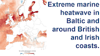
Summer rainfall in Norway is usually driven by evaporation over the North Sea, leading to rain when westerly winds prevail, and drier spells when the wind blows from the east. However, much of this summer's rain has been driven by the exceptionally high temperatures in the Baltic Sea this July, which have led to higher rates of precipitation, and high levels of rainfall when the wind blows from the east. The average annual rainfall in Norway has risen by 18% in the past century, with much of that increase happening in the past four decades. Should high summer temperatures in the Baltic become a regular feature of a warming climate, then it is likely that Norway, and Scandinavia in general, could shift towards a much wetter climate.

Flooding at Aurdal in southeast Norway on 11 August 2023. Ole Berg-Rusten/NTB/AFP/Getty Images.

See also...

Follow Sciency Thoughts on Facebook.

Follow Sciency Thoughts on Twitter.


Sunday, 16 July 2023

Flooding and landslides kill at least 37 people in South Korea.

Thirty seven people are known to have died and another ten are missing in a series of flooding and landslide related events in southern South Korea.  The highest number of fatalities occurred in Osong in North Chungcheong Province, where a river burst its banks, causing an underpass to flood, and trapping 15 vehicles, including a bus on the evening of Saturday 15 July 2023. Nine bodies have now been recovered from the site of this incident, with nine people receiving hospital treatment, and five still unaccounted for.

An underpass in Osong, North Chungcheong Province, which flooded on Saturday 15 July 2023, trapping fifteen vehicles and resulting in at least nine deaths. Korea National Fire Agency/AP.

At least seventeen people have died in landslide events in North Gyeongsang Province on Friday 14 and Saturday 15 July, with another nine missing. A rail engineer was injured when a landslide derailed a train, although fortunately no passengers were on the train at the time. Landslides are a common problem after severe weather events, as excess pore water pressure can overcome cohesion in soil and sediments, allowing them to flow like liquids. Approximately 90% of all landslides are caused by heavy rainfall. 

The aftermath of a landslide caused by heavy rains in Yecheon County in North Gyeongsang Province, on Saturday 15 July 2023. Yonhap/Reuters.

Many of the country's hydroelectric dams are struggling after 75 cm of rain fell of much of the country on Saturday, with the Goesan Dam in North Chungcheong Province reporting an inflow of 2700 tonnes of water per second - equivalent to its maximum outflow. This has led to many dams releasing water at high rates, further raising the risk of flooding. More than 7800 people have been evacuated from homes in low-lying areas since Thursday. Thirty two stretches of road are reported to have been swept away by flooding or otherwise destroyed, as are 33 homes. Forty nine rivers are reported to have burst their banks. Two hundred and sixteen roads and the entire national rail network were closed for at least some time, although most of the roads and some of the rail lines have now re-opened. Twenty of the country's national parks have been forced to close.

A collapsed river embankment in Cheongyang County in South Chungcheong Province on 15 July 2023. Yonhap.

The events are associated with the annual monsoon rains, which fall in Korea between mid-June and mid-August. Flooding and related incidents are not unusual during this season, but such large-scale problems have not happened in recent years. This years rains have been exceptionally heavy, with the country receiving an average of 30% more rain than would be expected, rising to 38.8% additional rain in the south of the country.

A rescue Dog and handler searching for survivors following a landslide in South Korea this week. Yun Kwan-shick/Yonhap/AP.

Monsoons are tropical sea breezes triggered by heating of the land during the warmer part of the year (summer). Both the land and sea are warmed by the Sun, but the land has a lower ability to absorb heat, radiating it back so that the air above landmasses becomes significantly warmer than that over the sea, causing the air above the land to rise and drawing in water from over the sea; since this has also been warmed it carries a high evaporated water content, and brings with it heavy rainfall. In the tropical dry season the situation is reversed, as the air over the land cools more rapidly with the seasons, leading to warmer air over the sea, and thus breezes moving from the shore to the sea (where air is rising more rapidly) and a drying of the climate.

Diagrammatic representation of wind and rainfall patterns in a tropical monsoon climate. Geosciences/University of Arizona.

See also...

Follow Sciency Thoughts on Facebook.

Follow Sciency Thoughts on Twitter.