Showing posts with label Satellite Tracking. Show all posts

Saturday, 4 March 2017

The down-side of Animal tagging in wildlife conservation and management.

The advent of satellite and radio tags that can be used to monitor the movement of wild Animals in their natural environment has revolutionised fields such as ecology, conservation and wildlife management, providing insights into the movement and behaviour of many species that have been elusive to Human trackers for generations. However, like all technologies these tracking systems have their potential downsides, particularly in their ability to modify the behaviour of both humans and animals. The potential of such tags to modify the behaviour, or even directly harm, the subjects of these studies was anticipated very early in the use of the technology, and most modern studies consider these possibilities carefully before a single tag is deployed.

In a paper published in the journal Conservation Biology on 20 February 2017, Steven Cooke and Vivian Nguyen of the Fish Ecology and Conservation Physiology Laboratory at Carleton University, Steven Kessel of the Department of Fisheries and Wildlife at Michigan State University, Nigel Hussey of the Department of Biology at the University of Windsor, Nathan Young of the Department of Sociology and Anthropology at the University of Ottawa and Adam Ford of The Irving K. Barber School of Arts and Sciences at The University of British Columbia, discuss a number of examples of how Humans have behaved in response to tagging programs, and the implications of these for people and organisations involved in animal tracking studies.

Firstly Cooke et al. note that there have been a number of attempts to obtain data from real-time tracking systems (systems that constantly broadcast the position of an animal to scientists monitoring it, as opposed to systems that broadcast packages of data at intervals), for the purposes of hunting or otherwise harming the subjects of the studies. 

In Minnesota in 2001 a group of anglers petitioned to be given access to data from a tagging study on Northern Pike, Esox lucius, agruing that since the study was publicly funded, they, as members of the public, were entitled to the data. The case was rejected by the court, on the basis that the data was collected to improve the catch-rates of recreational anglers, but the danger remains that a similar case elsewhere might be more successful. In 2014 White Sharks, Carcharodon carcharias, tagged as part of a study of their spatial ecology with a view to improving conservation planning were targeted for culling by the State Government of Western Australia, which had access to the data as part of the permitting agreement under which the researchers were working, as the government determined they were a threat to bathers on the state's beaches, despite the fact that the species is considered Endangered underh the terms of the Australian Environmental Protectionand Biodiversity Conservation Act.

An additional problem is that members of the public are often able to obtain equipment that enables them to track tagged Animals  directly. Even it this is done with essentially benign intent, for purposes such as photography or wildlife viewing, there can still be negative effects, such as Animals reacting to, or becoming habituated to, the presence of Humans and modifying their behaviour. In one such case authorities at Banff National Park in Alberta were forced to introduce restrictions on the use of VHF radio receivers in the park due to concerns about the harassment of Animals wearing tags. More worryingly in 2013 an attempt was made to hack a GPS system tracking Tigers in the Panna Tiger Reserve in Madhya Pradesh, India, apparently with the intention of poaching the Tigers.

Cooke et al. also raise concerns about the deployment of tagging systems for malign purposes. Tagging is generally considered an expensive technique by researchers, as most studies require a large number of tags to gather useful data. However a single tag could potentially be used for the purpose of tracking the movements of a group of social Animals. exposing that population to the risk of hunting, at a relatively low cost.

There is also the potential for the technology to be deployed in order to disrupt studies, for example by deploying extra tags to disrupt data collection. This might seem an obscure threat, but many conservation projects have commercial implications, potentially with vested interests that stand to benefit from undermining the quality of data collection, and some fringe groups are known to object to conservation projects for less definable reasons, for example it has been speculated that Wolves in Yellowstone National Park have been targeted by hunters who objected to the presence of Wolves in the park, and who may have been able to access encrypted data from radio collars worn by the Animals.

Tagged Wolf in Yellowstone National Park. William Campbell/US Fish and Wildlife Service/Wikipedia.

A negative public perception of tagging is also a potential problem, potentially undermining public support for conservation projects using the technology. Cooke et al. note that some indigenous fishermen around the Fraser River watershed in Canada objected to a tagging program targeting Pacific Salmon on the basis that it tampered with a food source (thought the majority of the population was strongly supportive of the project), while in parts of the US visitors to national parks have complained that visible tags on animals detract from the wilderness experience. 

See also...

http://sciencythoughts.blogspot.co.uk/2015/08/global-superpredator-how-human.htmlhttp://sciencythoughts.blogspot.co.uk/2016/04/lycaon-pictus-african-hunting-dogs.html
http://sciencythoughts.blogspot.co.uk/2014/08/satellite-tagging-whale-sharks-in-red.htmlhttp://sciencythoughts.blogspot.co.uk/2014/04/satellite-tracking-pygmy-blue-whales.html
http://sciencythoughts.blogspot.co.uk/2012/11/how-bar-headed-geese-cross-himalayas.htmlhttp://sciencythoughts.blogspot.co.uk/2012/05/satellite-tracking-manta-rays-off-coast.html
Follow Sciency Thoughts on Facebook.

Friday, 29 August 2014

Satellite tagging Whale Sharks in the Red Sea.

Whale Sharks (Rhincodon typus) are the largest extant Shark species, and indeed the largest living Fish species of any kind, often exceeding 10 m in length. They are found in tropical and subtropical waters across the world, but there life-cycle and biology are poorly understood;  they are filter feeding planktivores, however unlike the slightly smaller Basking Sharks (Cetorhinus maximus) they do not feed directly on phytoplankton, instead actively feeding on zooplankton and small fish. Whale Sharks are listed as Vulnerable on the International Union for the Conservation of Nature’s Red List of Threatened Species. They have a long life cycle, a slow reproductive rate and a migratory lifestyle that moves them across many political boundaries, making them hard to protect for their entire life cycles. They appear to change their movement patterns at different stages in their life-cycles, with observed aggregations of Whale Sharks typically consisting of individuals of similar age. Whale Sharks have been targeted by fisheries in many parts of the Indo-Pacific region, and while many countries have now introduced laws to limit or ban exploitation, these are seldom enforced. Tellingly several countries have reported a drop in catch without a reduction in fishing effort, which is usually a sign of a declining population.

In a paper published in the journal PLoS One on 30 July 2014, a team of scientists led by Michael Berumen of the Red Sea Research Center of the King Abdullah University of Science and Technology discuss the results of a satellite tagging program carried out on Whale Sharks at an aggregation site near Al-Lith, on the Saudi Arabian Red Sea coast, and the data this revealed about the biology and movements of the Sharks.

A diver approaching a Whale Shark, Rhincodon typus. Red Sea Research Center.

The study was initiated after a number or reported Shark sightings by commercial dive boats, carrying tourists to popular locations on the reefs of the southern Red Sea. Juvenile Whale Sharks (2.5-7.0 m in length) were found to be gathering on the northern Shi’b Habil Reef, about 4 km off the coast of Al-Lith during the spring period, which is roughly March to May in the southern Red Sea. Sharks were approached by divers in 2009, 2010 and 2011, who attempted to assess their size and sex before attaching a satellite tag to the dorsal fin with a long pole. 47 of the 59 tags deployed operated for 11-135 days, with a failure rate of 20.4% (12 tags that did not work at all); such a failure rate is typical for such experiments, though why it occurred is unclear.

Study sites for Rhincodon typus in the Saudi Arabian Red Sea. (A) Location of the study area within the Red Sea. (B) Locations of 59 satellite tag deployments on juvenile Rhincodon typus near Al-Qunfudhah (n = 2) and Al-Lith (n = 57). (C) Detail of tag deployments around Shi’b Habil near Al-Lith (n = 55). Symbol color indicates the year of tag deployment. Berumen et al. (2014).


The Sharks were found to have a roughly evenly balanced sex ratio (18 male, 21 female and 18 undetermined individuals). Studies of older Whale Sharks in aggregations have found these gatherings to be heavily skewed in favour of one sex or the other, though at what point in their lives the Sharks segregate, or why they do so, remains unknown.

The majority of the Sharks remained within the southern Red Sea, at least for as long as the tags remained operational, apparently following a regular cycle in which they spend spring on the Saudi Arabian coast, then move to the Sudanese coast during the summer, then south to the Eritrean Coast in autumn, before recrossing the Red Sea to spend winter off the coast of Yemen, moving northwards back into Saudi Arabian waters in the spring again.

Movements of 47 Rhincodon typus tagged with satellite tags in the Saudi Arabian Red Sea: Most individuals (n = 39) made basin-scale movements within the southern Red Sea. Berumen et al. (2014).

Three of the tagged individuals moved northwards, reaching as far as Sharm el-Sheikh on the Egyptian Coast. Exactly why they did this is unclear; the waters of the southern Red Sea are considered to be more productive, and therefore presumably present better feeding opportunities to Whale Sharks, and were clearly favoured by the majority of individuals.

Movements of 47 Rhincodon typus tagged with satellite tags in the Saudi Arabian Red Sea: Three individuals performed excursions into the northern Red Sea as far as Sharm el-Sheikh. Berumen et al. (2014).

Five individuals moved out of the Red Sea altogether, moving through the Gulf of Aden then northward into the northern Indian Ocean. These individuals were in the 3-5 m size range (roughly in the middle of the sample size range, rather than at the upper end which might imply an age-related change in behaviour), and four of the individuals were of indeterminate sex, the remaining one being male, making it impossible to determine if this movement related to sexual segregation in maturing individuals. It does, however, imply that the population of Whale Sharks in the Red Sea is not separate from that in the western Indian Ocean, and that individuals move between the two groups.

Movements of 47 Rhincodon typus tagged with satellite tags in the Saudi Arabian Red Sea: Five sharks departed the Red Sea and moved into the Gulf of Aden and northern Indian Ocean. Berumen et al. (2014).

The Sharks were all spotted and tagged close to the surface, and spent the majority of their time in the upper 50 m of the water column, though only 16% of their time within 2 m of the surface. The Sharks occasionally went through periods of deeper foraging and would spend about 80% of their time in the 200-400 m zone. Deeper excursions were also fairly common, with Sharks making individual dives below 400 m, and in the case of three individuals, below 1000 m (maximum recorded depth 1360 m). The waters of the Red Sea are unusual in that there is little vertical temperature differentiation, with waters ranging from up to 34˚C at the surface to about 21.7˚C at 400 m, then remaining constant to a depth of about 3 km. This meant that diving Sharks within the Red Sea were never encountering temperatures lower than 21.7˚C, and that the depth to which they dove was probably more influenced by oxygen availability. This is interesting, as it has been suggested that the movements of Whale Sharks are largely influenced by water temperature. However the Sharks which left the Red Sea continued to dive regularly, encountering a minimum temperature of 8˚C in the Gulf of Aden, suggesting that the Sharks are able to tolerate at least short periods at much lower temperatures.

It is not clear exactly why the Whale Sharks congregate around the Shi’b Habil Reef in the spring, though it may be associated with Coral spawning, which in the southern Red Sea takes place around the full moons in April to June. This is supported by the presence of Manta Rays in the area at the same time (also large plankton feeders), though the Mantas spend the majority of their year in inshore waters around Al-Lith, and do not engage in deep-diving behaviour, suggesting there is only a limited overlap in diet between the two species.

See also…


Sawsharks (Pristiophoridae) are highly specialized...


Eagle Rays (Myliobatidae) are large Batoid Fish (bilaterally symmetrical fish with cartilaginous skeletons descended from Sharks), that predominantly live as free swimming animals in the water column rather than on the sea bottom. They are strong swimmers, and some...


Manta Rays, or Devilfish (Manta birostris) are the worlds largest Batoid Fish (bilaterally symmetrical fish with cartilaginous skeletons descended from Sharks)...


Follow Sciency Thoughts on Facebook.

Saturday, 2 August 2014

Mapping deforestation on Borneo.

Industrial scale timber extraction began on Borneo in the 1970s and during the period 1980 to 2000 more timber was harvested from Borneo than from Africa and the Amazon Basin combined. In addition much forest has been cleared to make way for monoculture plantations, for the palm oil, rubber and timber industries, as well as being burned in forest fires.  For this reason the island is often assumed to be a hopeless case environmentally, where a once rich and globally important ecosystem has largely been destroyed and where remaining areas of forest are unlikely to be saved. An announcement by the Indonesian Government in 2011 that 45% of the original forest in the province of Kalimantan would be permanently protected was met with derision by environmental groups, who claimed that only 30% of Kalimantan’s forests remained. Despite this situation there is no overall data on deforestation on the island, which is split between the Indonesian province of Kalimantan, the Malaysian states of Sabah and Sarawak and the Sultanate of Brunei. 

In a paper published in the journal PLoS One on 16 July 2014, a team of scientists led by David Gaveau of the Center for International Forestry Research in Bogor, Indonesia, compared data from LANDSAT images from 1973 (the earliest year for which satellite data is available) and ALOS PALSAR images from 2010, in order to try to develop a clearer picture of the amount of forest that has been lost or converted to plantations over this time across the island.

Forest (dark green) and non-forest (white) in 1973. Gaveau et al. (2014).

Gaveau et al. estimate that in 1973 Borneo had about 558 060 km² of largely intact old growth forest, made up of Diptocarp-dominated lowland, hill and montane rainforests, freshwater and peat swamp forests, heath forests (kerangas) and Mangrove forests, largely dominated by Nypa Palms. These together covered 75.7% of the island.

By 2010 this coverage had been reduced by 168 493 km², a loss of 30.2% of the island’s forests leaving 389 566 km² of forest covering 28.4% of the island. The heaviest rates of loss have been in (more accessible) lowland forests, however this has changed over time, with logging advancing into more inaccessible highland areas. 75 480 km² of forest (about 10% of the surface area of the island) has been replaced with Palm oil or timber plantations.

Areas of forest loss during 1973–2010 (red). Gaveau et al. (2014).

This deforestation has not been even across the island, with the loss of 39.5% of the forests in Sabah, 30.7% in Kalimantan, 23.1% in Sarawak and only 8.3% in Brunei. Gaveau et al. note that this may in part be driven by climate; the forests of Sabah and Kalimantan are much drier than those of Sarawak, and easily affected by fires once deforestation begins to open up the forest, while the much wetter climate of Sarawak tends to prevent this.

42% of remaining forests on Borneo are in areas designated for timber production, and can therefore be expected to be logged in the future. A further 16% of the forests are in areas that have been designated for conversion to other uses (agriculture etc.) and will presumably also be lost. Only 11.9% of the forest lies in areas designated to be protected from logging (5.6% of lowland forest, the most threatened environment). 17% of the forest within national parks and other protected areas has also been logged, although this constitutes a mixture of illegally logged forests and forests which were logged prior to the designation of the area as national park (for example in the Sebangau National Park) and which hopefully will be enabled to regenerate.

Gaveau et al. also observe that the Borneo has large areas of ‘logged forest’, which have been targeted for timber extraction but not clear cut (i.e. loggers have removed some large, valuable trees but otherwise left the forest intact). They suggest that in the absence of the potential to save large areas of forest completely, such logged forest should become a priority for environmentalists, and the sustainable use of forests promoted over clear felling.

Remaining intact forest (dark green), remaining logged forest (light green), and industrial oil palm and timber plantations (Black) in 2010. Gaveau et al. (2014).

See also…


An investigation is underway after a section of pipeline carrying natural gas exploded in the Malaysian state of Sarawak, Borneo, exploded at about 2.00 am local time...


Two people have been killed by a landslide at a logging site in Sabah State, Malaysia, on Wednesday 4 June...


Straight Snouted Weevils (Brentidae) are wood-eating Beetles related to the True Weevils, found in temperate and tropical regions across the globe, though they are most diverse and numerous in the tropics. The classification of the group has changed dramatically a number of times in the last 20 years, and appears likely...


Follow Sciency Thoughts on Facebook.

Saturday, 12 April 2014

Satellite tracking Pygmy Blue Whales.

Pygmy Blue Whales (Balaenoptera musculus brevicauda) are a subspecies of Blue Whale discovered in the early 1960s and subsequently targeted by Japanese and Soviet whaling fleets. There are currently known to be four separate populations, ranging from the western Indian Ocean to the waters around New Zealand, with some exchange of individuals between these. Each population migrates between a southern feeding ground in the summer and a northern feeding ground in winter, but little is known about their movement paths, population structures or numbers. The subspecies is listed as ‘data deficient’ on the International Union for the Conservation of Nature’s Red List of Threatened Species, indicating that too little is known about them to make an accurate assessment of their conservation status.

A Pygmy Blue Whale off the coast of Mozambique. Paul Hilton/Greenpeace.

In a paper published in the journal PLoS One on 9 April 2014, a team of scientists led by Michael Double of the Australian Marine Mammal Centre discuss the results of an experiment in which Pygmy Blue Whales were radiotagged in Perth Canyon, off the coast of Western Australia, in April 2009 and March 2011, and their subsequent movements tracked by satellite until the tags stopped working. This population is known to migrate between the southwest coast of Australia and the Banda Sea in Indonesia, where they breed between June and September. This population is known to have been targeted by Soviet whaling fleets in the 1960s, but the health of the current population is not known, nor are the potential threats faced by these Whales.

Four of the tags deployed failed to activate properly, with the remainder lasting for between 8 and 308 days, though one of these failed to activate immediately, activating in June 2011, though when it did so the tagged Whale was with the rest of the population, therefore producing coherent data. 

Five of the Whales when first tagged moved southwards towards the Naturaliste Plateau, before turning about and joining the northward migration. The Whales travelled an average of 3009 km, at an average rate of 21.9 km per day. 

The Whales travelled northward along the Australian coast, past the Ningaloo Reef to the North West Cape in March and April, then northward through the Savu and Timor Seas in May and June, eventually reaching the Molucca and Banda Seas. The Whales occupied shallower waters while close to Australia, averaging 1369.5 m, then progressively deeper waters while crossing the Savu and Timor Seas, reaching the deepest waters of their range in the Banda and Molucca Seas, where the waters average 3788.5 m.

Filtered satellite tag derived locations of pygmy blue whales (n = 11) by month. Individuals were tagged in March (2011: n = 7) and April (2009: n = 3; 2011: n = 1) in the Perth Canyon. The northern terminus of migration occurred in Indonesia. A single whale was tracked intermittently until February 2012 at which time it was located in the subtropical frontal zone. Double et al. (2014).

The Whales face a number of anthropogenic threats along this route. The western coast of Australia is an area of expanding natural gas exploration, with the associated increase in noise from shipping and seismic exploration. In the waters of Indonesia they run the risk of encountering gillnets used in fishing, and increased noise pollution from reef dynamiting, again used in the fishing industry.

Other species of Whale have been known to abandon parts of their ranges in order to avoid noise pollution, and while most large marine Vertebrates can alter their movement patterns substantially in order to avoid threats and take advantage of novel food sources, the loss of a critical part of the Whales range, particularly the feeding grounds, could potentially have a strongly detrimental effect on the long-term survival of the population.

See also…


Follow Sciency Thoughts on Facebook.

Saturday, 17 November 2012

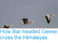
How Bar-headed Geese cross the Himalayas.

Bar-headed Geese, Anser indicus, are well known for their annual migration between breeding grounds in Tibet, Mongolia and northern China, and wintering grounds in southern India, a migration route that involves crossing the highest part of the Himalayas. There have been frequent reports of climbers witnessing the Geese at extremely high altitudes, and they are regularly cited in popular literature as achieving sustained flights at altitudes exceeding 8000 m. However empirical data on such flights has been lacking, and migration routes in excess of 8000 m seem highly unlikely to biologists, as the air at this height is rarified (thin), providing little lift to the Geese (which are quite large Birds), and therefore requiring more energy, and at the same time depleted in oxygen, making less energy available. In favor of the high altitude migration route, it has been agued that it would represent a much shorter total journey and that it would reduce the risk of Geese flying into mountains.

Bar-headed Geese (Anser indicus) in flight. Rajiv Lather/Birding in India.

In a paper published in the Proceedings of the Royal Society Series B: Biological Sciences on 31 October 2012, a team of Scientists led by Lucy Hawkes of the School of Biological Sciences at the University of Bangor and the Environment and Sustainability Institute at the University of Exeter, present the results of a study in which Bar-headed Geese were radio-tagged in order to trace their travel routes through or over the Himalayas.

Hawkes et al. found that the Geese spent 95% of their time bellow 5784 m (still impressively high), choosing to take a longer route through the Himalayas in order to utilize lower-altitude valleys and passes. Only 10 of the 91 Geese tagged were ever recorded above this altitude, and only one exceeded 6500 m, reaching 6540 m on an overnight flight, when the air was particularly cool (and therefore dense). While they cannot rule out the possibility that Geese do sometimes reach higher altitudes, Hawkes et al. strongly suspect that tales of Geese flying at 8000 m are apocryphal, owing more to climbers' folk-law than to accurate observation.

(a) Map showing the migration routes of the tagged birds. (b) The land elevation of a cross-section through the migration route (exaggerated). Hawkes et al. (2012).


Follow Sciency Thoughts on Facebook.

Monday, 14 May 2012

Satellite tracking Manta Rays off the coast of Mexico.

Manta Rays, or Devilfish (Manta birostris) are the worlds largest Batoid Fish (bilaterally symmetrical fish with cartilaginous skeletons descended from Sharks), reaching widths of up to 7.1 m. They are considered to be Vulnerable by the International Union for the Conservation of Nature, due to their low breeding speed (Manta Rays produce one or two live young after a pregnancy lasting twelve months) and increasing targeting by fishermen; Manta Rays are eaten and used as bait for sharks, they are also increasingly used in traditional Chinese medicine. Many Manta Ray habitats also coincide with shipping lanes, and reefs where the animals aggregate are in places becoming popular with tourists, both of which are likely to have some effect on them. To make matters more complicated scientist have recently recognized a second species of Manta, Manta alfredi, or the Reef Manta Ray, which is slightly smaller, but which may be the species found in most large groups on reefs, making the Giant Manta (M. biostris) somewhat rarer than previously thought; a third species may also exist.

A diver swimming with a Manta Ray off the coast of Mexico; it is unclear how this behavior affects the Rays. Franco Banfi/Caters/The Telegraph.

In a paper published in the journal PLoS One on 10 May 2012, a team of Scientists led by Rachel Graham of the Wildlife Conservation Society's Gulf and Caribbean Sharks and Rays Program and the Centre for Ecology and Conservation at the University of Exeter describe the results of the first study of the movements of Manta Rays using satellite tracking technology.

The team tagged a six Manta Rays during a thirteen day research cruise off the Yucatan Peninsula, Mexico. The Rays were then tracked by satellite for as long as the tags survived; between 2 and 64 days. During this time they were able to observe the movements, and asses the feeding strategies used by the Mantas by observing how they interacted with resources. 

Maps showing the movements of three Manta Rays, a female (g), a male (h) and a juvenile (i), during the period their tags remained attached. The colours represent Surface Sea Temperature. Dotted contour lines represent seafloor depth. Graham et al. (2012).

During the time of study the Mantas spent the majority of their time in surface waters; 83% of their time above 50 m deep, and 92% of their time above 100 m deep. They also favored warmer water, spending 95% of their time in water warmer than 26.1°C. They were conservative in their movements, spending the majority of their time in areas of known population density. This confirms the results of studies made using other techniques (principally visual identification) in other parts of the world.

Map showing known area of Manta population density (grey); darker colours representing denser populations. Blue areas represent established marine conservation areas. Crosses represent Mexican tourism ports. Graham et al. (2012).

There are a number of existing marine protected areas around the Yucatan Coast, set up to conserve other species, but the areas favored by Manta Rays are mostly outside of these. Manta Rays are in theory protected from exploitation by fishing vessels in Mexican waters, but these restrictions are thought to be widely ignored. In theory additional reserves could be established to include the areas used by Manta Rays, but there are clearly limits on how many such such reserves could be established and effectively policed; if fishermen find too much of the sea is closed to them they may stop respecting any of the reserves.

During the study the Mantas were observed using two feeding strategies. Firstly the visited an area being used for spawning by a shoal of Little Tunny (Euthynnus alletteratus), where large numbers of planktic eggs were being produced. Secondly they visited areas of seasonal upwelling, where currents were brining nutrient-rich waters up from the deep, fueling a phytoplankton (single-celled marine algae) bloom, and consequent boom in population in the animals which feed on these, typically Sergestid Shrimp and Calanoid Copepods and the predatory Chaetognaths (Arrow Worms) that feed upon them.

The areas used by the Manta Rays coincide with some of the busiest shipping lanes in the Caribbean, potentially putting the Rays at risk both from direct strikes, and from marine litter (particularly plastics) and oil or other spills.

Map showing shipping lanes in the West Caribbean. Graham et al. (2012).


Follow Sciency Thoughts on Facebook