
A rising global population combined with a desire for people around the world to enjoy higher standards of living has led to dramatic infrastructure development worldwide, including a massive expansion in roads and other transport networks. It is estimated that about 12 million km of new roads has been built since 2000, with a further 25 million km of new roads predicted by 2050. Much of this expansion has taken place in countries with extensive tropical forests, threatening many of the world’s biologically richest ecosystems. The island of Borneo sustains the largest intact forest area in Southeast Asia. These forests harbour a global biodiversity hotspot, exceptionally high species endemism, and large carbon stocks. They also provide important ecosystem services for local and indigenous communities. About 370 000 km² of this forest lies within Kalimantan, or Indonesian Borneo, an area which comprises diverse ecosystems including montane forests, lowland mixed-Dipterocarp forests, and peat-swamp forests. These forests have been undergoing clearance and degradation at varying but generally high rates since the onset of industrial-scale extractive industries half a century ago. About 31% of the forests remaining in Kalimantan in 1973 have disappeared since that date, with primary (old-growth) forests being the worst affected. Key drivers include infrastructure expansion, logging, oil palm and wood-pulp plantations, mining, and wildfires associated with major droughts.
In a paper published in the journal Scientific Reports on 15 January 2019, Mohammed Alamgir, Mason Campbell, and Sean Sloan of the Centre for Tropical Environmental and Sustainability Science at James Cook University, Ali Suhardiman of the Laboratory of Forest Inventory and Planning at the University of Mulawarman, Jatna Supriatna of the Research Center for Climate Change and Department of Biology at the University of Indonesia, and William Laurance, also of the Centre for Tropical Environmental and Sustainability Science at James Cook University, present the results of a study into the predicted impact of currently planned road and rail developments on the forests of Kalimantan.
Alamgir et al. obtained spatial data and maps of planned and ongoing roads and rail lines in Kalimantan from a variety of regional and national sources in an endeavour to include the majority of the planned and ongoing roads and rail lines in our analyses. They digitised parallel border roads and other planned and ongoing road developments from infrastructure maps of each of the five provinces of Kalimantan (West Kalimantan, East Kalimantan, Central Kalimantan, South Kalimantan and North Kalimantan) generated from the Indonesian Government Infrastructure Information website. These maps contain planned and ongoing roads in each province of Kalimantan. Alamgir et al. also digitized planned new and upgrade roads of Trans Kalimantan Highways from Potter (2008) and the Indonesian Master Plan, which identified the planned routes and other planned highways in Kalimantan. Furthermore, they digitized additional planned and ongoing roads in North Kalimantan and West Kalimantan. Alamgir et al.also compiled spatial data on the planned roads, rail lines and rail stations in North Kalimantan, and on the Samarinda Freeway from the Department of Forestry at Mulawarman University. Extensive discussions to appreciate the ambitions, constraints, and precautions surrounding the planned and ongoing road expansion projects were held with relevant provincial and district planning offices (Bappeda), environmental agencies, Non-Government Organisations such as the World Wide Fund for Nature, and local community groups such as Balikpapan Bay Community Group in Balikpapan, with the aim of understanding of local pressing issues relevant to these infrastructure expansion projects.

An aerial view of construction activities on the
Balikpapan-Samarinda toll road in the Samboja area in Kutai Kartanegara,
East Kalimantan. Akbar Nugroho Gumay/Jakata Post.
Indonesia, the most extensively forested Southeast Asian nation, experienced the world’s highest annual rate of forest loss in 2011-12, losing 22 000 km² of forest and overtaking Brazil. Over the same period, its road network increased by about 42%, with legally mapped roads expanding in length by roughly 151 000 km. Many roads have markedly increased nearby forest loss and degradation, particularly those built through and adjacent to wilderness areas. Such trends are slated to increase further under the Indonesian Master Plan for the Acceleration and Expansion of Economic Development, which aims to sharply expand road infrastructure by 2025 via the development of six major economic corridors across the Indonesian archipelago. One of these, the Kalimantan Economic Corridor, will sharply expand transportation infrastructure across Kalimantan.
Among the infrastructure projects planned or underway in Kalimantan are an upgrade of 3316 km of the Trans-Kalimantan Highway in southern Kalimantan, 1920 km of new roads (parallel border roads) in northern Kalimantan flanking the Malaysian-Indonesian border, and additional highways and expressways in Central, South, East, and North Kalimantan. The primary goal of this new infrastructure is to increase commercial connectivity and primary industries, particularly coal mining, Oil Palm, and industrial logging. However, the major impacts of this spate of new infrastructure and extractive industries on native forest, biodiversity and relevant attributes, forest fragmentation, landscape connectivity and current forests pattern, in Kalimantan have not been quantified.

Major planned and ongoing infrastructure-expansion networks in Indonesian Borneo examined in the current study. Parallel border roads were extracted from Indonesian Government Infrastructure Information maps for each five provinces of Kalimantan. Alamgir et al. (2019).
Kalimantan’s forests are host to one of the two remaining habitat on the planet where Orangutan, Rhinoceros and Elephant co-exist. It also harbours several globally endangered species such as the Bornean Orangutan, Pongo pygmaeus, and Pygmy Elephant, Elephas maximus borneensis, and iconic species such as Bearded Pig, Sus barbatus, and Sun Bear, Helarctos malayanus, that require a large home range to maintain viable populations. Consequently, if planned and ongoing infrastructure expansion fragments forests and reduces landscape connectivity, it will likely seriously impact the key species and landscape ecological dynamics in Indonesian Borneo.
Alamgir et al. found that planned and ongoing road development will substantially alter the current spatial pattern of forests in Indonesian Borneo. Infrastructure expansion will create an additional 970 km² of forest-edge habitat (i.e. forest that is within 900 m of the nearest forest edge), an increase of 17% on current levels. Conversely about 2370 km² of core forest (forest that is more than 900 m from the nearest forest edge) will be transformed into other, non-core forest categories, primarily small forest patches and edge forests, due to increased forest fragmentation or clearing associated with infrastructure development. Furthermore about 9320 km² of existing ‘bridge’ forest corridors connecting different core-forest areas will be impacted, potentially ecologically disconnecting large expanses of core forest from one another. Finally 900 km² of loop forest (stretches of forest that connect different sections of a core-forest patch) will be created because of increased fragmentation.
All these findings clearly indicate that planned and ongoing road development in Indonesian Borneo will substantially alter the current spatial pattern of forests, leading to large-scale degradation and fragmentation of currently intact forest and a marked decline of forest connectivity.
All these findings clearly indicate that planned and ongoing road development in Indonesian Borneo will substantially alter the current spatial pattern of forests, leading to large-scale degradation and fragmentation of currently intact forest and a marked decline of forest connectivity.

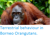
A disorientated and displaced Orangutan in search of food, is rescued along a road in East Kalimantan. Borneo Orangutan Survival Foundation.
Planned and ongoing road development in Indonesian Borneo will significantly reduce the connectivity of forests at regional scales. Alamgir et al.'s analysis shows that the Equivalent Connected Area, a measure of the percentage of habitat accessible by wildlife based on the degree of network connectivity, is currently 89% for forested areas of Indonesian Borneo. If the planned and ongoing infrastructure expansion were to occur, this index would be reduced to 55%, meaning that more than one-third (34%) of the accessible habitat in the region would be isolated from the remaining accessible habitat. This would create a number of additional isolated habitat patches across the Kalimantan region. This process of patch isolation would predominantly occur via the bisection of larger habitat patches and destruction of numerous forest linkages that currently connect core-forest areas.
The planned and ongoing road expansion would have a major impact on existing protected areas in Indonesian Borneo. Alamgir et al. found that planned and ongoing construction of new road and rail lines would intersect a total of 25 existing protected areas that are currently free from major road incursion. Notably, a planned parallel border-road project in north Kalimantan will intersect a relatively intact protected area, Kayan Mentarang National Park, that is among the largest remaining protected areas in Indonesian Borneo. Planned and ongoing projects would reduce the internal ecological connectivity of the protected areas and also the extensive trans-boundary connectivity between Indonesian Borneo and Malaysian Borneo. In addition to new infrastructure project, planned upgrades of existing roads will further impact 17 protected areas, particularly in southern Borneo. This process would increase disturbances from earth- and road-works, increase erosion and stream sedimentation, and increase barrier effects to wildlife by widening existing clearings inside protected areas.
The planned and ongoing road expansion in Kalimantan is likely to facilitate logging, oil palm, and wood-fibre industries in intact forest frontiers. Alamgir et al. found that most of the planned and ongoing road developments are situated either inside or along the margins of primary or selectively logged forests adjacent to logging, Oil Palm, and wood-fibre concessions. This pattern suggests that much road expansion will be at the expense of native forest. Alamgir et al. also observed that many ongoing and planned road developments are located along the margins of concessions adjacent to remaining primary or selectively logged forests.

Planned and ongoing infrastructure expansion and the projected decline in landscape connectivity in Indonesian Borneo. The left and right panel show landscape connectivity before and after infrastructure expansion, respectively. Different colours in a map indicate an isolated forest patch. Alamgir et al. (2019).
Different segments of the planned and ongoing road and rail lines in Kalimantan have varying environmental risks. Alamgir et al. classified planned and ongoing road and rail lines construction and upgrades into different categories, considering their overall potential implications for regional environmental integrity. They classified 634 km of new and upgraded road and rail lines in Kalimantan as Very High Impact (roads and rail line segments will bisect current protected areas), 1472 km of new road was classified as High Impact (segments will cut through primary forest or peat land), and 1242 km of new road was classified as Moderate Impact (indicating that these segments will cut through selectively logged forests or regrowth forests). This categorisation indicates that a substantial part of the planned construction and upgrade locations in Kalimantan coincides with current protected areas, peat land, intact forests, and selectively logged and regrowth forests.
The planned and ongoing expansion of infrastructure in Kalimantan will significantly degrade large expanses of native forest. It will sharply increase edge forests and forest fragmentation while reducing core forest. Alamgir et al.'s findings are consistent with several previous analyses showing that road proliferation in tropical landscapes dramatically increases forest fragmentation and abrupt forest edges. The projected changes in spatial pattern will occur because a number of ongoing and planned infrastructure projects, such as parallel border road projects in West, East, and North Kalimantan, will cut through large core-forest areas. Such large-scale fragmentation will inevitably diminish key environmental and ecological values, such as disturbance-sensitive biodiversity, carbon storage, and hydrological functioning. The fragmented forests would be more vulnerable to subsequent forest conversion via legal and illegal means, mirroring trends observed in the Amazon, Sumatra, and Malaysian Borneo.
Indices of landscape connectivity measure the proportion of suitable habitat in a landscape that is accessible by wildlife populations. Alamgir et al.'s findings include a marked loss of current forest linkages, the creation of a number of isolated forest patches, and a 34% decline in overall landscape connectivity. The consequences of this severe connectivity loss may be dire for the unique biodiversity of Borneo, particularly for several globally endangered animals that have large home ranges, such as Bornean orangutans, and Pygmy Elephants, as well as iconic species such as Bearded Pigs and Sun Bears, that will travel hundreds of kilometres in response to mast fruiting. The critically endangered Sumatran Rhinoceros, Dicerorhinus sumatrensis, may also persist in tiny numbers in Kalimantan. Planned projects could pose severe threats to the viability of these rare and space-demanding species, in part by massively reducing forest connectivity between Malaysian and Indonesian Borneo, which have long existed as a single forest block.

Categorization of planned and ongoing road and rail lines by their potential environmental impacts in Indonesian Borneo. Alamgir et al. (2019).
Many wildlife species, including many species actively poached and traded illegally, would become more vulnerable to poachers and hunters from increased road access and forest fragmentation. Similar consequences were reported from African tropical forests where Forest Elephants, Loxodonta cyclotis, declined by more than 60% between 2002 and 2011, largely due to the increased access for poachers and commercial hunters from forest-road expansion. In Peninsular Malaysia, about 90% of snares and poaching camps in a studied forested area were found within 5 km of a paved road. Similarly, Sumatran Orangutans, Pongo abelii, and Tapanuli Orangutans, Pongo tapanuliensis, in Sumatra are both critically endangered by infrastructure proliferation in their remaining habitat. Beyond these iconic species, infrastructure would also negatively affect forest-interior small Mammals, arboreal species, and Birds, among others.
Alamgir et al.'s analyses suggest that planned and ongoing infrastructure expansion in Kalimantan will be highly disruptive to protected areas, by diminishing their connectivity to nearby forests and increasing encroachment and poaching. If all planned infrastructure expansion proceeds, 42 protected areas will be impacted to varying degrees. This process will undermine the Indonesian commitment to achieve the Aichi Target 11 of the Convention on Biological Diversity that aims to ensure that by 2020 at least 17% of the total terrestrial area will be represented by well-connected protected area systems. Both at the regional (Kalimantan) and national scale, Indonesia is currently well behind schedule to achieve this target and immediate actions to maintain or improve protected-area connectivity are essential. Road construction facilitates deforestation and degradation of protection forest, and is one of the main causes of declining effectiveness of protected areas across Indonesia and the world.
If major infrastructure projects in Kalimantan proceed as planned, the majority of remaining old-growth forests (unlogged primary forests) and peatlands in Kalimantan may become accessible, threatening their near-term degradation. This would parallel current and historical trends of deforestation in Borneo and elsewhere in Indonesia. The current Indonesia Master Plan as presently framed will lead to sharp increases in forest loss and disruption and reductions in their associated environmental services, such as the high levels of carbon storage in upland and peatland forests, which would have global implications for climate change.

A massive toll road is near completion to connect to Balikpapan and Samarinda in East Kalimantan. Jack Board/MediaCorp.
See also...


Follow Sciency Thoughts on Facebook.