Showing posts with label Oil Exploration. Show all posts

Wednesday, 4 September 2019

Magnitude 1.1 Earthquake in Surrey, England.

The British Geological Survey recorded a Magnitude 1.1 Earthquake at a depth of 2 km, about 1 km to the south of Norwood Hill in Surrey, England, slightly before 6.15 am GMT (slightly before 5.15 am GMT) on Monday 2 September 2019. There are no reports of any damage or casualties associated with this Earthquake, and nor would they be expected with such a small event, people have reported feeling it locally. 

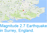
The approximate location of the 2 September 2019 Surrey Earthquake. Google Maps.

This is the latest in a series of shallow Earthquakes in the area, which began with a Magnitude 2.6 event on 1 April 2018, the first recorded Earthquake in Surrey in over 268 years, and included a Magnitude 2.4 event on 14 February,  Magnitude 2.0 event on 19 February, and magnitude 3.1 event on 27 February this year. Local residentshave raised concerns that these events may be linked to oil and gas exploration in the region, and have formed a protest group, Frack Free Surrey, which has called for a moratorium on such activities, a demand which has won the support of several senior British geologists, though the British Geological Survey has not been able to establish a link between the Earthquakes and the drilling, and the companies involved UK Oil & Gas PLC, and Angus Energy, deny such a link is even possible.

Letter written to The Times newspaper in London in August 2019, by four senior British geologists, Stuart Gilfillan, Stuart Haszeldine, Bill McGuire, and Richard Selley, calling for a moratorium on explorationary oil drilling in Surrey. Drill or Drop?

Earthquakes become more common as you travel north and west in Great Britain, with the west coast of Scotland being the most quake-prone part of the island and the northwest of Wales being more prone  to quakes than the rest of Wales or most of England. However, while quakes in southern England are less frequent, they are often larger than events in the north, as tectonic pressures tend to build up for longer periods of time between events, so that when they occur more pressure is released.

The precise cause of Earthquakes in the UK can be hard to determine; the country is not close to any obvious single cause of such activity such as a plate margin, but is subject to tectonic pressures from several different sources, with most quakes probably being the result of the interplay between these forces.

Britain is being pushed to the east by the expansion of the Atlantic Ocean and to the north by the impact of Africa into Europe from the south. It is also affected by lesser areas of tectonic spreading beneath the North Sea, Rhine Valley and Bay of Biscay. Finally the country is subject to glacial rebound; until about 10 000 years ago much of the north of the country was covered by a thick layer of glacial ice (this is believed to have been thickest on the west coast of Scotland), pushing the rocks of the British lithosphere down into the underlying mantle. This ice is now gone, and the rocks are springing (slowly) back into their original position, causing the occasional Earthquake in the process.

 (Top) Simplified diagram showing principle of glacial rebound. Wikipedia. (Bottom) Map showing the rate of glacial rebound in various parts of the UK. Note that some parts of England and Wales show negative values, these areas are being pushed down slightly by uplift in Scotland, as the entire landmass is quite rigid and acts a bit like a see-saw. Climate North East.

Witness accounts can help scientists to understand Earthquakes and the geological processes that cause them. If you felt this quake (or if you were in the area and did not, which is also useful information) then you can report it to the British Geological Survey here.

See also...

https://sciencythoughts.blogspot.com/2019/03/magnitude-31-earthquake-near-gatwick.htmlhttps://sciencythoughts.blogspot.com/2018/09/delphinapterus-leucas-beluga-whale.html
https://sciencythoughts.blogspot.com/2018/04/thaumetopoea-processionea-warnings.htmlhttps://sciencythoughts.blogspot.com/2018/04/england-and-wales-hit-by-measles.html
https://sciencythoughts.blogspot.com/2018/04/magnitude-27-earthquake-in-surrey.htmlhttps://sciencythoughts.blogspot.com/2018/03/hundreds-of-artefacts-stolen-from.html
Follow Sciency Thoughts on Facebook.

Friday, 1 March 2019

Magnitude 3.1 Earthquake near Gatwick Airport.

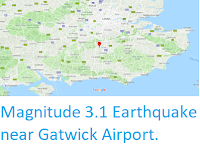
The British Geological Survey recorded a Magnitude 3.1 Earthquake at a depth of 2 km, in southeast Surrey, about 5 km to the west Gatwick Airport, slightly after 3.40 am GMT on Wednesday 27 February 2019. There are no reports of any damage or casualties associated with this Earthquake, and nor would they be expected with such a small event, people have reported feeling it across parts of Surrey, West Sussex, Kent, Hampshire and London. 

The approximate location of the 27 February 2019 Surrey Earthquake. Google Maps.

This is the latest in a series of shallow Earthquakes in the area, which began with a Magnitude 2.6 event on 1 April 2018, the first recorded Earthquake in Surrey in over 268 years, and included a Magnitude 2.4 event on 14 February,  Magnitude 2.0 event on 19 February. Local residents have raised concerns that these events may be linked to oil and gas exploration in the region, and called for a moratorium on such activities, though the British Geological Survey has not been able to establish a link between the Earthquakes and the drilling.

Earthquakes become more common as you travel north and west in Great Britain, with the west coast of Scotland being the most quake-prone part of the island and the northwest of Wales being more prone  to quakes than the rest of Wales or most of England. However, while quakes in southern England are less frequent, they are often larger than events in the north, as tectonic pressures tend to build up for longer periods of time between events, so that when they occur more pressure is released.

The precise cause of Earthquakes in the UK can be hard to determine; the country is not close to any obvious single cause of such activity such as a plate margin, but is subject to tectonic pressures from several different sources, with most quakes probably being the result of the interplay between these forces.

Britain is being pushed to the east by the expansion of the Atlantic Ocean and to the north by the impact of Africa into Europe from the south. It is also affected by lesser areas of tectonic spreading beneath the North Sea, Rhine Valley and Bay of Biscay. Finally the country is subject to glacial rebound; until about 10 000 years ago much of the north of the country was covered by a thick layer of glacial ice (this is believed to have been thickest on the west coast of Scotland), pushing the rocks of the British lithosphere down into the underlying mantle. This ice is now gone, and the rocks are springing (slowly) back into their original position, causing the occasional Earthquake in the process.

 (Top) Simplified diagram showing principle of glacial rebound. Wikipedia. (Bottom) Map showing the rate of glacial rebound in various parts of the UK. Note that some parts of England and Wales show negative values, these areas are being pushed down slightly by uplift in Scotland, as the entire landmass is quite rigid and acts a bit like a see-saw. Climate North East.

Witness accounts can help scientists to understand Earthquakes and the geological processes that cause them. If you felt this quake (or if you were in the area and did not, which is also useful information) then you can report it to the British Geological Survey here.

See also...
https://sciencythoughts.blogspot.com/2018/09/delphinapterus-leucas-beluga-whale.htmlhttps://sciencythoughts.blogspot.com/2018/04/thaumetopoea-processionea-warnings.html
https://sciencythoughts.blogspot.com/2018/04/england-and-wales-hit-by-measles.htmlhttps://sciencythoughts.blogspot.com/2018/04/magnitude-27-earthquake-in-surrey.html
https://sciencythoughts.blogspot.com/2018/03/hundreds-of-artefacts-stolen-from.htmlhttps://sciencythoughts.blogspot.com/2018/03/thousands-of-starfish-wash-up-on.html
Follow Sciency Thoughts on Facebook.

Saturday, 22 September 2018

Conglomerate Oilfield discovered in the Junggar Basin of Xinjiang Province, China.

The Junggar Basin of Xinjiang Province is the second largest sedimentary basin in China, covering an area of about 380 000 km². It is bounded by the Altai Mountains in the northeast and the North Tianshan Mountains in the south, with the central part of the basin forming the Guerbantonggute Desert. The basin has a basement of crystaline Precambrian rocks, overlain by folded Devonian to Early-Middle Carboniferous deposits, then a stratified sedimentary sequence that lasts from the Carboniferous to the Quaternary, comprising shallow sea facies limestone, and continental facies, including sandstone, mudstone and conglomerates. The Junggar Basin contains numerous fossil bearing strata, which have produced coal, oil, silicified wood, Dinosaurs, Fish and Shellfish. Oil has been exploited in the basin since 1955, when the Karamay Oilfield was discovered, the first oilfield discovered in China after the revolution, but over sixty years of exploration has failed to find any further significant oil reserves.

In a paper published in the journal Acta Geologica Sinica on 27 February 2018, Hao Ziguo and Fei Hongcai of the Chinese Academy of Geological Sciences and the Geological Society of China, Hao Qingqing of the Institute of Mineral Resources Research of the China Metallurgical Geology Bureau, and Liu Lian, also of the Chinese Academy of Geological Sciences and the Geological Society of China, describe the discovery of a significant oil resevoir in the central part of the Junggar Basin.

The discovery of the reserve was announced by the Xinjiang Oil Field Co, a subsidiary of PetroChina, announced the discovery at the end of 2017, having begun surveys of the basin in 2005. It is located in the Triassic Baikouquan Formation, a shallow water facies fan delta and associated conglomerate deposits, located 4400-6000 m below the surface.

Geological map showing the distribution of conglomerate type oilfields in the Junggar Basin of Xinjiang. (1) Proven reserves; (2) Probable reserves; (3) Possible reserves; (4) Fault; (5) Fan delta plain facies; (6) Fan delta front facies; (7) Shore-shallow lake facies. Hao et al. (2018).

The deposits represent the largest conglomerate is the second largest known conglomerate based oil-reserve in the world, after the Hemlock Oilfield in the United States, with an estimated reserve of over 1.24 billion tons of petroleum.

See also...

https://sciencythoughts.blogspot.com/2018/08/offshore-oil-prospecting-returns-to.htmlhttps://sciencythoughts.blogspot.com/2018/05/determining-diet-of-miocene.html
https://sciencythoughts.blogspot.com/2016/08/using-zircon-uranium-lead-geochronology.htmlhttps://sciencythoughts.blogspot.com/2016/05/xenoxylon-junggarensis-new.html
https://sciencythoughts.blogspot.com/2015/12/hualianceratops-wucaiwanensis-new.htmlhttps://sciencythoughts.blogspot.com/2013/10/environment-america-reports-on-fracking.html
Follow Sciency Thoughts on Facebook.

Friday, 24 August 2018

Offshore oil prospecting returns to The Gambia.

Australian oil exploration company Far Ltd. has announced plans to commence exploratory drilling for oil in the Samo Prospect, off the coast of The Gambia, West Africa, following a series of seismic surveys off in the area. The drilling intends to target Albian (late Early Cretaceous) sandstones thought likely to hold a reservoir of oil laid down in a deep sedimentary basin, and follows a series of successful exploratory well drillings in the SNB field in Senegalese waters, to the north of the site.

 A2 and A5 prospects (which were acquired by Far in February this year) and leads showing Samo-1 well location. Far Ltd.

A previous exploration well dug in Gambian waters by Chevron in 1979 targeted what was thought to be a Turonian (Late Cretaceous) carbonate platform likely to host oil, however this well proved to be dry, and is now thought to have encountered material eroded from the reef, rather than the reef itself. There was renewed interest in the area in the late 1980s and early 1990s, with further seismic prospecting carried out, but this was abandoned following the 1994 coup which replaced the government of Dawda Jawara with that of Yahya Jammeh. The Jammeh regime was removed in 2017, following an election in 2016 which was won by the current president, Adama Barrow (Jammah did not initially recognise the result of this election, but eventually stood down following international pressure), and interest in prospecting in Gambian waters was quickly resumed.

 Representation of the rocks of the A1 prospect off the Gambian coast (to the west of the area where Far intend drilling, showing the location of the Jammah-1 well drilled by Chevron in 1979, and a proposed new drilling site from 2013, labled Alhamdulilah. African Petroleum Corporation Limited.
 
Far believe there are likely to be two hydrocarbon layers reachable by the well, an upper reservoir of liquid rich natural gas and a lower oil layer. The target area forms part of the wider Mauritania-Senegal-Guinea-Bissau-Conakry Basin, which is thought likely to contain a series of deepwater Jurassic and Cretaceous hydrocarbon reservoirs, with Fae already drilling in Senegalese waters and planning to do so in Guinea Bissau in the future.

Seismic depth section through the Samo prospect showing geological interpretation with reservoir intervals which are proven at SNE. Far Ltd.

See also...

https://sciencythoughts.blogspot.com/2016/07/militant-group-claims-to-have-blown-up.htmlhttps://sciencythoughts.blogspot.com/2015/07/pipeline-explosion-kills-at-least.html
https://sciencythoughts.blogspot.com/2015/03/crude-oil-spill-in-bayelsa-state.htmlhttps://sciencythoughts.blogspot.com/2014/07/exxon-mobile-facility-in-akwa-ibom.html
https://sciencythoughts.blogspot.com/2014/06/oil-tanker-hijacked-off-coast-of-togo.htmlhttps://sciencythoughts.blogspot.com/2013/07/gas-and-oil-leak-at-taylor-creek-in.html
Follow Sciency Thoughts on Facebook.

Saturday, 10 September 2016

Magnitude 3.8 Earthquake beneath Spencer, Oklahoma.

The United States Geological Survey recorded a Magnitude 3.8 Earthquake at a depth of 5.0 km beneth the city of Spencer in Oklahoma County, Oklahoma, slightly after 9.05 pm local time on Thursday 8 September 2016 (slightly after 2.05 am on Friday 9 September GMT). There are no reports of any damage or injuries associated with this Earthquake, but it was felt across much of Oklahoma as well as parts of Arkansas and Texas.

 The approximate location of the 8 September 2016 Spencer Earthquake. Google.

Oklahoma is naturally prone to Earthquakes, particularly in the southwest of the state, near the Meers Fault Zone, but since 2009 has suffered a sharp increase in the number of small quakes in the central and northeast parts of the state. While most of these quakes have been quite small, a few have been large enough to potentially cause problems, and any unexplained increase in seismic activity is a cause for concern.

In a paper published in the journal Geology on 26 March 2013, a team of geologists led by Katie Keranen of the ConocoPhillips School of Geology and Geophysics at the University of Oklahoma linked one of the largest of these quakes, a Magnitude 5.7 event in November 2011 which caused damage locally and was felt across 17 states, to the practice of pumping liquids (usually brine) into injection wells, which is common in the hydrocarbons industry and used to displace oil or gas, which can then be extracted from nearby extraction wells (where this is done in bursts at pressure to intentionally break up rock it is called hydraulic fracturing, or fracking). Significantly they suggested that the practice could lead to quakes years or even decades after the actual injection.

Witness accounts of quakes can help geologists to understand these events and the rock structures that cause them. If you felt this quake (or if you were in the area but did not, which is also useful information) you can report it to the USGS here.

See also...

http://sciencythoughts.blogspot.co.uk/2016/09/magnitude-56-earthquake-in-pawnee.htmlMagnitude 5.6 Earthquake in Pawnee County, Oklahoma.                               The United States Geological Survey recorded a Magnitude 5.6 Earthquake at a depth of 6.6 km 14 to the northwest of Pawnee City in Pawnee County County, Oklahoma, slightly after 7.00 am local time (slightly...
   
http://sciencythoughts.blogspot.co.uk/2016/03/magnitude-42-earthquake-in-logan-county.htmlMagnitude 4.2 Earthquake in Logan County, Oklahoma.                                             The United States Geological Survey recorded a Magnitude 4.2 Earthquake at a depth of 4 km slightly...
http://sciencythoughts.blogspot.co.uk/2015/11/magnitude-43-earthquake-in-woods-county.htmlMagnitude 4.3 Earthquake in Woods County, Oklahoma.                                             The United States Geological Survey recorded a Magnitude 4.3 Earthquake at a depth of 5 km...
Follow Sciency Thoughts on Facebook.

Saturday, 3 September 2016

Magnitude 5.6 Earthquake in Pawnee County, Oklahoma.

The United States Geological Survey recorded a Magnitude 5.6 Earthquake at a depth of 6.6 km 14 to the northwest of Pawnee City in Pawnee County County, Oklahoma, slightly after 7.00 am local time (slightly after noon GMT) on Saturday 3 September 2016. There are no reports of any damage or injuries associated with this Earthquake, but it was felt across a large area the central United States, from New Mexico, Texas and Louisiana in the south to South Dakota, Minesota and Wisconsin in the north.

The approximate location of the 3 September 2016 Pawnee Earthquake. Google.

Oklahoma is naturally prone to Earthquakes, particularly in the southwest of the state, near the Meers Fault Zone, but since 2009 has suffered a sharp increase in the number of small quakes in the central and northeast parts of the state. While most of these quakes have been quite small, a few have been large enough to potentially cause problems, and any unexplained increase in seismic activity is a cause for concern. 

In a paper published in the journal Geology on 26 March 2013, a team of geologists led by Katie Keranen of the ConocoPhillips School of Geology and Geophysics at the University of Oklahoma linked one of the largest of these quakes, a Magnitude 5.7 event in November 2011 which caused damage locally and was felt across 17 states, to the practice of pumping liquids (usually brine) into injection wells, which is common in the hydrocarbons industry and used to displace oil or gas, which can then be extracted from nearby extraction wells (where this is done in bursts at pressure to intentionally break up rock it is called hydraulic fracturing, or fracking). Significantly they suggested that the practice could lead to quakes years or even decades after the actual injection.

Witness accounts of quakes can help geologists to understand these events and the rock structures that cause them. If you felt this quake (or if you were in the area but did not, which is also useful information) you can report it to the USGS here.

See also...

http://sciencythoughts.blogspot.co.uk/2016/03/magnitude-42-earthquake-in-logan-county.htmlMagnitude 4.2 Earthquake in Logan County, Oklahoma.                                             The United States Geological Survey recorded a Magnitude 4.2 Earthquake at a depth of 4 km slightly...
http://sciencythoughts.blogspot.co.uk/2015/11/magnitude-43-earthquake-in-woods-county.htmlMagnitude 4.3 Earthquake in Woods County, Oklahoma.                                             The United States Geological Survey recorded a Magnitude 4.3 Earthquake at a depth of 5 km...
http://sciencythoughts.blogspot.co.uk/2015/08/magnitude-37-earthquake-in-oklahoma.htmlMagnitude 3.7 Earthquake in Oklahoma County, Oklahoma.                             The United States Geological Survey recorded a Magnitude 3.7 Earthquake at a depth of 5 km in northern Noble County, Oklahoma, before 7.20...
Follow Sciency Thoughts on Facebook.

Monday, 29 August 2016

Using zircon uranium-lead geochronology to understand the origins of the Miocene Sanya Formation beneath the South China Sea.

The Miocene Shanya Formation forms part of the geological sequence in the Yinggehai Basin, which underlies part of the northwestern South China Sea. The formation is 2950 m thick at its maximum, and is known to host a number of hydrocarbon reserves, making it of great interest to exploration geologists. The formation comprises shallow marine sedimentary deposits formed by the deposition of material washed from nearby terrestrial environments, however, like many offshore deposits, the processes that led to the formation of the Shanya Formation are poorly understood, making it hard to make predictions about where hydrocarbons might be found within these beds.

In a paper published in the journal Acta Geologica Sinica in February 2016, Wang Ce of the State Key Laboratory of Isotope Geochemistry at the Guangzhou Institute of Geochemistry and the University of the Chinese Academy of Sciences, Liang Xinquan, also of the State Key Laboratory of Isotope Geochemistry at the Guangzhou Institute of Geochemistry, and Fu Jiangang, Jiang Ying and Dong Chaoge, again of the State Key Laboratory of Isotope Geochemistry at the Guangzhou Institute of Geochemistry and the University of the Chinese Academy of Sciences, describe the results of a study in which zircon uranium-lead geochronology was used to develop an understanding of the origins of sedimentary material in the Shanya Formation.

Zircon is a mineral formed by the crystallization of cooling lavas. When it forms it often contains trace amounts of uranium, which decays into (amongst other things) lead at a known rate. Since lead (which has a much lower melting point) will not have been present in the original lava, it is possible to calculate the age of a zircon crystal from the ratio between these elements.

 A ziron crystal, about 250 µm in length. Wikipedia.

This has obvious uses for the dating of igneous rocks, but can also be useful in sedimentary geology, since it enables geochemists to link zircons found in sedimentary rocks to their sources (i.e. the igneous rocks from which they were eroded before being deposited in the sedimentary strata).

Wang et al. collected zircons from sandstones attributed to the Sanya Formation from drill cores in the northern, northeaster and eastern parts of the Yinggehai Basin. The first sample (from the north) yielded zircon uranium-lead dates with a very wide range of dates, though the most abundant were 274, 432 and 957 million years old, with smaller peaks in abundance at 793, 1966 and 2481. The second site (from the northeast) yielded a similar range of dates, with the commonest dates being 156 and 428 million years old and smaller peaks at 41, 239 and 733 million years old. The third site (the one in the east) produced zircons with a smaller range of dates, being much younger, with peaks at 99 and 238 million years old.

The youngest zircons present, the 41 million-year-old crystals in the second sample, are approximately the right age to be associated with melting and exhumation during a period of motion on the Red River Fault Zone, which runs through Yunnan Province and Vietnam, and which is a fault within the Yangtze Block that accommodates movement by the Indo-Australian Plate.

The zircons aged 99 and 156 million years old, found in the second and third drill cores, are consistent with the formation of the Yanshanian Granites on Hainan Island in the Late Jurassic-Cretaceous.

Zircons with dates of 230-250 million years old, again found in the second and third samples, are likely to have originated during the collision of the Indochina and Yangtze Blocks, and could have come from a wide range of sources in South China, Vietnam or Hainan Island.

Samples dating to about 430 million years ago, found in the first and second samples, are thought likely to be associated with the Caledonian Orogen, when the ancient continents of Laurentia, Baltica and Avalonia collided during the closure of the Iapetus Ocean; grains of this age are common in South China, but very rare on Hainan.

Grains 700-1000 million years old, again found in the first and second samples only, are likely to have formed during the Jinningian Movement, part of the breakup of the ancient supercontinent of Rodinia, and originated on the Yangtze Block.

Zircons 1966 and 2481 million years old, found only in the first sample, are likely to have formed during the origin of the Yangtze block.

Thus zircons in the sediments from the first and second drill cores are dominated by grains that originated from the Yangtze Block to the north (i.e. mainland China), while the third sample appears to contain mostly zircons that originated on Hainan Island, a source which also provided a significant minority of the material in the second sample.

Possible provenance directions of the Lower Miocene Sanya Formation in the Yinngehai Basin. Wang et al. (2016).

See also...

http://sciencythoughts.blogspot.co.uk/2016/08/significant-new-gold-deposits.htmlSignificant new gold deposits discovered on the Jiaodong Peninsula in Shandong Province, China.                                           The Jiaodong Peninsula of Shandong Province in northeast China...
http://sciencythoughts.blogspot.co.uk/2016/04/assessing-impact-of-land-reclamation-in.htmlAssessing the impact of land reclamation in the Spratly Islands.                                      The Spratly Islands are a widely distibuted archipelago of over 750 coral reefs, atols and islands in the South China Sea. Ownership of the islands is disputed between surrounding nations, with China, Taiwan, Thailand, Vietnam, Malaysia, the Philippines and...
http://sciencythoughts.blogspot.co.uk/2016/03/predicting-eruptions-in-monogenetic.htmlPredicting eruptions in monogenetic volcanic fields.                                                        Seismic activity and fumerol (gas) emissions are well established as predictors of eruptions on stratovolcanoes (volcanic mountains which undergo repeated eruptions), but predicting eruptions in...
Follow Sciency Thoughts on Facebook.

Friday, 9 May 2014

At least three dead following helicopter crash in Jubilee Oil Field off coast of Ghana.

Three people are known to have died in a helicopter crash off the Ghanaian coast during heavy rains on Thursday 8 May 2014. The helicopter, operated by Volta River Aviation crashed on route from Takoradi to the GSF Jack Ryan, a drilling exploration ship which had been chartered by the Russian company Lukoil. Another person is understood to be missing, and four more are being treated in hospital, one of whom is described as being in a critical condition. Local press sources have claimed the helicopter had three Ghanians on board at the time of the crash, plus one French citizen, one Briton and one Nigerian; none of the men are thought to have been employees of Lukoil. The identities of the casualties have not yet been given, though it is understood the missing person is Ghanaian. The cause of the crash has not yet been determined.

The approximate location of the Jubilee Oil Field. Ghana Oil Watch.

Oil was discovered in the Jubilee Field in 2007, and production began in 2010. This is the first known fatal accident associated with the Ghanaian oil industry. The industry has yet to make a major impact upon the Ghanian economy, where there are both hopes that the revenue it brings will help to bring prosperity to a nation where 25 million people still live in poverty, and fears that it may instead bring the widespread corruption that has been seen in some other African nations.

See also...


Nigeria is the world's fifth largest oil producer, earning over 98% of its export earnings from the sale of hydrocarbons. However the presence of oil has widely been seen as a curse as much as a blessing, with the oil producing areas of the Niger Delta...


A major spill has been reported in the Nembe Kingdom area of Bayelsa State, Nigeria, with oil covering mangrove swamps, rivers and commercial waterways. The spillage appears to have originated...


On the 4th of August 2011 the United Nations Environment Program published its report into oil pollution in the Ogoniland area of the Niger Delta in Nigeria. The report paid particular attention to the oil giant Shell, who have been a dominant player in the area for many years...


Follow Sciency Thoughts on Facebook.