Showing posts with label Geochemistry. Show all posts

Friday, 3 January 2025

Using strontium isotope ratios to try to determine the origin of victims of the transAtlantic slave trade.

Between the fifteenth to nineteenth centuries, at least 12.5 million people were abducted from sub-Saharan Africa and taken as slaves to the Americas, and to a lesser extent Europe, the largest forced migration in Human history. This has had a profound impact on the demographics, economics, and politics of both Africa and the Americas, and while is some ways the process was well-documented (we have, for example, documented records of the voyages of at least 30 079 vessels which were involved in the slave trade, including records of ports they visited and the number of captives they transported), we know very little about the identities of the individuals involved and their actual points of origin.

Recent studies have used genetic information from archaeological remains from the Caribbean, Brazil, North America, St Helena, and South Africa, have had some success in determining the populations from which individuals descended, this cannot tell us where they a person was born or brought up.

Strontium isotopes (specifically the ratio between the isotopes strontium⁸⁷ and strontium⁸⁶) in water are largely determined by bedrock, as well as rainfall and geomorphology, and is taken up and incorporated into biomineralized tissues, such as tooth and bone. Importantly, these ratios remain stable over archaeological timescales, enabling archaeologists to use them to determine the origin of Human and Animal remains, as long as a geological reference map, with the isotope ratios present in appropriate locations, is available. 

In sub-Saharan Africa, strontium isotope ratios have been used to trace the migration routes of large Mammals, and to determine the origin of ivory seized from smugglers, as well as to analyse landscape use by early Hominins, but has been under-used in other spheres, such as historical archaeology, largely because data on strontium isotope ratios are not available for large areas of the continent, and in particular much of West and West-Central Africa, the areas from which the overwhelming majority of slaves were taken to the New World. This is in part due to the high cost associated with carrying out strontium isotope testing over large areas, with the added complication that some parts of the continent are plagued by ongoing conflicts and political instability, making the necessary fieldwork difficult and dangerous.

In a paper published in the journal Nature Communications on 30 December 2024, a team of scientists led by Xueye Wang of the Center for Archaeological Science at Sichuan University and the Anthropology Department at the University of California Santa Cruz, present strontium isotope ratios from 778 new environmental studies from 24 African countries, mostly in West and West-Central Africa, which they combine with 1488 previously published strontium isotope ratios from other studies, to build a more detailed map of strontium isotope ratios across sub-Saharan Africa. These are then compared to ratios obtained from Human remains at two cemeteries in the Americas associated with African slaves, the Anson Street African Burial Ground in Charleston, South Carolina, and the Pretos Novos Cemetery in Rio de Janeiro, Brazil.

Strontium⁸⁷/strontium⁸⁶ ratios in Africa range from 0.70381 to 0.87810, a far higher range than is known from any other continent studied. Some areas have a high proportion of radiogenic strontium⁸⁷, notably those areas with an underlying Archaean bedrock, such as Angola, Zimbabwe, Zambia, western Tanzania, northern South Africa, Côte d'Ivoire, Liberia, Sierra Leone, and southwestern Mali. Other areas have a very low level of strontium⁸⁷, particularly areas of East Africa covered by Mesozoic-Cainozoic volcanic rocks, and areas of South Africa covered by flood basalts, as these tend to generate soils with a high cation exchange capacity and clay content. Strontium ratios are also affected by precipitation levels and elevation, both of which impact the weathering rate of silicate rocks.

Geological map and sampling locations. (a) Simplified geological map. (b) Map showing the environmental sampling locations from this study and previously published work. The sampling locations focused on filling gaps in West Africa, West-Central Africa, and parts of South Africa, covering all major geological units across the African continent south of the Sahara. Wang et al. (2024).

Strontium isotope ratios were analysed for five individuals from the Anson Street African Burial Ground for which genetic analysis had been used to determine a population-of-origin, and five individuals from the Pretos Novos Cemetery, for which this data was not available, but oxygen isotope ratios, which can be used to determine diet, were.

Two of the Anson Street African Burial Ground individuals had previously been determined to be of West-Central African origin, both of which produced strontium isotope ratios consistent with an origin in eastern-central Angola. The remaining three individuals were all determined to be from West Africa by genetic analysis. The first of these produced a strontium isotope ratio which indicates that they could have originated from a wide area, including large regions of Liberia, Côte d’Ivoire, Guinea, Sierra Leone, and Mali. The remaining two individuals showed much higher levels of radiogenic strontium, consistent with having come from either a 100 km stretch of the coast of southern Côte d’Ivoire and Ghana, or from the eastern part of Guinea.

Four of the five individuals from the Pretos Novos Cemetery produced strontium isotope ratios consistent with having come from different regions of Angola or South-East Africa, while the fifth produced a result consistent with having come from parts of Guinea, Nigeria, Cameroon, or South Africa. 

Oxygen isotope ratios suggest that this individual grew up in a region where the main crops were C₄ Plants. This would exclude the 'Rice Coast' of West Africa, which runs from Guinea Bissau through Guinea into western Côte d’Ivoire, or the vegecultural zone of southern West Africa, where the predominant crops are Manioc, Yams, and other C₃ root vegetables, but would include parts of central Nigeria where the main crops are Sorghum and Millet, and parts of northern Cameroon where different areas would have grown Sorghum and Millet or Maize (itself introduced from the Americas by European traders). Potentially, a South African could have also had a diet dominated by C₄ Plants, which are easily grown in many places there, but Wang et al. consider this less likely, given the much larger number of slaves taken from West Africa to Brazil.

The four other individuals from Pretos Novos Cemetery are hypothesized to have come from different parts of Angola based upon strontium isotope ratios. This was supported by the oxygen isotope analysis, which suggests they did not share common dietary habits in early life. This is consistent with the known agricultural practices in Angola at the time, with different regions emphasizing the cultivation of manioc and other root crops, or maize and millet.

Wang et al. are confident that improved groundwater sampling from a wider area of Africa would have the potential to greatly improve our ability to determine the origin of African remains from the New World. With the limited sampling available, they were able to provide approximate locations of origin for ten individuals from two well-studied burial grounds, one in the United States and the other in Brazil, and while their answers cannot be taken as 100% reliable at this stage, none of them contradict data from previous studies, nor do they suggest improbable points of origin for the individuals examined.

There are still some notable gaps in the strontium ratio maps used by Wang et al. most notably Namibia and the Sahel Region. Wang et al. identify these regions as being sparsely populated, and therefore unlikely to have been heavily targeted by slavers. This is probably true for Namibia, where the most habitable areas are separated from the coat be large areas of desert, but certainly isn't true for the Sahel Region, which was home to powerful states such as the Mali Empire, and where travellers such as Mungo Park recorded extensive activity by slavers. Sampling is also limited for Mozambique, from where historical records show that at least half a million people were taken as slaves in the first half of the nineteenth century. The method is further limited in that it can only trace the origins of people born and raised in Africa, anyone raised in the Americas will have a strontium isotope signal from there, no matter where their parents came from.

Wang et al. also note that an improved isotope map for Africa, particularly if it includes other elements, such as oxygen, hydrogen, sulphur, and carbon, has the potential to improve not just our ability to identify the origins of Human remains from archaeological contexts, but also items such as smuggled wildlife and timber. It also has the ability to improve our understanding of wildlife migrations, or historic dispersals, including those of species extinct today. Moreover, it also has the ability to help identify the thousands of African migrants who perish in the Mediterranean Sea during their passage to southern Europe, something which has been described as potentially the greatest humanitarian disaster in Europe since the Second World War.

See also...

Saturday, 20 April 2024

Assessing the importance of plate tectonic for the development of complex life.

Over the past three decades, research has shown that the overwhelming majority of stars in our galaxy have planets. Logically, a proportion of those planets will have the conditions for life, and life will actually arise on some proportion of the planets which can support it. Furthermore, a small proportion of the planets with life are likely to produce intelligent life, capable of radio communication and other activities which we might be able to detect. This works out at a very small proportion of stars hosting civilizations, but a very small proportion of hundreds of billions still works out at a very large number. We have, nevertheless, never detected any sign of intelligent life (of life at all) beyond our own planet, leaving us, as far as we know the only civilization in the universe, something referred to as the Fermi Paradox. A number of possible explanations have been offered for this paradox, most of which revolve around the idea that while life is probably quite common in the galaxy, complex life is probably much rarer. A variety of reasons why this might be the case have also been proposed, with a link to the other phenomenon also as far as well know unique to our planet, plate tectonics, frequently being proposed.

In a paper published in the journal Scientific Reports on 12 April 2024, Robert Stern of the Department of Sustainable Earth Systems Science at the University of Texas at Dallas, and Taras Gerya of the Department of Earth Sciences at ETH-Zurich, re-examine the biological and geological history of the Earth, looking for connections between key stages in the development of life on Earth and changes in the Earth's geological activity.

Life is generally accepted to have first appeared on Earth more than 3800 million years ago, but the first Animals did not appear until less than 1000 million years ago. Various possible explanations have been proposed for this, including lower oxygen levels on the early Earth and a possible lack of key biological innovations until more recent times. The fact that Animals, Plants, and even multicellular Algae did not appear until quite late in the Neoproterozoic suggests that some profound change in the Earth or its biology led to this development, and Stern and Gerva suggest that this change was a shift from single lid to plate tectonics, and the subsequent profound shifts in the Earth's atmospheric oxygen levels.

The timing of the onset of plate tectonics is still a matter of debate among Earth Scientists, with two broad camps, one which argues that plate tectonics began during the Archean, while the other argues that the current plate tectonic regime began in the Neoproterozoic (although there may-or-may-not have been earlier phases of plate tectonics on Earth). The processes of seafloor spreading, subduction, and continental collision lead to the formation of a distinctive set of minerals, rocks, and rock assemblages, some of which appear to be absent before the onset of the Neoproterozoic, although it has been argued that these differences are due to higher mantle temperatures on the early Earth. Similarly, it is possible to track the movements of continents over the Neoproterozoic and Phanerozoic through the traces of magnetic fields left in some types of rocks when they form, but in rocks older than about 1200 million years this method is not reliable, leaving us uncertain about the movement of the continents that long ago. 

In previous work, Robert Stern divided indicators of plate tectonics into three groups, (1) indicators of seafloor spreading and subduction initiation, (2) subduction indicators, and (3) plate collision indicators. All of these indicators are present in rocks from Neoproterozoic and Phanerozoic times, but their presence in older rocks is far less clear. 

In order for plate tectonics to operate, it is necessary for oceanic lithosphere to be subducted at plate margins, and it is likely that this oceanic lithosphere was not sufficiently strong and dense enough for this to happen in a coherent way until the upper mantle had cooled to between 100°C and 150°C above current temperatures, again something which is predicted to have happened in the Neoproterozoic.

If plate tectonics did indeed start, then it is unlikely to have started all over the world at once, but instead should have started in one place, then taken hundreds of millions of years to spread around the globe. This would result in a gradual increase in the presence of Stern's three indicators for the presence of plate tectonics, something which can again be seen in the Neoproterozoic rock record. The first ophiolites, which are indicators of subduction initiation, appear about 870 million years ago, with the first indicators of actual subduction zones appearing about 750 million years ago, and the first indicators of continental collision appearing about 600 million years ago. 

As far as we understand, an active silicate body can have either a single lid or plate tectonic system. This being the case, for plate tectonics to have initiated in the Neoproterozoic, the Earth must have had a single lid system in the Mesoproterozoic. Stern's previous work also identified three potential indicators for single lid systems. These are (1) an elevated thermal regime, (2) an abundance of unusual dry magmas such as A-type granites and anorthosites, and (3) a lack of new continental margins. The Mesoproterozoic shows an absence of Stern's indicators for plate tectonics, but is rich in the three indicators for single lid tectonics. Curiously, indicators for plate tectonics do appear to be present in the Palaeoproterozoic.

Evolution of Earth’s tectonic regime over the past 1.6 billion years; (a) single lid tectonic indicators, (b) plate tectonic indicators cumulative plot, (c) simplified climate history, (d) Simplified biological evolution. Stern & Gerva (2024).

There is a similar shift in the formation of mineral deposits between the Mesoproterozoic and Neoproterozoic, with orogenic gold and porphyry copper deposits, all associated with an active tectonic regime, being common in Neoproterozoic strata but absent in the Mesoproterozoic, while iron oxide copper gold  deposits and iron-titanium-vanadium-phosphorus deposits, both of which are associated with anorthosites are common in the Mesozoic but rare in the Neoproterozoic.

Finally, the palaeomagnetic record does not show any significant movement of continental landmasses during the Mesoproterozoic, while this is common in younger rocks. Particularly noteworthy is the supercontinent of Nuna (or Colombia), which assembled during the Palaeoproterozoic, then appears to have persisted relatively unchanged throughout the Mesoproterozoic.

Plate tectonics requires a global mosaic of plates, which it could be reasonably expected would take hundreds of millions of years to form a a single lid system. Theoretically, following the formation of an initial subduction zone with associated transform systems and divergent plate boundary margins, the system could slowly propagate to form a global mosaic. The rate at which such a system could form would be governed by the rate at which new subduction zones can form and lengthen. In Cretaceous and younger rocks, subductive trenches appear to be able to lengthen at rates of between 100 and 600 km per million years, which would require between 92 and 550 million years to develop a global network of about 55 000 km of convergent margins.

The last 1.6 billion years of Earth’s tectonic history. Stern & Gerva (2024).

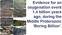
The Neoproterozoic is also known to have had major carbon isotope excursions (changes in the proportions of different carbon isotopes laid down in sedimentary deposits) as well as several glacial interludes, major disruptions to the Earth's environment which we associate with plate tectonics. The most notable of these is the Neoproterozoic Snowball Earth, a prolonged phase of near-global glaciation, which may have been triggered by a huge increase in volcanic activity or true polar wander.  The first major carbon isotope event in the Neoproterozoic is the Bitter Springs Event, at about 811 million years before the present, while the youngest is the Shuram Event, about 570 million years ago. If these events bracket a change from a single lid to a plate tectonic system, then that change took about 241 million years, with the Neoproterozoic Snowball Earth, which started at about 720 million years ago and ended about 580 million years ago, in the middle. If the beginning and end of the Snowball Earth mark the transition period then it is shorter, at about 140 million years. The fact that both the carbon isotope excursions and the glaciation events were sporadic suggests that this process was not smooth, bur occurred in a series of episodes. The Palaeoproterozoic is also noted for several isotope excursions, as well as glacial events, and the Great Oxidation Event, during which the Earth first developed an oxygenated atmosphere. All of these events occurred between about 2.50 and 2.05 billion years ago, with a proposed interval of plate tectonics between 2.05 and 1.80 billion years ago, giving an apparent different relationship between these geochemical events and plate tectonics. This Palaeoproterozoic tectonic interval appears to have ended with the formation of the Supercontinent of Nuna, although these ancient events are not well understood and would merit significant further investigation.

Life first appeared on Earth more than 3.8 billion years ago, but appears to have remained fairly simple for the next three billion years, with all terrestrial ecosystems dominated by Prokaryotes (Bacteria and Archaea), simple organisms which lack cell nuclei organelles. All complex multicellular life on Earth is Eukaryotic (i.e. has cells with nuclei and organelles), so Eukaryotic life had to appear before multicellular life-forms. The fossil record shows what appear to be Eukaryotic single-celled organisms dating back to at least the Palaeoproterozoic, suggesting a link between the emergence of the first Eukaryotes and the Great Oxygenation Event, the first case of co-evolution between the evolution of the atmosphere and Eukaryotic life.

The Mesoproterozoic lacks any such major events, making it impossible to split it into any subdivisions, and making its beginning and end points somewhat arbitrary. The interval between 1800 and 800 million years ago (roughly the Mesoproterozoic) has been referred to as the 'Boring Billion' because of this lack of events, with oxygen levels staying roughly constant, geobiological systems apparently remaining unchanged, and constant carbon isotope ratios throughout. The period, which lasted for about 20% of Earth's history, also saw stability in the proportion of sulphur molybdenum, chromium, and strontium isotopes trapped in sediments throughout, and a prolonged low nutrient system.

In contrast, the Neoproterozoic is a period of both climatic instability and rapid biological evolution, during which the Snowball Earth occurred, as well as major shifts in the carbon cycle, the ocean's oxygen content, a major diversification in microscopic Eukaryotes, and the appearance of Metazoans. The era can be split into three periods based upon clear geological differences, the longer and somewhat uneventful Tonian, between 1000 and 720 million years before the present, the Snowball Earth Cryogenian, and the Ediacaran, which saw the first widespread Metazoan fossils. Molecular clocks suggest that the first multicellular organisms appeared during the Tonian, the bilaterian body plan appeared in the Cryogenian, and that the majority of Metazoan phyla diversified during the Late Ediacaran, between 560 and 540 million years ago. All known Animal phyla are believed to have arisen during the Neoproterozoic.

Five conditions are thought to have been needed for this biological shift to have occurred; an increased nutrient supply, increased oxygen levels in both the atmosphere and oceans, an improved climate, an increased rate of habitat formation and destruction, and a sustained evolutionary pressure caused by such shifting environments.

Summary diagram showing how plate tectonics stimulates life and evolution whereas a single lid tectonic style retards life and evolution. Stern & Gerva (2024).

Nutrients are essential for life, and in particular organic carbon (i.e. compounds with bio-available carbon - we cannot, for example, eat diamonds), ammonium (which provides bio-available nitrogen), ferrous iron (again, bio-available iron) and phosphates (bio-available phosphorus). Phosphorus, in particular, plays vital role in biogeochemistry and is considered a global limiting nutrient. A shortage of phosphorus is thought to have been one of the major restrictions on the Mesoproterozoic biosphere. Phosphorus typically becomes available through the erosion of rocks, and its subsequent delivery to the oceans via rivers. This makes it likely that rock weathering was much reduced during the Mesoproterozoic. In the modern world, fresh rocks are constantly exposed at the surface due to tectonic processes, providing new sources of phosphorus and other nutrients, while soil formation covers rocks, inhibiting this supply. The Earth has gone through phases of enhanced nutrient supply associated with major uplift events, such as the Pan-African Orogeny, the Transgondwanan Supermountain Orogeny, and the Circum-Gondwanan Orogens, which all occurred on convergent plate boundaries associated with tectonic transitions. These events greatly increased the rate of erosion, and therefore the delivery of phosphorus into the oceans, with the microbial enhancement of carbon and sulphate acid weathering being an important part of this delivery process. Rising oxygen levels in the atmosphere would have increased the role of microbes in weathering, which in turn would have increased the rates at which organic carbon was buried and phosphorus was delivered to the oceans, resulting in depleted phosphorus depletion in palaeosols (preserved terrestrial soils), something observed during both the Neoproterozoic Oxygenation Event and the Palaeoproterozoic Great Oxygenation Event.

Further evidence for a major onset of uplift, erosion, and weathering during the Ediacaran can be seen in a rise in the proportion of the isotope strontium⁸⁷ within marine sediments. Strontium⁸⁷ is radiogenic, formed by the decay of rubidium within rocks, and can enter the water column either by the erosion of rocks in which this decay has occurred, or by the erosion of older marine sediments. The proportion of this isotope began to rise during the Tonian, and continued to do so throughout the Neoproterozoic, with a significant increase during the Ediacaran, and the highest values recorded in Earth's rock record being found in the Early Palaeozoic. This Neoproterozoic increase in the proportion of strontium⁸⁷ is thought to have been associated with the Pan-African uplifts and the formation of the Transgondwanan Supermountains. These events were caused by continental collisions, with no similar events having apparently happened during the Mesoproterozoic. Thus the low strontium⁸⁷ levels seen in the Mesoproterozoic are another line of evidence supporting a phase of single lid tectonics during this era. The production of phosphorus, iron, and other nutrients by erosion broke the Mesoproterozoic nutrient drought, stimulating biological evolution. 

Free oxygen levels in both the atmosphere and oceans are likely to have been caused by a proliferation of photosynthetic Cyanobacteria, Prokaryotes which have been around since at least the Palaeoproterozoic, combined with a more efficient burial of organic carbon (which will tend to react with free oxygen). This increased oxygen availability enabled the evolution of larger more complicated organisms, such as Animals, something impossible under the low-oxygen conditions of the Mesoproterozoic. Larger, more complicated Animals need higher oxygen levels than smaller, simpler ones, with oxygen levels during the Cambrian thought to have been much lower than today, but Mesoproterozoic oxygen levels are thought to have been lower still, incapable of supporting even simple Animal life. A range of isotopic proxies indicate a significant oxygenation event during the Neoproterozoic, leading to oxygen levels capable of supporting Animal life in most marine ecosystems by the end of the Cryogenian. 

The most likely explanation for this increase in oxygen is that an increase in nutrient supply led to a boom in phytoplankton growth, converting more carbon dioxide into organic matter. This would have allowed the development of more sophisticated Algae with increased photosynthetic abilities, something thought to have happened in the Late Cryogenian. This in turn further boosted oxygen production, as well as transforming the base of the food chain and providing novel food sources for the first Animals. An alternative explanation is increased weathering on land, leading to more nutrients flowing into the oceans, provoking a surge in Cyanobacterial and Algal production, which caused oxygen levels to rise. The common element to all hypothesis is that more phytoplankton were dying and being buried, increasing the  amount of organic carbon sequestered at the same time as sedimentation rates increased in the new rift basins and continental margins of the changing world.

A stable climate is important for Metazoan life. Prokaryotes can thrive at temperatures between 0°C and about 120°C, but most Animal life needs a temperature between about 5°C and about 35°C. Single lid and plate tectonics will provide different climatic regimes. Under a plate tectonic system, the regular release of volcanic gasses can have either a warming or cooling effect; notably mid-ocean ridges produce large amounts of carbon dioxide, tending to warm the climate, while volcanoes on convergent margins produce lots of sulphur dioxide, tending to cool the environment. 

The presence of oceans on the Earth's surface tends to modulate the overall temperature, due to the thermal inertia of water (it takes a lot more energy to warm water than air). This means that the Earth has a more temperate climate when a higher proportion of its surface is covered by water, and a harsher climate when the proportion of the surface covered by water is lower. This means that during a plate tectonic regime, the climate will go through cycles, with a warm greenhouse phase typically arising about 100 million years after a continental breakup event as the oceans widen. It is unclear how the depth and extent of the oceans would have varied under a single lid tectonic system, but it is likely that any change would have been considerably less significant than under a plate tectonic regime.

The process of weathering silicate rocks uses carbon dioxide. This means that the continual exposure and weathering of new silicate rocks, as happens under a plate tectonic system, will consume more carbon dioxide, leading to a reduction in the proportion of this greenhouse gas in the atmosphere, cooling the climate. Thus the enhanced erosion and weathering under a plate tectonic regime will not only release more nutrients, leading to more photosynthesis in the oceans and a subsequent rise in the burial of organic carbon in marine sediments, it also directly removes carbon dioxide from the atmosphere. Under a single lid system, the amount of uplift occurring should be close to zero, leading to a much lower nutrient flux and a lower exposure of silicate rocks to weathering by carbon dioxide.

Plate tectonics also removes large amounts of marine carbonate rocks and buried organic carbon from the Earth's surface systems as they are drawn down into the Earth at subduction zones, further reducing the amount of carbon dioxide in the atmosphere, and leading to further cooling. 

The carbon cycle on planets with single lid tectonic cycles is not well understood, and that of the Mesoproterozoic Earth less so. Two planets in the modern Solar System have single lid tectonic systems, Venus and Mars, and both of these have atmospheres which are more than 95% carbon dioxide, suggesting a poor ability to cycle this gas. However, models of the early Earth suggest that it might have been possible to recycle carbon dioxide reasonably efficiently if volcanic activity was sufficiently high, through the weathering, burial, sinking and delamination of carbonated crust. This fits with the observation that the Mesoproterozoic Earth had a relatively warm climate without any glacial phases, despite the Sun being 5-20% dimmer than today, presumably due to the contribution of greenhouse gasses.

The constant formation and then destruction of new ecosystems is a feature of an active plate tectonic system. This is also something required for the efficient evolution of biological organisms, but is unclear to what extent this would happen under a single lid tectonic system, possibly leading to a system of biological stasis.

The continuous environmental change of a plate tectonic system should present a constant need for biological innovation, with constantly changing nutrient fluxes, topographies, climates, and habitats. This is particularly true along active plate margins, in shallow marine ecosystems which appear to have been hotspots for biological innovation throughout the Earth's recent history. In these environments plate tectonics produces shifting habitats with abundant nutrient and sediment supplies, as well as strong currents and tides, which will tend to distribute these nutrients. 

The switch a plate tectonic system appears to have stimulated the rapid diversification of life, something which may not have been possible at all under a single lid system. The most dramatic environmental shifts encountered under a single lid system are likely to have been mantle plumes, which would cause global warming when they first appeared, due to the production of carbon dioxide, followed by a period of cooling as weathering of basalts leads to carbon oxide levels lowering again. Under this system the oceans would also likely suffer from conditions of anoxia, acidification, and toxic metal-input.

Without the driving force of plate tectonics, the evolution of biological life appears to be an extremely slow process. Under a plate tectonic regime, the evolution and demise of new organisms, groups of organisms, and whole global ecosystems, appears to follow the opening and closing of oceans. This makes it extremely unlikely that complex life would have arisen on Earth without the development of a plate tectonic system.

We know that life appeared in Earth's oceans more than 3.8 billion years ago, and remained within the oceans for more than 3 billion years. Despite this, it is generally accepted that the presence of dry land on Earth was needed for both the origin and evolution of life, since without this all nutrients would eventually be lost from surface systems. It is possible that the first life originated in ancient palaeosols (or more accurately, regalith), but seawater appears to have been a vital environment for much of the history of life, providing a nutrient bath in which primitive organisms could absorb nutrients through their cell membranes, as well as protection from the Sun's harmful ultraviolet radiation. All complex life on Earth is Eukaryotic, and it is generally accepted that Eukaryotic cells first evolved in the sea, where water would provide structural support for these larger cells until they evolved it themselves. This structural support would also have been needed for the first Metazoans, which appear to have been the soft-bodied organisms recorded in the Ediacaran Biotas.

Stern and Gerva reason that while primitive life must evolve in the sea, advanced civilizations need to evolve on dry land. Changing terrestrial ecosystems provide even more varied habitats than the oceans, providing an additional stimulus for biological evolution, and areas around the margins of continental plates tend to produce particularly varied habitats, as can be seen in the circum-Mediterranean, Mesoamerica, Madagascar and Southeast Asia today. The harsher terrestrial environment also stimulates life to produce specialist water retention and gas exchange structures, reproduction by internal fertilization, and movement systems which do not rely on the support of water, all of which lead organisms to become increasingly sophisticated and complex. 

This biological complexity is one of the prerequisites to developing a system for organisms to transfer experiences and knowledge to one-another, which in turn has the potential to lead to abstract thinking, and the development of language, technology, and science.  In particular, an advanced civilization would require the organisms building it to develop a familiarity with both fire and electricity, something more-or-less impossible if they are restricted to water. Thus the development of an advanced civilization on a planet would require the presence of a plate tectonic system, which Stern and Gerva suggest should be added to the Drake Equation.

The Drake Equation, as envisaged by astrobiologist Frank Drake, proposed that the number of potentially detectable  advanced civilizations in the Galaxy would be equal to the average rate of star formation, multiplied by the fraction of stars which host planets, multiplied by the fraction of planets which hold the conditions for life, multiplied by the fraction of planets which hold the conditions for life which actuallt develop life, multiplied by the proportion of planets with life which develop civilizations, multiplied by the proportion of civilizations which produce detectable signals (such as radiowaves etc.), multiplied by the lifetime of such civilizations. 

Based upon this, Drake made an 'educated guess' that between 200 and 50 000 000 detectable civilizations might exist in the Galaxy, with subsequent estimates by other scientists producing figures from below a hundred to several million. Stern and Gerva suggest that the proportion of planets with life that go on to develop civilizations should be considerably lower than in most estimates, due to the additional requirement for these planets to develop plate tectonic systems which operate for several hundred million years.

See also...

Sunday, 7 April 2024

Looking for the origins of garnets from Lower Nubia.

From about the third century BC, garnets became highly valued gemstones to the peoples of the Mediterranean Basin, the Middle East, India, Sri Lanka, Southeast Asia, and China, along with other hard gemstones, such as emerald, aquamarine, and sapphire. Transparent red garnet was used to make engraved rings or seal stones; inlays in diadems; earrings or necklaces or even small sculptures; thin, doubly polished plates in cloisonné jewellery, as well as simple beads, merely drilled to be assembled into necklaces, bracelets, or applied to garments. Studies of garnets dating from the Hellenistic Period to Early Medieval times have identified seven distinctive garnet types (A-G), with unique compositions, some of which have been linked to sources in Europe, India, or Sri Lanka, while the source of others remains unknown.

Garnets were also used as gemstones prior to the Hellenistic Period in several places, although the origin and typology of these is less well understood. Green grossular, a calcic garnet, often intergrown with green vesuvianite was used to make seals, beads, and amulets by the Indus Valley Civilization, and to much lesser extent in ancient Mesopotamia. This material was worked in Harappa, Mohenjo-Daro, and Loal-Mari on the Indus River, and was probably sourced in Balochistan and northern Pakistan. Both grossular and vesuvanite have hardnesses of between 6.5 and 7.0 on the Moh scale (i.e. are slightly softer than quartz) making it possible to work these materials with the tools available to the Indus Valley Civilization.

Red aluminous garnet, however, is harder than quartz, making it much more difficult to work without specialist tools, and is rare in Asia before the advent of the Iron Age. Surprisingly, this material was worked early in Northeast Africa, with red garnet beads known from Predynastic Egypt and the contemporaneous A-group Cultures of Lower Nubia. The use of red garnet continued in Egypt till around the end of the New Kingdom, after which the mineral is seldom found. Thus, the red garnets of Egypt and Nubia are the oldest known examples of the working of this mineral.

In a paper published in the journal Archaeometry on 7 March 2024, Albert Gilg of Engineering Geology at the Technical University of Munich, Joanna Then-Obłuska of the Antiquity of Southeastern Europe Research Centre at the University of Warsaw, and Laure Dussubieux of the Elemental Analysis Facility at the Field Museum, present the results of an analysis of 34 garnet beads from burials in Lower Nubia, dated from the late A-Group to the Post-Meroitic, an age range of about 3200 BC to about 600 AD, as well as two garnets from separate alluvial deposits near the Fourth Cataract of the Nile in the Bayuda Desert of Upper Nubia.

Ancient Nubia is divided into Lower Nubia, which lay between the First and the Second Cataracts of the Nile, and Upper Nubia, to the south of the Second Cataract. Gilg et al. selected beads excavated  from graves in Qustul, Adindan, and Serra East, in the collection of the Museum of the Institute for the Study of Ancient Cultures at the University of Chicago, associated with the Early Nubian A-group Culture, the Middle Nubian C-group and Pan Grave cultures, and the New Kingdom, Napatan, Meroitic, and Post-Meroitic/Nobadian periods.

The A-group Culture (roughly 3700 to 2800 BC) and C-group Culture (roughly 2300 to 1550 BC) are known to have been wealthy societies, due to their location at a junction of trade routes between Egypt and the Mediterranean to the north and the African interior to the south. The Pan Grave people (2200 to1550 BC) lived in small, dispersed groups in the Eastern Desert. All of these peoples traded to differing extents with the Pre-Kerma and Kerma cultures of Upper Nubia. Between about 1570 and about 1069 BC Nubia was controlled by the Egyptian New Kingdon, then between 747 and 656 BC, Egypt was ruled by the Kushite 25th Dynasty, which ruled an area from the confluence of the Blue and White Niles to the Mediterranean. This interval forms part of the Napatan Period in Nubia, which lasted from about 750 BC to about 350 BC, and was another period of wealth in Lower Nubia. This was followed by the Meroitic Period, from about 350 BC to about 350 AD, when Lower Nubia became an intermediary in trade between the Kingdom of Meroë in Upper Nubia and the Hellenic and Roman rulers of Egypt. Between about 350 and 600 AD Lower Nubia was Kingdom of Nobadia, which often had less peaceful relations with both Egypt and the Blemmye peoples who controlled the Eastern Desert and the Red Sea Coast.

Map of Nubia. Gilg et al. (2024).

Gilg et al. analysed garnet beads from tombs 11, 17, 22, 24 of Royal Cemetery L at Qustul, which have been dated to Late A-Group/Naqada III (Naqada III is the final phase of Predynastic Egypt), as well as the late A-Group tombs W19 and V59; garnets from these tombs were commonly accompanied by similarly shaped carnelian beads. Another bead was from the  C-Group Phase III tomb T12B at Adindan, which is of equivalent age to the Egyptian 18th Dynasty (the first dynasty of the New Kingdom). Five more beads come from tombs K74 and K93 at Adindan, which were associated with the Pan Grave Culture; notably, garnet beads are more common in Pan Grave Culture burials than C-Group Culture burials, despite the two being roughly contemporary. Six more beads came from New Kingdom tombs VC45 and R19 at Qustul, three from the Amenhotep III to Amarna Period and three from the post-Amarna Period. A single short barrel bead came from the 25th Dynasty/Napatan tomb W43 at  Qustul. Also from Qustul came an oblate bead from the Meroitic tomb Q465, and a truncated hexagonal bicone bead from the Post-Meroitic tomb Q143.

Beads associated with the A-Group culture are all less than 5 mm in diameter and 2.5 mm wide. They were shaped into short cylinders, barrels, or oblates with a relatively poor polish, and perforated from each end by irregular pecking. Similar beads are known from Predynastic Upper Egypt, which were presumably made in the same way, possibly from the same people. A single bead of similar appearance has also been found at Mehrgarh in Pakistan, which is exotic to that site, but of unknown origin. C-Group and Pan Grave Culture beads are also typically poorly polished and of imperfect shape, though the shape varied slightly, with both rounded and short-barrel beads found. These beads were perforated from each end by drilling, forming either cylindrical or conical holes; the smooth nature of the hole suggests the drill made from a hard stone, such as flint, or possibly copper. Similar perforations have been observed in Middle Kingdom garnet beads from Egypt. Workshops producing carnelian beads are known from A-Group and C-Group sites in Lower Nubia, and while no trace of garnet-working has been found at these sites, the similarity between the carnelian and garnet beads suggests that the garnet beads are also likely to have been manufactured locally.

Microphotographs of garnet beads from lower Nubia. (a) A-group bead with irregular pecked hole (ISAC 13); (b) Pan Grave bead with a smooth drilled hole (ISAC 21); (c) C-group bead with silver beads (ISAC 20);  (d) New Kingdom long barrel-shaped beads with poor polish (ISAC 29-31); (e) Meroitic irregular oblate bead (ISAC33); (f) Post-Meroitic facetted bead (ISAC 34); (g) drill hole (about 1 mm in diameter) with concentric deep grooves from a diamond tipped drill (ISAC 34); (h) tiny short- and long-prismatic colourless inclusions (ISAC 34). Scale bar is 500μm. Gilg et al. (2024). 

The New Kingdom beads showed much improved shaping. The majority of these beads were globular in shape, but also present were unusually long barrel to tubular shapes with a length of up to 7.9 mm and a diameter of 4 mm. These beads all have a low polish, and again are drilled from both ends. The Napatan and Meroitic beads were similar in form to the Pan Grave and C-Group beads.

None of these beads had a high polish, something seen in Egyptian beads from the Great Aten temple at Amarna (18th Dynasty), which were made by polishing with corundum powder as an abrasive, a technique apparently unknown in Upper Nubia. How the Upper Nubian beads were polished is unclear at this time.

The youngest, Post-Merotic bead differs from all others in the study, having a faceted shape (a hexagonal truncated bicone), a well-polished surface, and deep, regularly spaced, concentric grooves in the drill hole, probably indicative of the use of a diamond drill bit. Similar garnet beads are known from Arikamedu in southern India, and sites in southern Sri Lanka. Microscopic examination of this bead revealed the presence of many tiny, short- and long-prismatic, colourless inclusions, something seen in Sri Lankan garnets but not garnets from southern India. Though this is not sufficient evidence to confirm the origin of this bead, Gilg et al. consider it highly likely that this bead comes from South Asia, and probably Sri Lanka.

Chemically, all of the garnets, including the alluvial samples from Upper Nubia were found to be of similar composition, with the exception of the single Post-Merotic bead. These beads have an almandine-rich composition, with a low calcium content (the Post-Merotic bead has a pyrope-rich composition with a low calcium content). Compositionally, these beads do not fit into any of the types used to classify Hellenistic to Early Medieval garnets, with magnesium oxide-calcium oxide ratios intermediate between type A and type B contents, combined with a high manganese and yttrium, low chromium composition not seen in either of these types. This suggests that the beads were made from alluvial garnets sourced from deposits in Upper Nubia, and that garnets from this source were not used in the Hellenistic to Early Medieval periods.

Almandine-rich garnet was the first mineral harder than quartz to be worked in northeast Africa, apparently being sourced at a site in the Bayunda Desert of Upper Nubia at least 670 km south of the most southerly known occurrence of worked garnet beads in Lower Nubia. These Upper Nubian deposits appear to have been the only source of garnets used in manufacturing for at least 3500 years. 

See also...

Wednesday, 24 January 2024

Estimating the phosphorus content of the Ediacaran seas.

The availability of phosphorus is considered to be a major limiting factor on biological productivity, and its availability in the oceans over geological timescales is thought to have been a significant control on the evolution of life. Most phosphorus found in the modern oceans derives from the weathering of continental rocks, and needs to be constantly replenished as it is taken up by living organisms in the photic zone, sinks, and is buried, as well as to a lesser extent being absorbed by iron (oxyhydr)oxide minerals. 

Buried organisms typically break down releasing their phosphorus as they are degraded by microbes, and iron (oxyhydr)oxide minerals often dissolve in reducing subsurface environments, also releasing their phosphorus. This can be reabsorbed by other mineral phases at the sediment surface, including apatite and vivianite, as well as more iron (oxyhydr)oxide minerals, or may be recycled back into the water column, promoting further biological productivity. Such recycling of phosphorus into the water column is thought to be promoted by euxinic conditions (low oxygen, high sulphur) but inhibited by ferruginous conditions (low oxygen, high iron), due to the high capacity for iron mineral formation, although conditions in the sediment are probably more important than in the water column; sulphide generation in shallow sediments is likely to lead to the release of phosphorus.

Calculating the amount of bioavailable phosphorus in ancient oceans is notoriously difficult. One method that has produced results has been to compare the ration of phosphorus to iron in iron-rich sediments, which can give some idea of the proportion of phosphorus in the water column. However, this is complicated by a number of factors, such as the proportion of dissolved silica in the water, which is known to have an influence on the uptake of phosphorus by iron (oxyhydr)oxide minerals. Siliceous Phytoplankton appeared in the oceans in the Cambrian, and are presumed to have lowered the amount of silica in the water column. Thus the Precambrian oceans should have had higher silica contents that those of the Phanerozoic. However, the rock record suggests that the silica content of the Neoproterozoic oceans was probably lower than was the case for Palaeoproterozoic and Mesoproterozoic oceans. Despite these uncertainties, it is generally accepted that the phosphorus content of the world's oceans increased significantly during the global glaciations of the Cryogenian Period.

Iron formations are not ubiquitous in the geological record, and there are long periods of time for which no such deposits are known, making it difficult to reconstruct the phosphorus content of the oceans using this method. Notably, there are few useful iron formations available for the Ediacaran Period, leaving researchers unclear about phosphorus concentrations in the post-Cryogenian oceans in which multicellular Animals first began to diversify. The oceans of the Ediacaran are thought to have undergone some severe redox fluctuations, with oxygen reaching the deep ocean in the places where the distinctive Ediacaran fauna first appeared. Phosphorus can also be measured in siliclastic rocks, which have a nearly unbroken record dating back to the Palaeoproterozoic. However, while some studies of the phosphorus content of these rocks suggests that the amount of phosphorus being incorporated into shales increased between about 800 million years ago and 635 million years ago, as more studies have been carried out, they have produced a picture in which the average amount of phosphorus in shales varies little over the Neoproterozoic and early Palaeozoic.

Depite this, calculations have suggested that the phosphorus content of the oceans increased significantly during the Ediacaran, due to rising sulphate concentrations in sediments, and the release of phosphorus by sulphate-reducing Bacteria. It has been argued that for much of the Proterozoic primary production, and therefore oxygen production, was supressed by limited recycling and consequently high rates of burial of phosphorus, leading to the oxygen-poor oceans seen over much of this time. In the Neoproterozoic, rising sulphate levels are thought to have helped phosphorus recycling, leading to more fertile seas and a rise in marine oxygen levels, although direct evidence for this model has yet to be found.

In a paper published in the journal Communications Earth & Environment on 19 January 2024, Xiuqing Yang of the School of Earth Science and Resources at Chang’an University, and the School of Earth and Environment at the University of Leeds, Jingwen Mao, also of the School of Earth Science and Resources at Chang’an University, and of the Key Laboratory for Exploration Theory & Technology of Critical Mineral Resources at the China University of Geosciences,  Fred Bowyer of the School of GeoSciences at the University of Edinburgh, Changzhi Wu, Rongxi Li, Chao Zhao, and Guowei Yang, again of the School of Earth Science and Resources at Chang’an University, and Simon Poulton, also of the School of Earth and Environment at the University of Leeds, document a newly discovered Ediacaran iron formation within the North Qilian Orogenic Belt of northwest China.

Present distribution of Neoproterozoic iron formations. Yang et al. (2024).

The iron formations of the North Qilian Orogenic Belt have only been very lightly metamorphosed, and comprise largely haematite and jasper, giving it good potential for the study of phosphorus cycling. Yang et al. conducted high-resolution petrographic, mineralogical and geochemical studies on the North Qilian iron formations, and compared these to other datasets from around the world, in order to create a scheme of phosphorus bioavailability across the crucial Ediacaran interval in the evolution of Earth's life.

The Kawa, Jiapigou and Xiaoliugou iron formations of the lower Zhulongguan Group of the Qilian Orogenic Belt have been dated to about 600 million years ago. They comprise mostly haematite and jasper, with smaller amounts of clay minerals,  magnetite, carbonate minerals and apatite. Well-defined banding is rare, but where present comprises separate bands of haematite-rich and jasper-rich laminae, between 0.5 mm and 5 mm in width. All samples were taken from open pit mines, with care being taken to avoid collecting where there were signs of weathering or late-stage hydrothermal alteration.

(a) Schematic tectonic map of China. (b) Simplified geological map of the Qilian Orogen Belt. (c) Geological map of the western segment of the North Qilian area, China. Yang et al. (2024).

In places where banding could be found, phosphorus rich grains were present in both the haematite and jasper layers. Notably, the haematite layers were dusty or microplaty, suggesting that they have retained their original mineralogy. Some courser haematite grains are present, probably as a result of late-stage diagenesis or low-grade metamorphism. Phosphorus is primarily concentrated within apatite grains, which also have a high calcium content. Phosphorus and calcium levels also correlate in analysis of bulk samples. Energy dispersive spectroscopy analysis of apatite grains suggests that these are predominantly carbonate fluorapatite, mostly less than 5 μm in diameter, though some, rare, larger grains may reach 50 μm. Bulk samples were found to have high phosphorus/iron ratios, but low organic 

Photomicrographs of Ediacaran iron formations and carbonate fluorapatite. (a) Thin section of iron formations with a typical banded structure, where the red laminae are jasper and the grey laminae are hematite (sample JPG-30, Banded Iron Formation). (b) False-colour scanning electron microscope mineral map of (a), where the red-violet colour shows carbonate fluorapatite, which is mainly distributed in jasper-rich laminae. (c) Scanning electron microscope images of fine-grained haematite particles (sample KW-6, Iron Formation). (d) Disseminated carbonate fluorapatite grains with a subhedral shape (sample KW-33, Iron Formation). (e) Euhedral carbonate fluorapatite grains (sample JPG-30, Banded Iron Formation). (f) Rare coarse-grained carbonate fluorapatite (sample JPG-28, Banded Iron Formation). (g) Haematite inclusions in a carbonate fluorapatite particle (sample JPG-26, Banded Iron Formation). (h) Energy dispersive spectroscopy spectrum from an apatite particle shown in (e), using a gold-plated thin section. Peaks for carbon, oxygen, fluorine, phosphorus and calcium confirm the mineral is carbonate fluorapatite. Abbreviations: Hem, Haematite; Qtz, Quartz. Yang et al. (2024).

Howthe phosphorus cycle works under ferruginous conditions is poorly understood, as is how this relates to iron formation deposition. Ferruginous oceans were prevalent for much of the Precambrian, and phosphorus levels typically low. It has generally been assumed that these phenomena are connected, with the low phosphorus levels being due to an iron trap, in which phosphorus atoms are bound into iron minerals and taken out of ocean circulation.

If phosphorus was in fact largely being bound into carbonate fluorapatite minerals in Archaean-Mesoproterozoic iron formations and ironstones, then it is possible that much of this phosphorus was being remineralized from biological sources. However, this is difficult to reconcile with the low organic carbon content of these Precambrian iron deposits. An alternative is possibility would be that the early oceans in fact had mush higher phosphorus contents that has previously been supposed, and that the binding of phosphorus into carbonate fluorapatite is simply a consequence of iron silicate precipitation under these conditions.

Stratigraphic column of Ediacaran iron formations in the North Qilian area, China. Yang et al. (2024).

Yang et al.'s study demonstrates that carbonate fluorapatite was the main sink for phosphorus in the Ediacaran iron formations of North Qilian, China, but does not provide any information on the process by which the phosphorus was bound in this way. Nevertheless, Yang et al. do feel able to make some inferences from the data. The lack of an association between phosphorus and aluminium suggests that the phosphorus was not being deposited as detrital particles (i.e. bound to clay minerals, which have high aluminium contents), which in turn suggests that this phosphorus was not derived directly from a terrestrial source. This does not preclude the phosphorus having been originally derived from terrestrial weathering, simply that any such phosphorus must have been dissolved in the ocean, where it could be scavenged by iron minerals, rather than being deposited in a particulate form with aluminium minerals.

The remineralization of phosphorus from organic matter to carbonate fluorapatite cannot be ruled out, however this would have been likely to lead to the formation of the precipitation of iron minerals such as magnetite and siderite as the organic carbon was oxidised. The dominance of haematite in the North Qilian iron formations, combined with the rareness of magnetite, makes this scenario improbable. Thus, the high phosphorus content of the North Qilian deposits compared to earlier iron formations is unlikely to be related to the remineralization of organic material. 

Field and microphotographs of iron formations from North Qilian. (a) Iron formations with haematite-rich laminae and jasper-rich laminae. (b) Iron formations with a jasper lens. (c) and (d) Microphotographs of iron formations; (c) was taken under reflected light, and (d) is a scanning electron microscope image. Abbreviations: Hem, Haematite; Qtz, Quartz. Yang et al. (2024).

This does not, however, imply that the main reason for the high phosphorus levels seen in the North Qilian iron formations was drawdown by iron minerals. The dominance of haematite in these formations implies that iron was being precipitated from the water column as a form of hydrated ferric oxide, probably when ferruginous waters were oxygenated during upwellings. Phosphorus could potentially have been absorbed during this process, but would have been released within the sediment as the ferrihydrite remineralized into more stable haematite. In modern hydrothermal deposits a correlation can be seen between iron and phosphorus because phosphorus adsorbs onto iron (oxyhydr)oxides, but there is no evidence for this happening in the North Qilian deposits. This suggests that the concentration of phosphorus in porewaters was above the saturation point for carbonate fluorapatites, due to phosphorus being released by the remineralization of ferrihydrates into haematite, which would have led to carbonate fluorapatite deposition. This would also help to explain the presence of haematite inclusions within carbonate fluorapatite grains.

Yang et al. also note that where banding is present, carbonate fluorapatite grains are found in both haematite and jasper laminae, but are more common within jasper. This is also consistent with the release of phosphorus during the remineralization of ferrihydrates. Studies of Mesoproterozoic iron deposits suggest that phosphorus was precipitated into carbonate fluorapatite, despite the water being supersaturated for the iron phosphate mineral vivianite, because iron ions were being removed from the water by the formation of iron silicates. In the North Qilian deposits, these iron ions were probably only ever present within pore water, again favouring the deposition of carbonate fluorapatite.

Images of banded iron formation samples JPG-30 (a), (c), (e), (g), (i), (k) and JPG-28 (b), (d), (f), (h), (j), (l) from the Jiapigou section. (a), (b) Thin section photographs; (c), (d) Scanning electron microscope images. (e)–(j) False-colour scanning electron microscope mineral map of haematite, quartz and carbonate fluorapatite. (k), (l) Energy dispersive spectroscopy elemental map of phosphorus. Yang et al. (2024).

Despite the difficulties associated with the determination of ocean phosphorus concentrations from ancient iron formations, Yang et al. believe that they can detect a significant change in phosphorus levels in the Ediacaran compared to earlier deposits. Experiments have determined that no more than about 10% of phosphorus present in iron formations when they form is likely to be subsequently lost due to post-depositional processes; far lower than the determined difference between the Ediacaran and earlier deposits. Studies of the rock record have determined four phases with their own distinctive iron/phosphorus ratios (with some gaps). The oldest of these covers the Archaean and Palaeoprotorezoic, the next the Cryogenian, then the Cambrian to the Jurassic, and finally the Cretaceous to Quaternary. The phosphorus/iron ratio observed in the North Qilian Formation are consistent with those from Ediacaran iron formations in Iran, and much higher than those observed in Archaean to Palaeoprotorezoic, Tonian, or Cryogenian deposits, and indeed much higher than is observed in Cambrian to Jurassic iron formations, falling closest to the levels seen in Cretaceous to Quaternary strata.

This large jump in phosphorus levels in Ediacaran iron deposits seems highly suggestive of elevated phosphorus levels in the Ediacaran oceans, to the extent that phosphorus was probably being adsorbed onto iron (oxyhydr)oxide minerals in preference to ions such as calcium or magnesium. The North Qilian iron formations are interlayered with dolostones and sandstones, which implies that they were being laid down in a shallow marine setting, making it unlikely that the phosphorus levels recorded were something restricted to deep ocean basins. Although the levels of dissolved calcium and magnesium in the Ediacaran seas is poorly understood, the high levels of phosphorus recorded in Ediacaran iron formations compared to Palaeozoic and Mesozoic examples implies that dissolved phosphorus levels were high in the Ediacaran, despite the higher levels of dissolved silica likely to have been present.

If this is correct, then the increase in the proportion of phosphorus in the Ediacaran seas was one of the largest seen in Earth's history. This is consistent with the average proportion of phosphorus in Ediacaran shales (which are about 0.34 % phosphorus by weight) compared to Tonian (0.09 % phosphorus by weight) or Cryogenian (0.13 % phosphorus by weight) shales. Tonian iron formations also show very low levels of phosphorus, supporting the idea that Tonian seas had very low phosphorus levels. This, while the precise reasons for and timing of phosphorus increases in Neoproterozoic oceans is unclear, multiple lines of evidence suggest that this increase was not a phenomenon restricted to the Cryogenian glacial phases, but rather something which intensified during the following Ediacaran Period.

Schematic representation of the evolution of marine redox state through the Neoproterozoic to Cambrian based on compiled palaeoredox proxy records. Yang et al. (2024).

High levels of terrestrial erosion have been proposed as a mechanism for the increase in phosphorus in the Cryogenian, though why this would continue significantly into the Ediacaran is unclear. An alternative is that recycling of phosphorus back into the water column may have played a significant role in keeping phosphorus levels high. Yang et al.'s findings suggest phosphates were mobilized during the remineralization of iron (oxyhydr)oxide minerals to haematite close to the sediment-water interface suggests a degree of phosphorus recycling was likely, but iron formations were relatively rare in the Ediacaran, making it unlikely that this system was having a major impact on the global environment.

Both the Ediacaran and Cryogenian oceans are thought to have been redox-stratified. Ferruginous conditions were probably widespread, but increased sulphate levels in the oceans may have been more important for phosphorus recycling, as sulphate-reducing Bacteria would have increased the rate at which organic phosphorus was remineralized. This would have been a marked difference between Ediacaran and earlier Neoproterozoic oceans, where ferruginous conditions were prevalent, but sulphate levels low.

Most phosphorus entering shallow-marine waters today does so in upwelling zones, where currents bring water upwards from the deep ocean. This source brings about 60 times more phosphorus into shallow  marine waters than all of the world's river systems combined. If this was also the case in the Ediacaran seas, then upwelling currents would have been the major source of the phosphorus which fuelled primary production in these seas, and therefore the Ediacaran rise in oxygen content, as well as the nutrients which fed the diversifying Eucaryotes of the Period; the phosphate-rich iron formations of North Qilian have been dated to approximately 600 million years ago, slightly younger that the Lantian assemblage of South China, which at 602 million years old is the ealiest known example of the macroscopic Ediacaran Fauna.

See also...