Showing posts with label Siberia. Show all posts

Sunday, 7 May 2023

Human DNA extracted from a Palaeolithic pendant.

Understanding the changes in technology and population that went on during the Palaeolithic is the key to understanding much of the history of our species. Unfortunately, Palaeolithic deposits tend to be highly condensed, so that objects and remains found alongside one-another may be separated by hundreds or even thousands and years, making it impossible to connect artefacts to remains unless they were clearly directly buried together. 

Recent advances in the recovery of DNA from ancient sediments provide us with the possibility of establish connections between artefacts and specific Human populations, although this would require the recovery of DNA directly from the objects in question. Potentially, artefacts made from tooth and bone have the best chance of preserving ancient DNA, as they are porous and capable of absorbing body fluids, and because they contain hydroxyapatite, which is known to both absorb and preserve DNA. Thus ancient pieces of tooth or bone may potentially preserve DNA not only from the Animal from which they came, but also DNA from other organisms that came into contact with them after that Animal's death, For the most part, this tends to be the DNA of Microorganisms which colonised the decaying body of the original Animal, but could also potentially include Humans which handled these pieces, or made things from them. 

However, Palaeolithic artefacts made from tooth and bone are extremely rare, and therefore of great value to science, something particularly true of pendants or other objects likely to have been worn close to the skin for long periods of time, and therefore the most likely to have absorbed ancient Human DNA. The conservation of such objects is therefore considered a high priority, and archaeologists are reluctant to expose them to the destructive methods used to extract DNA, or even to soak them in buffers which might absorb DNA passively, as these can alter specimens irreparably. 

In a paper published in the journal Nature on 3 May 2023, a team of scientists led by Elena Essel of the Max Planck Institute for Evolutionary Anthropology, Elena Zavala, also of the Max Planck Institute for Evolutionary Anthropology, and of the Department of Biology at San Francisco State University, and the Department of Molecular and Cell Biology at the University of California, Berkeley, Ellen Schulz-Kornas of the Department of Cariology, Endodontology and Periodontology at the University of Leipzig, Marie Soressi of the Faculty of Archaeology at Leiden University, and Matthias Meyer, again of the Max Planck Institute for Evolutionary Anthropology, describe development of a method for non-destructively recovering DNA from ancient bone and tooth artefacts, and the first results obtained using this technique.

In order to test potential reagents for DNA extraction from ancient artefacts, Essel et al. first obtained ten pieces of faunal remains from the  Quinçay and Les Cottés Palaeolithic sites in France, none of which are thought to have been deliberately modified by Human activity, but all of which were similar in size and shape to common bone and tooth artefacts. These were immersed in ten different potential reagents, including a guanidinium thiocyanate-containing reagent previously suggested for non-destructive DNA extraction, an ethylenediaminetetraacetate (EDTA) solution, which is a decalcifier commonly used in ancient DNA extraction,  a sodium hypochlorite (bleach) solution, which is an oxidizing reagent used to remove surface-exposed contaminant DNA, and a sodium phosphate buffer supplemented with detergent, which has been recently shown to enable temperature-controlled DNA release from powdered bone samples.

The microtopography of the surface of these artefacts was mapped  using quantitative 3D surface texture analysis prior to immersion, and then again once the samples were removed, in order to detect any changes caused by the reagents. The guanidinium thiocyanate-containing reagent and ethylenediaminetetraacetate solution were both found to cause significant alteration to the samples, whereas all of the other samples caused much smaller and more sporadic changes (none of the reagents caused zero alterations), possibly due to the removal of small particles of soil and other substances from the sample surfaces. 

Faunal remains used in reagent testing. Photographs of samples taken before and after treatment with various reagents used in ancient DNA extraction (GuSCN, guanidine thiocyanate reagent; EDTA, ethylenediaminetetraacetate solution; Phosphate, sodium phosphate buffer with detergent; Bleach, sodium hypochlorite solution). The black bar represents 1 cm. Note that colours are not directly comparable, as the photographs were taken at slightly different angles, with different light settings and camera adjustments. Essel et al. (2023).

Based upon this, Essel et al. were able to develop a step-wise method for the extraction of DNA from ancient bone and tooth artefacts. using serial incubations in sodium phosphate buffer at 21, 37, 60 and 90 °C, with three incubations per temperature.

Workflow of the gradual, non-destructive DNA extraction method using sodium phosphate buffer at elevated temperatures. Essel et al. (2023).

Next Essel et al. applied this to eleven bone and tooth objects from Châtelperronian layers of Quinçay Cave in France, all of which are believed to have potentially been used as tools between 35 000 and 45 000 years ago. One of these objects (Q10), identified as a piece of Reindeer bone, yielded 1828 fragments of Cervid mitochondrial DNA, which showed elevated frequencies of cytosine-to-thymine substitutions at their ends, which is consistent with the deamination of cytosine seen in other ancient DNA samples, and which has been used to date such DNA. Another object (Q15), identified as a piece of ivory, yielded 2004 fragments of Elephantid mitochondrial DNA, again showing cytosine-to-thymine substitutions. All eleven samples also yielded Hominid and Suid mitochondrial DNA, none of which showed cytosine-to-thymine substitutions, and all of which is therefore is considered to be the result of modern contamination. Since all of these samples were found several decades ago, and were neither collected or stored under sterile conditions, this was not surprising.

Artefacts before and after DNA extraction. Photographs of samples taken before and after phosphate-based, non-destructive DNA extraction. The black bar represents 1 cm. Note that colors are not directly comparable, as the photographs were taken at slightly different angles, with different light settings and camera adjustments. Essel et al. (2023).

Given that contamination by modern DNA appeared to be ubiquitous in ancient bone and tooth objects that had been handled by hand, Essel et al. decided to directly obtain objects from ongoing excavations at two Palaeolithic sites currently still under investigation; Bacho Kiro Cave in Bulgaria, and Denisova Cave in the Altai Republic of southern Siberia. Three tooth pendants (‘BKP1–BKP3) were obtained from Bacho Kiro, and one (DCP1) from Denisova Cave, all by archaeologists wearing gloves and facemasks to prevent contamination.

Photograph of DCP1 as it became exposed during excavation. The photograph was taken shortly before the pendant was removed and placed into a plastic bag using gloves. Essel et al. (2023).

Large and visible chunks of soil were removed from these artifacts by (gloved) hand, and they were washed in water three times before being subjected to the phosphate buffer DNA extraction technique. All four pendants produced ancient Mammalian mitochondrial DNA, with BKP1 producing Bovid DNA, BKP2 and BKP3 producing Ursid DNA, and DCP1 producing Cervid DNA. Human mitochondrial DNA was recovered at much lower levels than from the Quinçay material, and very few pieces of Suid DNA suggesting that the modified excavation method had helped prevent the contamination of these samples. Notably, the DCP1 Human mitochondrial DNA showed signs of significant cytosine deamination, suggesting that this was indeed ancient Human DNA.

Photographs of DCP1 before and after cleaning and non-destructive DNA extraction. Essel et al. (2023).

Very little ancient Human mitochondrial DNA was recovered from the Bacho Kiro Cave material, with the largest sample, 29 deaminated fragments, coming from a soil particle attached to BKP3. In contrast, DCP1 produced significant amounts of ancient Human mitochondrial DNA, enabling the construction of a near-complete consensus sequence, which could be used to place the material within a phylogenetic analysis. This DNA seemed to mostly (but not exclusively) originate from a single individual, assigned to mitochondrial haplogroup U (because mitochondrial DNA is found in the mitochondria, organelles outside the cell nucleus, it is passed directly from mother to child without being sexually recombined each generation, enabling precise estimations of when individuals shared common ancestors, at least through the female line, forming a mitochondrial  haplogroup).

Essel et al. estimate that this Human mitochondrial DNA came from an individual lived about 18 500 years ago, and falls within a group of Ancient North Eurasians who otherwise are known from further east within Siberia, including the 24 000-year-old Mal’ta 1 individual, and the 17 000-year-old Afontova Gora 3 individuals. All of these samples are more closely related to one-another than to modern North Eurasians, and show affinities to other ancient Siberians and Native Americans. As well as the mitochondrial DNA, sufficient chromosomal DNA was recovered to establish that the individual was female.

Essel et al.'s work establishes that it is possible to recover ancient Human DNA from bone and tooth artefacts, providing a previously unexplored source of information about the makers and users of these ancient objects. The amount of ancient DNA recovered from DCP1 was comparable to that obtained from well-preserved Pleistocene Human remains, and the recovery of both Human and Cervid DNA from the same object enabled two separate cytosine deamination dates from the same artefact.

Future work will determine how frequently such ancient Human DNA is preserved within bone and took artefacts. Essel et al. recommend that all archaeologists working with such material adopt the practice of wearing gloves and masks while extracting bone and tooth sample at archaeological sites, and express the hope that in future it might be possible to establish a dataset which can connect specific late Pleistocene technologies to specific ancient Human populations.

See also...

Follow Sciency Thoughts on Facebook.

Follow Sciency Thoughts on Twitter.


Tuesday, 20 December 2022

Three killed by explosion on natural gas pipeline in Russia.

Three workers carrying out maintenance work on a gas pipeline in the Russian Republic of Chuvashia have been killed in an explosion that took place on Tuesday 20 December 2022. A fourth person, described as their driver, is being treated for shock. The explosion produced a fire described as two stories high, but this was quickly extinguished by cutting the gas supply to the pipeline.

Fire caused by an explosion on a gas pipeline in the Russian Republic of Chuvashia, seen from the village of Yambakhtino. Moscow Times.

The explosion occurred on a section of the Urengoy-Pomary-Uzhhorod Pipeline, which is operated by the Russian state-controlled natural gas company Gazprom, and which supplies gas from the Yamburg Gas Field in the Yamalo-Nenets Autonomous Okrug, within the West Siberian Arctic Circle, to the Uzhhorod Pumping Station in Western Ukraine, and then on to Central and Western Europe. The explosion interrupted the supply of gas temporarily, but this was quickly restored by switching to a parallel section of pipeline.

The aftermath of an explosion on the Urengoy-Pomary-Uzhhorod Pipeline in the Russian Republic of Chuvashia on 20 December 2022. Ministry of Emergency Situations/AP.

The Urengoy-Pomary-Uzhhorod Pipeline is currently the only pipeline supplying natural gas to Western Europe from Russia; the Nordstream 1 pipeline which ran beneath the Baltic Sea to Germany was shut off by Russian authorities in August, citing equipment problems, although this has widely been interpreted as a response to Germany providing weapons, equipment and training to Ukraine following the Russian invasion of that country in February this year. A second Baltic pipeline, Nordstream 2, was never brought into service, after Germany withdrew support for the project in protest at the invasion of Ukraine. A section of both pipelines beneath the Baltic was destroyed by an explosion in September, with Swedish investigators subsequently finding traces of explosives at the site, although who blew it up, and why, remains unclear.

See also...

Follow Sciency Thoughts on Facebook.

Follow Sciency Thoughts on Twitter.


Tuesday, 21 December 2021

Russian mine safely evacuates 128 employees after a rise in carbon monoxide is detected.

A mine in Kemerovo Oblast in southwest Siberia has safely evacuated 128 miners who were working below ground when a rise in carbon monoxide was detected on Sunday 19 December 2021. The sudden increase triggered concerns that a fire might be burning within the mine (coal, which is essentially pure carbon, usually burns to produce carbon dioxide, but when the oxygen supply is limited, as in an underground mine, incomplete combustion can result in the production of the more deadly carbon monoxide). However, the owners of the Ruban Mine have found no evidence of a fire, and now believe the gas was emitted directly from the coal following a rise in temperature within the mine.

 
Russian emergency workers attending a mine in Kemerovo Oblast following the detection of a rise in carbon monoxide levels, which provoked concerns about the risks of an underground fire. Generico.

Coal is formed when buried organic material, principally wood, in heated and pressurized, forcing off hydrogen and oxygen (i.e. water) and leaving more-or-less pure carbon. Methane is formed by the decay of organic material within the coal. There is typically little pore-space within coal, but the methane can be trapped in a liquid form under pressure. Some countries have started to extract this gas as a fuel in its own right. When this pressure is released suddenly, as by mining activity, then the methane turns back to a gas, expanding rapidly causing, an explosion. This is a bit like the pressure being released on a carbonated drink; the term 'explosion' does not necessarily imply fire in this context, although as methane is flammable this is quite likely.

Coal is also comprised more or less of pure carbon, and therefore reacts freely with oxygen (particularly when in dust form), to create carbon dioxide and (more-deadly) carbon monoxide, while at the same time depleting the supply of oxygen. This means that subterranean coal mines need good ventilation systems, and that fatalities can occur if these break down.

While this incident resulted in no harm, with employees being safely evacuated from a potential threat, which is good practice in mine safety management, the Russian Emergencies Ministry has raised concerns about mine safety in Kemerovo Oblast, following an explosion at the Listvyazhnaya Mine which killed 51 people in November, with one of the mine's owners subsequently being arrested on suspicion of falsifying data on methane emissions within the mine. Kemerovo Oblast was also the location of the worst mining disaster in post-Soviet Russian history, when an explosion at the Ulyanovskaya Mine killed more than 100 people.

See also...


Follow Sciency Thoughts on Facebook.

Follow Sciency Thoughts on Twitter.
 

Friday, 11 December 2020

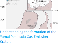
Understanding the formation of the Yamal Peninsula Gas-Emission Crater.

Methane is a powerful greenhouse gas, and the recent abrupt events of degassing and crater formation on the Yamal and Gydan Peninsulas have caused major concern that a warming Arctic may lead to increased thawing of permafrost and gas emissions. In addition, exploration and development of oil and gas fields in northern West Siberia, with construction of production, transportation and support facilities upon permafrost, face problems due to the harsh Arctic climate, low negative temperatures of air and ground and complex periglacial processes like frost heaving, thermokarst, thermal erosion. Processes in shallow permafrostmaylead to the formation of gas-emission craters, a phenomenon discovered during exploration for the past decade in the Arctic West Siberia. The first methane-leaking crater (Yamal Crater) was found in the Yamal Peninsula 42 km from the Bovanenkovo gas field and that discovery was followed by several more from the Yamal and Gydan Peninsulas. The Yamal Crater has been better documented than the others, which are only imaged in few photographs, but the available data are insucient to concede about the conditions and causes of its origin. The crater origin has been unanimously attributed to an explosive gas emission event, but the origin of the gas remains a subject of discussions.

In a paper published in the journal Geosciences on 8 May 2020, Evgeny Chuvilin of the Center for Hydrocarbon Recovery at the Skolkovo Institute of Science and Technology, Julia Stanilovskaya of Total, Aleksey Titovsky of the Department of Science and Innovation of the Yamal-Nenets Autonomous District, Anton Sinitsky of the Arctic Research Center of the Yamal-Nenets Autonomous District, Natalia Sokolova, Boris Bukhanov, Mikhail Spasennykh, Alexey Cheremisin, Sergey Grebenkin, and Dinara Davletshina, also of the Center for Hydrocarbon Recovery at the Skolkovo Institute of Science and Technology, and Christian Badetz, also of Total, present a summary of the proposed hypotheses for the formation of the Yamal Crater.

 
Location map of the Erkuta Crater and oil and gas fields in the Yamal Peninsula. Chuvilin et al. (2020).

The proposed hypotheses explaining the formation of the Yamal Crater, and other craters in the Yamal and Gydan Peninsulas, can be divided into two main groups that invoke either deep-seated or shallow causes. The deep-seated causes of crater formation include increased deep heat flux, upward migration of deep gaseous fluids through fault zones and fault intersections to shallow permafrost and dissociation of intrapermafrost gas hydrates driven by ascending heat and gas flows. These processes can produce reservoirs of pressurized gas in shallow permafrost which can release explosively, break up the frozen cap and form a crater.

 
Helicopter view of the Erkuta crater and adjacent territory in summer 2017. Chuvilin et al. (2020).

The crater was discovered in June 2017 by people from the Erkuta Polar Station on the floodplain of the Erkuta River, 30 km east of the station. The area is of interest to biologists for its proximity to the nesting-place of falcons. Two years before, the terrain was absolutely flat, as witnessed by Alexander Sokolov in a TV broadcast (Vesti Yamal) of 30 June 2017.

The team of biologists led by Sokolov observed heaving of the previously flat surface, as well as cracks in soil, during field works in July 2016, a year before the crater was first discovered in June 2017. The newly formed crater had a cylindrical shape, 10 to 12 m in diameter, with smooth walls was 20 m deep. The original heave mound was not fully eliminated: the crater was encircled by a 2–3 m high parapet-like ridge, with its slopes covered with silt and clay silt ejected during the explosive gas emission.

In December 2017, a field trip to the Erkuta Crater was organised jointly by the Government of the Yamal–Nenets Autonomous District, Total SA and the Skolkovo Institute of Science and Technology. The field work included sampling of soil, ice and water from the crater rim. By that time, the southern wall of the crater had collapsed and the diameter increased to 17.5 m. The crater was partly filled with water which made an up to 8-m-deep lake covered by about 1-m-thick ice under approximately 0.8 m of snow. A part of the parapet-like ridge remained around the crater next to a lake.

 
(Top) Panoramic view of the Erkuta cCrater in December 2017. (Bottom left) Lake next to the remnant parapet-like ridge around the Erkuta Crater in December 2017. (Bottom right) Panoramic view of the Erkuta Crater in summer 2018. Julia Stanilovskaya, Evgeny Chuvilin, and Alexander Sokolov in Chuvilin et al. (2020).

In June 2018, the crater was imaged by a drone survey, which showed further degradation of its wall. The deep crater of a year before became almost fully filled with water and transformed into a lake semi-circled by a remnant 2–3 m parapet. The crater wall was deformed by thermal erosion and slumping in its outer part but remained vertical in the inner part.

Field studies in December 2017 revealed a layer of massive ground ice, 3–4 m of visible thickness, in the inner wall of the crater.

 
Sampling points (red circles) in the inner wall of the Erkuta crater, December 2017. (left) Fragment of the sampling sight, (right). Red dashed line in left panal delineates the ice line. Evgeny Chuvilin in Chuvilin et al. (2020).

Ice at the sampling site was generally transparent and pure, but locally enclosed 1-2 cm thick layers of fine grained soil and a minor amount of intricately shaped 1-3 mm gas bubbles. The clear massive ice was topped by a dirty gray ice layer of a few centimtres thick with abundant soil inclusions.

 
Massive ground ice in the crater wall, December 2017. (left) The surface of the ice, (right) fresh cut of ground ice with soil inclusions. Evgeny Chuvilin in Chuvilin et al. (2020).

The ground ice was overlain by frozen silt with organic inclusions (plant remnants). The sediments had cross and wavy stratification common to aluvial facies. Some organic layers on lenses were a few centimeters thick and a few cm to tens of centimetres long.

The sandy crater wall was locally cut by discontinuous branching fractures partly filled with ice, often within zones of iron impregnation. The fractures possibly formed under stress produced by fluid (water or gas) pressure from underlying sediments.

 
Interbedded sandy and silty soils with inclusions of organic matter in the crater wall (December 2017). (left) Discontinuous branching fractures, (right) wavy stratification of organic material. Evgeny Chuvilin in Chuvilin et al. (2020).

The ejected clay silt on the outer crater wall was originally wet and was deposited in a floodplain environment; it di ered markedly from the overlying organic-rich alluvial sand.

Shrubs on the remnant slope facing the lake do not di er much from the surrounding lowland vegetation. Therefore, heaving shortly preceded the gas emission event and caused substantial changes to the vegetation. Otherwise, at years-long heaving, vegetation would have adapted to new conditions. Shrubs on Arctic tundra are usually lower on topographic highs than on the plainland and are absent in many areas where only grass can grow.

The samples collected in the December 2017 field trip to the crater included frozen soil from the northern wall, fine-grained material ejected from the crater and ice.

The particle size distribution of soil samples and soil inclusions in ground ice was analyzed in the laboratory of Fundamentproekt. The particles sizes were determined by the pipette method in silt and clay and by sieve analysis in sand.

The particle sizes of soil over the ground ice mainly correspond to silty sand while the ejected material is mainly light clay silt and silt, with particle sizes similar to those of soil inclusions in visible ground ice.

The mineralogy of soil samples was analyzed at the Geological Faculty of the Lomonosov Moscow State University on a Rigaku ULTIMA-IV X-ray di ractometer. The samples consist mainly of quartz and feldspar minerals (microcline and albite), about 80%–90% in total. Quartz percentages reach 61.8% and 74.3% in silty sand samples 8 and 9, respectively, notably more than in clay silt sample 2 (about 45.2%). The feldspar minerals are 32.3% in sample 2, 23.9% in sample 8 and about 15.4% in sample 9. Clay minerals are mainly mixed-layer illite–smectite, from 5.8% in sample 9% to 10.2% in sample 2. Other minerals occur in minor amounts (1% or less). Samples 2 and 8 share similarity in mineralogy, with similar amounts of microcline, illite, smectite and kaolinite, and thus were originally involved in similar deposition processes.

The soil and ice samples were analysed for the contents of soluble salts by using soil–water extracts prepared from 100 g of dry substance. Soil-free massive ground ice was analysed in the molten state. The total percentage of salts did not exceed 0.1% in soil samples and was in a range of 40–173 mg per litre in ice samples. The predominant major ions were alkaline metals sodium, potasium and magnesium as cations and sulphate and chlorine as anoins. 

The contents of unfrozen pore water in samples of erupted material (sample 2) and sand from the crater wall (sample 9) were determined from pore water activity. The amount of liquid water in the sand samples decreased abruptly at temperatures below -1°C and was less than 1% at -4°C. The clay silt sample (2) contained more unfrozen water than the sand sample (9): about 4% at -4°C and around 3% at -10°C.

Chuvilin et al. compared major-ion chemistry and stable isotopes of water in ice samples from the crater wall and in crater lake water. The ice samples (11 and 13) were recovered from the middle part of the ice lens free from visible soil inclusions. Prior to analyses, ice samples were melted, and the obtained water was collected without filtering.

The salinity of lake water is higher than that of ground ice: contents of some major ions are 7 to 11 times higher, especially sulphate, magnesium and calcium.

The oxygen and hydrogen isotope compositions of water from the lake and ice are also diff erent: those of ground ice are more depleted than in surface water from the crater. These compositions indicate that the mean annual temperature was 7 to 10°C lower than now when the ice was forming. 

The structure and texture of soil and ice samples were analyzed at Skoltech. The microstructure of frozen soil was studied in replica samples (imprints of fresh fracture planes on a plexiglass film) under an optical microscope (at the Skolkovo Institute of Science and Technology) and a scanning electron microscope (at Moscow University). The techniques for preparing replica samples and their optical and electron microscopy were reported in a number of publications. Ice structure and texture were studied in thin sections between crossed Polaroids; the thin sections were prepared following the standard procedures.

Soil microstructure was studied in sand from the crater wall (sample 9) and in ejected clay silt (sample 2). According to reflected light optical microscopy, the sand sample (9) mostly consists of 0.1–0.25 mm subrounded isometric quartz particles, with lesser amounts of fine-grained material, lenses and layers of more or less strongly degraded organic remnants, distinct 1–2 mm brown organic inclusions, as well as black organic–mineral concretions of silty sand and decayed organics.

Scanning electron microscope images highlight the morphology of quartz grains, with signatures of brittle fracture and dissolution and with organic inclusions of di erent sizes, shapes and decay degrees. Finer silt or clay particles make continuous or discontinuous films and clusters on the surface of sand particles.

 
Scanning electron microscope images of sand sample 9 at di erent magnification factors, with signatures of fracture and dissolution (left) and organic inclusions (right). Chuvilin et al. (2020).

The microstructure of clay silt ejected from the crater (sample 2) was also examined under the optical and electron microscopes. Reflected light optical microscopy revealed quite uniform silt and clay particles with rare sand grains and fuzzy dark brown organic inclusions. Scanning electron microscope images of di erent magnifications resolve fine sand and coarse silt particles (and their replica imprints) cemented by clay silt at a magnification of x 500 and 5 μm to 20 μm particles at x 2000. The x 2000 images reveal orientations of mineral matrix particles delineated by sericite flakes, as well as organic inclusions easily spotted due to their particular shapes.

 
Scanning electron microscope images of clay silt sample 2 at diff erent magnification factors: general view (left) and detail image (right). Chuvilin et al. (2020).

The ice macrostructure was studied in samples 6, 8 and 11 of ground ice and sample 22 from the top of the ice lens, at the ice-soil contact. Samples 6 and 11 are generally similar: massive transparent ice with chains of rare 0.3-0.5 cm air bubbles and thin flaky layers of silt and clay particles. Clusters of mineral particles occur at ice crystal boundaries. Mineral inclusions more numerous than air bubbles. Ice crystals in samples 6 and 11 appear as exceeding 5–7 cm in size, but the actual size is difficult to estimate because only crystal fragments fit into the thin sections.

 
Ice sample 6: general view (left) and structure under polarised light (right). Chuvilin et al. (2020).

Unlike samples 6 and 11, ice sample 8 encloses a layer of silty sand in pure ice almost free from soil particles and air bubbles. The ice crystals are fine (few mm) along the soil layer and coarser (2–3 cm) away from it. Although the true size of the ice crystals remains unknown because of the limited thin section size, they may be commensurate with those in samples 6 and 11. The soil layer, in its turn, encloses numerous small 3–5-mm-long, and up to 2-mm-thick lenses of ice with fine crystals (fractions of mm).

 
Ice sample 8: general view (left) and structure under polarised light (right). Chuvilin et al. (2020).

Ice sample 22 from the top of the ice lens differs markedly in colour from the other ice samples. It encloses numerous scattered small soil particles and air bubbles which make it look like dirty opaque ice. The ice crystals are 2-4 mm and generally isometric. The sand-silt material occurs both along the boundaries of ice crystals and inside them. The ice crystals in this sample are finer than in the three other samples possibly because they nucleated and grew in the presence of mineral components in the medium which provide numerous centres of crystallisation but is unfavorable for the formation of large ice crystals.

 
Ice sample 22: general view (left) and structure under polarized light (right). Chuvilin et al. (2020).

The gas component was analysed in sample 9 of sandy permafrost samples 6, 21, 22, and 23 of ground ice. Intrapermafrost gas from sample 9 was extracted by 150 ml syringes from thawing, roughly 50 g specimens in a concentrated salt solution following a standard technique, using pure nitrogen or helium as carrier gas.

Methane was present in all samples: mostly a few cm³ per 1 kg of soil or ice. Its content reached 94 cm³/kg at the top of ground ice (sample 22) but was about 10 times less in sample 21 from the middle of the ground ice lens. All samples except for 21 contained much more carbon dioxide than methane, which may be evidence of cryogenic concentration in frozen sand, e.g. during freezing of a talik. The contents of ethane and propane (methane homologs) varied from fractions to 2–3 cm³/kg. The ratios of methane to its homologs in ice samples were generally from 2 to 40 and indicated the presence of both biogenic methane and a component associated with sediment maturation (deep gas). The carbon isotope composition of methane in ground ice, analysed at the Hydroisotope Laboratory (Germany) likewise suggests biogenic origin of the gas.

The obtained results have implications for the formation mechanism of the Erkuta Crater, which formed on the site of the palaeo-channel of the Erkuta–Yakha River. The contours of the dried riverbed can be seen in a photograph of 2017, as well as in a satellite image of 2013. As a result of evolution, the palaeo-channel gradually turned into an oxbow lake, which continued to degrade and split up into several small drying lakes. Then a heaving mound began to form within one of these dried-up lakes. Contour of a mound is a bright spot (probably slightly elevated and drained soils) against the background of a dark thawed water-saturated soils, which can be distinguished in a satellite image of the beginning of summer 2013. 

 
Satellite image of the Erkuta crater area at the beginning of summer 2013. Chuvilin et al. (2020).

The thermal e ect of such lakes often produces a zone of unfrozen rocks (a talik) underneath. The lake sediments within the taliks contain organic matter recycled by microorganisms with release of biogenic methane. Additionally, gases can penetrate into the lake sediments from deep subsurface through permeable deformed zones. The talik beneath the Erkuta crater was most likely closed, given that the permafrost thickness in the area is about 200 m deep and the lake was small. The lake was gradually shoaling and shrinking whereby the talik was freezing from below and from the sides, which caused stress buildup inside the remaining confined talik. talik [19,20]. The stress released explosively by eruption of the gas–water–soil mixture from the freezing talik and the ensuing formation of the crater in its place.

Based on our results and available information, Chuvilin et al. propose the following conceptual model for formation of the Erkuta Crater.

 
Formation of the Erkuta crater in several stages: I: a lake and a talik underneath; II: onset of talik freezing after the lake has dried out; III: confined freezing of the talik and buildup of cryogenic pressure. Arrows show the expulsion direction of gas (blue dots); IV stratification of gas, water, and soil in the freezing talk and frost heaving; V: collapse of the frozen cap above the talik by pressurised gas (cryovolcanism); VI: active eruption of the gas-water-soil mass and onset of crater formation; VII: end of eruption and crater formation; VIII: lake formation as crater becomes filled with water. Chuvilin et al. (2020).

Stage I: A lake is underlain by a talik, with periodic inputs of organic matter into the lake in summer seasons. The organic matter in the lake sediments is recycled microbially with generation of biogenic methane which is accumulated in winter and emitted into the air in spring. The gaseous component of the sediments in the talik increases additionally due to migration of deeper thermogenic gases along faults and fractures in the crust. Emission of deep-seated gases from Arctic lakes is known from several other areas.

Stage II: Onset of talik freezing takes place after the lake had dried out. The talik undergoes confined freezing and becomes saturated with biogenic and deep-seated thermogenic gas.

Stage III: Confined freezing of the talik and buildup of cryogenic pressure takes place. Freezing of gas-saturated pore moisture under gas pressure at this stage has been studied previously by thermodynamic modeling in laboratory experiments.

As the lake is drying, the sub-lake unfrozen sediments are freezing from the top and from the sides, which leads to cryogenic gas concentration and stress buildup in the freezing closed talik. Gas-bearing sediments in the latter are confined by the surrounding ice-rich sediments, which increases gas pore pressure in the talik. The pressure may lead to ductile deformation of the permafrost cap above the talik if it exceeds the overburden pressure. At this stage, gas, water and soil in the residual talik can start to stratify.

Stage IV: Stratification of gas, water and soil in the residual talik and heaving. This process occurs in fairly homogeneous alluvial deposits. represented by sandy and silty sediments. As a result of stratification, heavier and denser soil stays on the bottom, while the light volatile gas component rises to the top; liquid water is in the middle. The layers of predominant soil, water and gas components are separated by dash lines in the figure, which are drawn tentatively because each layer contains some amounts of other components. If the pressure buildup is slow, the frozen cap can deform ductily, producing long-lasting heaves on the surface, pingo-like structures. However, if pressure increases rapidly, no slow loss heaving occurs before the stress release.

Stage V: Pressure increase in the talik saturated with water and gas and explosive pressure release breaking through the frozen cap. This phenomenon is known as cryovolcanism; eruption of water, fluids and liquefied soil triggered by overpressure in a freezing confined or open water-bearing system. The collapse of the frozen cap may be accompanied by outpouring of water or mud. No explosion occurs if the amount of gas in the talik is small, but the gas–water–soil mass from the talik erupts explosively and becomes dispersed, together with the frozen cap debris, in the presence of a gas cap.

Stages VI and VII: Progress of cryovolcanism. At stage VI, the gas–water–soil mixture erupts vigorously, and a crater starts to form. The explosive gas emission breaks up the meters thick frozen cap and disperses its material around the cryovolcano vent. A part of the ejected material falls near the crater and produces a parapet-like ridge rising above the surface around the crater, while some other part obviously falls back into the crater and gradually sinks to the bottom. As the eruption continues, the ejected unfrozen soil falls over the debris of the frozen cap. The soil, water and gas components of the talik, which were previously stratified during the confined freezing, mix again when erupting. (Stage VI). The level of the gas–water–soil mixture in the crater gradually decreases and the crater walls emerge. At stage VII, the eruption stops and leaves a crater, with its diameter commensurate with that of the residual closed talik prior to the emission. The ice-rich debris of the cap and the ejected talik sediments are scattered around the crater and cover its bottom.

Note that stages V, VI and VII follow one after another in a few hours to days.

Stage VIII: Stable evolution of the crater and its gradual transformation into a di erent landform. As the ejected material becomes involved into seasonal freezing–thawing cycles, the crater becomes filled with water in a few months and transforms into a circular lake surrounded by ejected material.

The suggested model explains the crater formation as a result of gas generation and accumulation in a sub-lake talik and the evolution of the talik exposed to confined freezing as the lake is drying out. Gas accumulation in the talik is additionally maintained by ascend of deep fluids migrating upwards through permeable faulted and fractured bedrock.

The data on the structure and composition of soil samples from the crater wall, as well as the proposed conceptual model for formation of the Erkuta crater, characterize it as a feature of explosive gas emission. Apparently, the crater formed in the place of a freezing closed talik under a dried lake by explosion of pressurized gas in the confined unfrozen sediments. The formation of the crater was preceded by rapid heaving within one or two years, judging by remnants of a mound detected in the first helicopter view of the area. The crater had a shape of a vertical cylinder with smooth walls, possibly because the explosion broke the frozen cap above the talik and mobilized the unfrozen soil–water–gas mass from the talik. A similar process of cryovolcanism has been proposed for formation of the Yamal Crater. Chuvilin et al. also consider the talik zone freezing. However, the essential role in the gas accumulation process (unlike the model for the Yamal crater) is played not by the biogenic gas generated in the bottom sediments of the thermokarst lake, but by the deep gas entering through the permeable zones.

The presence of fractures partly filled with ice on the crater walls also indicates that the freezing talik underwent buildup and partial release of stress. Our results indicate that the gas accumulated in and emitted from the talik came from two sources: it was biogenic gas resulting from microbially mediated decay of organic matter in lake sediments and thermogenic gas that migrated from deeper hydrocarbon reservoirs through permeable deformed bedrock. The proposed formation model of the Erkuta crater, unlike that of cryovolcanism suggested for the Yamal Crater, includes the contributions of thermogenic gas that had migrated along faults and fractures from deeper hydrocarbon reservoirs in addition to biogenic gas that formed within the talik.

In general, proposed formation model for the Erkuta crater associated with the emission of gas, which is accumulated in shallow permafrost. Its main feature is the consideration of the combined influence of deep-seated (deep gas migration) and shallow (oxbow lake evolution and closed talik freezing) causes in the process of Erkuta gas-emission crater formation. This vision is fundamentally di erent from the models of other authors, where only one prerequisites type of crater formation is considered: either deep-seated causes or only shallow ones.

The study presents exceptional data on the Erkuta gas-emission crater which was discovered in the summer of 2017 in the floodplain of the Erkuta–Yakha River on the Yamal Peninsula, south of all other craters of this kind found in the North of West Siberia for the past decade.

The main value of the research was the timely organized field trip to the crater in December 2017, which allowed collecting field data and sampling soil, ice and water before the crater became fully filled with water. The lifetime of these features being very short (less than 2 years), the soil and ground ice collected in December 2017 are the only samples suitable for laboratory analyses.

The study provides field data on the crater evolution in 2017–2018 and laboratory results for samples of frozen soil and ground ice from the crater walls. The crater formation was preceded by rapid heaving (within 1–2 years) detectable in aerial photographs. The presence of fractures partly filled with ice on the crater walls records buildup and partial release of stress in the freezing talik.

The carbon isotope composition of the gas component in ground ice proves the biogenic origin of methane in the surrounding permafrost. The presence of ethane and propane indicates that deep-seated gases generated during sediment maturation processes may have been involved into the gas-emission event. The higher contents of carbon dioxide compared to methane in several samples confirms the assumption of cryogenic concentration, which usually occurs during freezing of taliks.

The results are used to model the formation of the Erkuta gas-emission crater in shallow permafrost caused by the evolution of a talik under a dry lake, assuming a deep gas flow into the unfrozen zone. The model describes the crater evolution in several stages from geological prerequisites to the formation of a new lake-like landform.

See also...


Follow Sciency Thoughts on Facebook.

Follow Sciency Thoughts on Twitter.


Thursday, 10 December 2020

Evidence for two separate dispersals of Neanderthals into southern Siberia

The period of existence of Neanderthals, their geographical range, and the timing of their dispersal and extinction are key issues in the study of human evolution and migration. Most Neanderthal remains and associated artifacts have been reported from Europe and western Asia, where they range in age from about 430 000 to 40 000 years ago. Further east, the unequivocal presence of Neanderthals prior to the last interglacial (which began around 130 000) until about 50 000 is based on Hominin remains and DNA analyses of skeletal remains and sediments at three caves (Okladnikov, Denisova, and Chagyrskaya) in the Altai Mountains of southern Siberia. Additional evidence is required to support suggestions that Neanderthals had reached eastern and northern China by 125 000 to 105 000 and 45 000, respectively. Two genetically distinct Neanderthal populations inhabited the Altai region sometime during the Late Pleistocene, but the geographical origin of these populations and the timing of their migrations into the region remain unclear. On current evidence, Neanderthals were present at Denisova Cave between about 200 000 and 100 000 years ago.

In a paper published in the Proceedings of the National Academy of Sciences of the United States of  America on 27 January 2020, a team of scientists led by Kseniya Kolobova of the Institute of Archaeology and Ethnography of the Siberian Branch of the Russian Academy of Sciences, and Richard Roberts of the Centre for Archaeological Science at the University of Wollongong, and the Australian Research Council Centre of Excellence for Australian Biodiversity and Heritage, present the results of a study which sought to identify the most probable ancestral source region for the Neanderthals of Chagyrskaya Cave in the Altai foothills of southern Siberia.

Chagyrskaya Cave s situated 19 m above the Charysh River in the western piedmont of the Altai Mountains, approximately 100 km west of Denisova Cave. The cave consists of two chambers, with a stratigraphic sequence up to 3.5 m thick. The dense basal deposit (layer 7) is archaeologically sterile and composed mainly of gravel and fine-grained sediments. An erosional contact (unconformity) separates it from overlying layers 6 and 5, which consist of poorly sorted sediments that contain approximately 90 000 Middle Palaeolithic artifacts (including numerous bone tools), 74 Neanderthal specimens, about 250 000 Animal fossils, and a range of Plant remains. The sequence is capped by Bronze Age deposits, with no evidence of Upper Palaeolithic occupation.

Chagyrskaya Cave. (A) Site location in the Altai region of southern Siberia. (B) View of the cave entrance, which faces north. (C) Plan of the cave interior showing the excavated area (in blue). (D) and (E) Stratigraphic profiles along the two transects (A)–(A′) and (B)–(B′), respectively) shown in (C). Kolobova et al. (2020).

Optical ages for 23 sediment samples indicate that layer 7 was deposited 329 000 ± 16 000 years ago (weighted mean age of four samples) and that layers 6 and 5 accumulated sometime between 63 000 ± 4 000 and 48 000 years ago (weighted mean age of 54 000 ± 2500 years ago). The latter are consistent with the mostly infinite radiocarbon ages obtained for 20 Bison, Bison priscus, remains. but are younger than the DNA-based age estimate of 87 000 to 71 000 years for the 'Chagyrskaya Neanderthal' (Chagyrskaya 8), a distal manual phalanx retrieved from the sieved sediments of subunit 6b. This discrepancy may reflect a higher mutation rate in Neanderthals than in modern Humans that has not been taken into account and/or the omission of other uncertainties in the genetic age estimates, such as population size and generation interval. Chagyrskaya 8 and Denisova 3 (the youngest Denisovan fossil) share similar proportions of 'missing' genetic mutations compared to present-day Humans, which suggests that they are similar in age. Denisova 3 has been dated to between 76 200 and 51 600 years ago, an age range compatible with the optical ages for layers 6 and 5 at Chagyrskaya Cave.

 
(A) Location map of Chagyrskaya Cave, Okladnikov Cave, Denisova Cave, Ust’-Karakol-1 and Kara-Bom in the Altai Mountains. (B) View upstream (i.e., to the southeast) along the Charysh River valley, with the location of Chagyrskaya Cave indicated by the arrow. Kolobova et al. (2020).

The subunits of layer 6 have statistically indistinguishable ages, which indicate that these Neanderthal-associated Middle Palaeolithic deposits accumulated over a few millennia or less, during the final phase of Marine Isotope Stage 4 and/or the start of Marine Isotope Stage 3. This was a period of cold climate (but warmer than during Marine Isotope Stage 4), as indicated by pollen and Mammal and Bird remains from layer 6 compatible with a dry steppe environment and a rarity or lack of tundra species. Layer 5 was deposited during a period of relatively warm and humid climate, characterised by steppe and forest-steppe vegetation. The main Hominin occupation of Chagyrskaya Cave occurred during accumulation of subunit 6c, which represents the primary depositional context of the Middle Palaeolithic assemblage; subunits 6b and 6a and layer 5 include redeposited Middle Palaeolithic artifacts, bones, and sediments. Sedimentology and micromorphology analyses support these interpretations of cave use, site formation, and environmental conditions. Neanderthal hunting activity was focused on bison (juveniles and females in particular) and may have been connected to the seasonal migration of Bison herds to and from the mountain foothills. Other prey hunted to a lesser extent included Horse, Reindeer, Siberian Ibex, and Argali.

 
(A) Plan map of Chagyrskaya Cave showing excavation squares, locations of optical dating samples collected in 2012, 2014 and 2017 (CHAG12-1 to -10, CHAG14-2 to -12 and CHAG17-3 to -9, shown in orange) and locations of micromorphology samples collected in 2014 (MM2–4, shown in green) and 2017 (2969, 2970, 2984, 2985, 2987–2989, shown in blue). The area shaded in yellow was excavated in 2016 and 2017. (B) Stratigraphic profile along the purple line in panel (A). (C) Stratigraphic profile along the red line in panel (A). Both vertical scales are in cm below reference datum, the horizontal scale is in bottom right-hand corner, and the layer, subunit and sublayer numbers are circled. Kolobova et al. (2020).

A total of 89 539 artifacts have been recovered from layer 6. Detailed lithic analysis of 4249 artifacts from subunits 6a to 6c indicates that the assemblage represents a single technocomplex, with no marked differences between subunits. Subunit 6c consists of two sublayers (6c/2 and 6c/1) with indistinguishable ages. Sublayer 6c/1 contains more artifacts than does sublayer 6c/2, which is preserved in only a few, spatially restricted, parts of the site. Accordingly, we focus here on the technological and typological characteristics of the 3021 artifacts from sublayer 6c/1 and on the morphological variability of plano-convex bifacial tools (commonly retouched using bone) and convergent scrapers in particular.

 
Stone artifacts from Chagyrskaya Cave, sublayer 6c/1. (A)–(C) Photographs, line drawings, and cross-sectional profiles of three plano-convex bifacial tools diagnostic of Micoquian Bocksteinmesser and Klausennischemesser types. Scale bar is 5 cm. Kolobova et al. (2020).

The lithic assemblage consists of 25 raw materials, including high-quality jaspers, chalcedonites, and porphyrites, which were sourced as pebbles from the nearby riverbed. The assemblage is dominated by debris and chips, with the remaining artifacts characterised by a high proportion of tools and a few cores. Most of the flakes have asymmetrical trapezoidal and rectangular shapes and were manufactured on site using bifacial plano-convex, radial (Levallois centripetal), and orthogonal core-reduction flaking methods; blades occur in low numbers as occasional byproducts. Scrapers dominate the toolkit, with a preference for trapezoidal and leaf shapes.

 
Photo montage of micromorphology samples collected by Maciej Krajcarz. in 2017. panels (A)–(D), and by Mike Morley in 2014, panels (E)–(G). Kolobova et al. (2020).

The Chagyrskaya toolkit had been previously been grouped with the small artifact assemblage from Okladnikov Cave and named the Sibiryachikha variant, Only the remains of Neanderthals have been found in association with this variant, whereas the assemblages found at Denisova Cave and at the open-air sites of Kara-Bom and Ust’-Karakol-1 cannot be related unambiguously to a specific Hominin species. Both Neanderthals and Denisovans (a genetically related group of archaic Hominins) were present at Denisova Cave during the Middle Palaeolithic, while Kara-Bom and Ust’-Karakol-1 have not yielded any Hominin remains. These assemblages reflect the local development of Levallois-based industries with Mousterian features, and they differ markedly from the Sibiryachikha variant, which is dominated by bifacial plano-convex, radial, and orthogonal flaking methods; bifacial tools; convergent scrapers and points; and the absence of Levallois preferential and Levallois convergent core reductions.

 
Overview of the Human remains from Chagyrskaya Cave. The teeth and postcranial remains are not to scale. (A) Remains from the northern cluster, squares К6, К7 and Л6. (B) Remains from the southern cluster, squares Н10 and Н11. (C) Remains from outside the two clusters. Kolobova et al. (2020).

Similarities between Middle Palaeolithic artifacts and associated Hominin remains in the Altai, central Asia, and eastern Europe have been proposed, but limitations in the archaeological and fossil records have precluded firm conclusions. Kolobova et al. used a set of statistical methods (including hierarchical cluster analysis, nonmetric multidimensional scaling, and principal component analysis) to compare the technological and typological attributes of the Chagyrskaya artifacts with Levallois-Mousterian Middle Palaeolithic and Upper Palaeolithic assemblages in central Asia, and with Micoquian assemblages in central and eastern Europe. The analysis clearly distinguishes the Chagyrskaya assemblage from the central Asian Levallois-Mousterian Middle Palaeolithic and Upper Palaeolithic assemblages. Analysis of debitage that has been examined using a technological approach yields the same outcome. This suggests that the Chagyrskaya assemblage and that from Okladnikov Cave, the age of which is uncertain but is likely also younger than that of the Denisova Neanderthals, constitute a separate and unique regional Middle Palaeolithic variant, technologically and typologically distinct from the Altai Levallois-Mousterian technocomplex.

 
Location of sites with Levallois-Mousterian and Micoquian assemblages used for statistical comparison with Chagyrskaya Cave artifacts. Kolobova et al. (2020).

There are strong similarities between the Chagyrskaya assemblage and the Micoquian/Keilmessergruppen technocomplex, which is based on non-Levallois corereduction flaking methods and bifacial tool production using plano-convex methods. Micoquian/Keilmessergruppen sites dating to between approximately 130 000 and 30 000 years ago have been found across central and eastern Europe. Statistical analysis of the Micoquian/Keilmessergruppen and Chagyrskaya assemblages (using the same methods as above) demonstrates a uniformity of the European assemblages grouped by 26 variables, the most significant of which are related to the plano-convex technological and typological characteristics. All assemblages from Chagyrskaya and central/eastern Europe contain bifacial tools diagnostic of the Micoquian, such as the Bocksteinmesser and Klausennischemesser types. The Chagyrskaya assemblage fits most closely with the eastern European Micoquian complexes.

 
Selected isolated teeth from Chagyrskaya Cave. (A), (B) Chagyrskaya 13 I1 in occlusal and labial view. Note the pronounced shoveling and large basal tubercle. (C), (D) Chagyrskaya 12 P3 in occlusal and mesial view. (E), (F) Chagyrskaya 14 P4 in occlusal and distal view. (G), (H) Chagyrskaya 41 P3 in occlusal and distal view. (I), (J) Chagyrskaya 50 P3 in occlusal and mesial view. Kolobova et al. (2020).

The pronounced similarity of European Micoquian and Chagyrskaya bifacial tools is also supported by a geometric morphometric shape analysis of bifaces, including Bocksteinmesser and Klausennischemesser types, from the key Micoquian/Keilmessergruppen site of Sesselfelsgrotte (Germany) and Chagyrskaya Cave. This result suggests the existence of a common design in the technological concept of bifacial production of Micoquian/Keilmessergruppen complexes.

 
Chagyrskaya 6 mandible fragment preserving right C–M2. (A) Buccal view; note the relatively posterior position of the mental foramen. (B) Lingual view and (C) occlusal view. Kolobova et al. (2020).

Chagyrskaya 8 genetically resembles Neanderthals from northern Croatia and the northern Caucasus, Vindija 33.19 (radiocarbon age approximately 48 000 years before present), and Mezmaiskaya 1 (electron spin resonance ages around 70 000 to 55 000 years). The associated Middle Palaeolithic assemblage at Vindija Cave is in questionable stratigraphic context, but the Micoquian assemblage at Mezmaiskaya Cave is characterized by numerous plano-convex bifacial tools, including Bocksteinmesser bifaces, numerous convergent scrapers, retouched/Mousterian points, and angled scrapers. Kolobova et al. compared the Chagyrskaya assemblage with the combined European Micoquian (including Mezmaiskaya) and Altai/Central Asian Middle Palaeolithic and Upper Palaeolithic datasets using a more limited number of technological and typological variables common to these technocomplexes. The Chagyrskaya and European Micoquian assemblages cluster together, and the Altai/Central Asian assemblages form a separate cluster.

 
Core, core preparation blanks and tools from Chagyrskaya Cave (subunit 6a): straight ventral scraper with natural back (1), overpassed bifacial thinning flake (2), bifacial thinning flake (3), semi-crescent dorsal scraper (4), sub-trapezoidal alternate scraper (5), semi-leaf dorsal, thinned base point (6), bifacial scraper straight, thinned base, naturally back (7), unidentifiable bifacial fragment (8), radial core (9), semi-leaf dorsal, thinned back scraper (10). Kolobova et al. (2020).

The Chagyrskaya assemblage and the European Micoquian technocomplex overlap chronologically between about 59 000 and 49 000 years ago and have strong technological and morphological similarities. The Chagyrskaya assemblage can therefore be viewed as a southern Siberian variant of the European Micoquian, and the Sibiryachikha variant seen more broadly as an expression of Micoquian variability across Eurasia. Micoquian populations are commonly considered specialised Horse and Bison hunters, adapted to steppe and piedmont environments. Kolobova et al. attribute their presence in the Altai to the eastward migration of Neanderthals from eastern Europe along the Eurasian steppe belt during the cold and arid conditions of Marine Isotope Stage 4. 

 
Core and tools from Chagyrskaya Cave (subunit 6b): semi-leaf alternate point (1), unidentifiable convergent bifacial scraper (2), semi-crescent dorsal thinned base scraper (3), sub-trapezoidal alternate scraper (4), semi-trapezoidal point (5), semi-triangular dorsal thinned base point (6), semi-triangular dorsal point (7), sub-trapezoidal alternate scraper (8, 11), sub-trapezoidal dorsal thinned base scraper (9), orthogonal core (10). Kolobova et al. (2020).

DNA recovered from Human remains and sediments indicates that Neanderthals first appeared in the Altai before or during Marine Isotope Stage 5. These early populations are not associated with Micoquian artifacts, which appear at Chagyrskaya only toward the end of Marine Isotope Stage 4 or the start of Marine Isotope Stage 3. It is not possible to distinguish Neanderthal from Denisovan technocomplexes in the cultural sequence at Denisova Cave due to the homogeneous technological and typological characteristics of the lithic assemblages. However, the absence of Micoquian-like artifacts at Denisova Cave in deposits dated to between 59 000 and 49 000 years ago indicates that Denisova and Chagyrskaya Caves were occupied by two distinct Neanderthal populations, most likely at different times given current evidence that Neanderthals were present at Denisova Cave much earlier than at Chagyrskaya Cave. Genetic data from Denisova Cave have also revealed several episodes of gene flow between Neanderthals and Modern Humans  and two different Neanderthal components in Denisova 11, the Neanderthal-Denisovan offspring. 

 
Cores from Chagyrskaya Cave (sublayer 6c/1): radial core (1), orthogonal cores (2), (3). Kolobova et al. (2020).

Kolobova et al. therefore propose that Neanderthals entered southern Siberia on at least two separate occasions, with the most recent incursion originating in eastern Europe and the northern Caucasus, which lie 3000 to 4000 kilometers to the west of Chagyrskaya Cave. The identification of Micoquian assemblages in all three regions is consistent with the genetic similarities between Neanderthal remains at Chagyrskaya, Vindija, and Mezmaiskaya Caves. Kolobova et al.'s archaeological data supports a rarely observed case of long-distance demic dispersal in the Palaeolithic and illustrate that artifacts are culturally informative markers of ancient population movements.

 
Core preparation blanks from Chagyrskaya Cave (sublayer 6c/1): crested débordant flake (1), débordant flake from radial core (2), bifacial thinning flakes (3, 4), cortical débordant flake (5), technical flake (6), lateral débordant flake (7), débordant flake from radial core/pseudo-Levallois point (8). Kolobova et al. (2020).

See also...


Follow Sciency Thoughts on Facebook.

Follow Sciency Thoughts on Twitter.