Showing posts with label Pleistocene. Show all posts

Sunday, 5 January 2025

Provanna dongshaensis: A new species of fossil Gastropod from hydrate-bearing sediments in the South China Sea.

The Abyssochrysoidea are a large group of Caenogastropods found in deep-sea environments. The genus Provanna is the largest within this group, currently containing 29 extant species from  hydrothermal vents, hydrocarbon seeps, and organic falls (such as sunken wood and Whale falls) in the Pacific Ocean, the Caribbean, the Southern Ocean, and off the west coast of Africa, as well as nine species from preserved seep deposits and organic falls in Japan, New Zealand, the United States, and Peru, the oldest of which date back to the Cretaceous. These Snails are grazers and detritivores form part of biological communities which are dependent on the chemosynthetic activities of Bacteria and Archaeans for their survival.

In a paper published in the journal Zoosystematics and Evolution on 2 January 2024, Cong Wu and Fang Chen of the National Engineering Research Center of Gas Hydrate Exploration and Development, the Key Laboratory of Marine Mineral Resources of the Ministry of Land and Resources, and the Guangzhou Marine Geological Survey, Ying Tian of the Key Laboratory of Mariculture and Stock Enhancement in North China Sea at Dalian Ocean University, and the Dalian Shell Museum, Kazutaka Amano of the Department of Geology and Paleontology at the Japanese National Museum of Nature and Science, and Xin Su of the School of Ocean Sciences from the China University of Geosciences, describe a new species of Provanna from specimens recovered from two drill cores sunk into cold seeps in the South China Sea.

The new species is described from two specimens, and three other shell fragments, recovered from two separate drill cores (GMGS2-09B and GMGS2-07B) sunk into the seafloor of the northern South China Sea. The shells were obtained from carbonate layers with carbon isotope signatures which strongly indicate that they were laid down at ancient methane seeps. The new species is named Provanna dongshaensis, where 'dongshaensis' means 'from Dongsha' in reference to the island known as 'Dongsha' in Chinese, which lends its name to the area where the fossils were found. This island is currently administered by Taiwan under the name 'Tungsha', and is known as 'Pratas Island' in English.

Global distribution of genus Provanna displayed as type locations of known species and location of the study (GMGS2-07B and GMGS2-09B). orange circle: active hydrothermal vents, hydrocarbon seeps where extant Provanna species are discovered; blue circle: seep deposits or organic falls that yield fossil Provanna. Wu et al. (2025).

The larger of the two specimens of Provanna dongshaensis is 10.89 mm high and has a final whorl width of 7.13 mm; the smaller has a height of 7.80 mm and a final whorl width of 5.02 mm. It is not possible to tell the length of the original shells as both are slightly damaged and lack their tips. This means that the protoconch (the shell that a marine Gastropod uses during its larval, planktonic stage), an important diagnostic tool for Gastropods is missing. Nor is the radula (tongue), another key diagnostic feature, present in any specimens, nor any genetic organic material from which DNA could be extracted. Previous studies, however, have established that the shell microstructure of the genus Provanna, is distinctive, so Wu et al. are confident in their assignment of the shells.

Provanna dongshaensis, from a late Pleistocene seep site in the northern South China Sea. (A)–(C) Holotype, GMGS2-09B-C15-2, specimen from core 09B-4, shell height: 7.8mm; (D)–(F) Paratype, GMGS2-07B-A1, specimen from core 07B-2H-2A with the protoconch almost lost, shell height: 10.89mm; (G)–(I) Incomplete specimen GMGS2-09B-C15-1 from core 09B-2M-1A; (J)–(L) Incomplete specimen GMGS2-09B-C14 from core 09B-4. (M)-(O) Incomplete specimen GMGS2-09B-C13 from core 09B-2M-1A. Scale bar is 5 mm. Wu et al. (2025).

The largest of the specimens in the collection has been dated to 91 693 yeats before the present, though all others are significantly younger, with dates of 16 230±50 years before the present and 15120±50 years before the present. This places all specimens within the final Pleistocene glaciation, although their chronological distribution is probably more closely linked to the life cycle of the cold methane seep where they lived than to the climate on the surface. Wu et al. note that a number of other Gastropod shells are present in the cores from which Provanna dongshaensis was derived, suggesting that the site might be significant for our understanding of ancient cold seeps in the South China Sea.

See also...

Sunday, 29 December 2024

Late Pleistocene-Early Holocene faunal remains from the Waterfall Bluff Rock Shelter in the Mpondoland region of Eastern Cape Province, South Africa.

A number of coastal archaeological sites across Southern Africa provide an excellent record of faunal and Hominin interactions during Pleistocene interglacial periods and the Holocene, but a much poorer record of the same during glacial periods, when sealevels were lower, with the effect that most coastal settlements during these intervals would be below modern sealevels. The Waterfall Bluff Rock Shelter in the Mpondoland region of Eastern Cape Province, appears to be an exception to this, with an archaeological record which begins during Marine Isotope Stage 3 (roughly 39 000 to 29 000 years ago) to the Early Holocene (about 8000 years ago), and includes the Last Glacial Maximum, and the glacial/interglacial transition at the end of the Pleistocene. This site has yielded the remains of Fish, Shelfish, and Marine Mammals, which demonstrate that the hunter-gatherer populations using the rock shelter were utilizing coastal resources even during the Last Glacial Maximum.

In a paper published in the South African Journal of Science on 4 December 2024, Sandee Oster and Jerome Reynard of the School of Geography, Archaeology and Environmental Studies at the University of the Witwatersrand, Hayley Cawthra of the African Centre for Coastal Palaeoscience at Nelson Mandela University, and the Minerals and Energy Unit at the South African Council for GeoscienceIrene Esteban, also of the African Centre for Coastal Palaeoscience at Nelson Mandela University, and of the Archaeological and Archaeometric Research Unit and Institute of Archaeology at the University of Barcelona, Justin Pargeter of the Department of Anthropology at New York University, and the Rock Art Research Institute at the University of the Witwatersrand, and Erich Fisher, again of the African Centre for Coastal Palaeoscience at Nelson Mandela University, and of the Evolutionary Studies Institute at the University of the Witwatersrand, the Interdisciplinary Center for Archaeology and the Evolution of Human Behavior at the University of Algarve, and the Institute of Human Origins at Arizona State University, present a preliminary analysis of the fauna at the Waterfall Bluff Rock Shelter, and discuss the implications of this for the local palaeoenvironmental and palaeoecological conditions, and how this would have affected the subsistence activities of hunter-gatherer populations in the area.

Eastern Mpondoland, defined as the area between the mouths of the Mthatha and Umtamvuna rivers, has a diverse landscape with a number of deeply incised plateaus, and areas of sourveld grassland, forest vegetation and bushveld, with patches of Southern Coastal Forest, Southern Mistbelt Forest and Scarp Forest. This area has a diverse fauna including woodland species such as bushbuck, Tragelaphus scriptus, Blue Duiker, Philantomba monticola, and Grey Rhebok, Pelea capreolus, grassland species such as Southern Reedbuck, Redunca arundinum, Oribi, Ourebia ourebi, and Bontebok, Damaliscus pygargus,  as well as mixed environment species such as Eland, Tragelaphus oryx.

Waterfall Bluff Rock Shelter is located 24 m above sealevel, close to the Mlambomkulu River Waterfall. It has yielded an assemblage of lithic tools, predominantly made from hornfels (metamorphically altered sandstone), as well as Plant remains which have been used to demonstrate that all the vegatation types found in the area have been present since the End Pleistocene. More than 17 000 items have been recovered from the site to date, including tools, Plant, and Animal remains.

Two broad stratigraphic layers, termed Stratigraphic Aggregates, or 'StratAggs', have been determined from the rock shelter. These are somewhat homogenised internally, but apparently distinct from one-another. The oldest is the Light Brown Coarse Sands, which has been dated to between 37 600 and 12 500 years before the present. Overlying this is the Shell-Rich Clayey Sands, dated to between 11 000 and 10 500 years before the present, both of which can be sub-divided into a number of discrete sub-units, termed sub-Stratigraphic Aggregates, or 'SubAggs'.

The ages and locations of SubAggs at Waterfall Bluff. Oster et al. (2024).

The material used in Oster et al.'s study was excavated in 2016 under permit from the Eastern Cape Provincial Heritage Resources Authority, and with the support of King Zanozuko Tyelovuyo Sigcau, Nkosi Mthuthuzeli Mkwedini, and the Lambasi AmaMpondo community. Specimens were compared to reference material in the collection of the Ditsong National Museum. Where Bovid remains could not be identified they were split into four size classes, with (1) being the smallest, and including species such as Oribi, and (4) is the largest, including species such as Eland. Where the species could be determined, ungulates were categorised as grazers, browsers or mixed feeders.

The majority of the specimens came from the Early Holocene Shell-Rich Clayey Sands, with a smaller amount from the Late Pleistocene Light Brown Coarse Sands. The majority of the material was extremely fragmentary, typically less than 2 cm on the longest dimension. About 10% of the material showed signs of Human modification, such as cut or percussion marks, though only one of these modified bones could be assigned to species level, a charred astragalus with cut marks from the Early Holocene determined to come from a Blue Duiker.

The most common Animals in the sample were Bovids (the group that includes Antelopes), while the most easily identifiable remains were those of Rock Hyraxes, Procavia capensis. A single Seal-tooth was found in a Pleistocene layer dated to between 22 560 and 19 430 years before the present. This was determined to have come from a Leopard Seal, Hydrurga leptonyx, a species which today is found on Antarctic and sub-Antarctic islands, and the waters which surround these, although occasional visitors to South Africa are recorded. The presence of such a tooth in a Pleistocene layer at the Waterfall Bluff Rock Shelter could imply that during this period, when sea temperatures would have been about 3° lower that today, Leopard Seal colonies were found further north, on the South African coast, or simply that individuals occasionally visited the area, as they do today. Three Seal bone specimens were also found, a vertebra and two bone fragments, from both the Pleistocene and Holocene layers, although these could not be identified more precisely.

Leopard Seal tooth from Waterfall Bluff Rock Shelter (#CN47208, Lot 303). Oster et al. (2024).

Only two Bovid specimens could be identified from the Late Pleistocene deposits, a Common Duiker, which is an obligate woodland species, and an Eland, which is environmentally adaptable. No obligate grassland species could be identified, but with the very small sample size, it would be problematic to place much emphasis on this.

Both Fish and Seal remains were found in Late Pleistocene layers along with marine Shelfish and possible Barnacle fragments, suggesting that the area was within practical range of the coast even during periods of glaciation. This is not completely surprising as the coastal shelf is narrow on this part of the coast (i.e. at the edge of the continental shelf the seafloor is steep, so that the sealevel can drop a long way vertically without moving far horizontally), although even at this time it was probably about 8 km from the rock shelter.

In the Early Holocene, Bushbuck and Reedbuck were both common. Since these species favour riverine environments, suggesting that the Mlambomkulu River had continued to run at this time; this supports earlier findings of incisions on the (now submerged) continental shelf, which also support the presence of a river. Reedbuck also favour grassland environments, as do African Buffalo and Bontebok/Blesbok, which were also fairly common in the Holocene layers, suggesting a grassland environment was definitely present by this time. The presence of Blue Duiker and Vervet Monkeys, which are obligate woodland species, indicate that woodland was still present, hinting at an environment not much different from today.

See also...

Wednesday, 17 April 2024

Earlier and Middle Stone Age tools from Egypt's Eastern Desert.

During the Pleistocene interglacial phases, Hominin and Human groups migrated out of Africa and into Asia through Egypt. For a long while it was presumed that the main route of migration was along the Nile, but in recent years it has become increasingly apparent that the Eastern Desert was also a significant migration route, although little is known about the populations that inhabited this region.

In a paper published in the journal AntiquityAlice Leplongeon of the Center for Archaeological Research of Landscapes at KU Leuven, the Department of Anthropology at the University of Connecticut, and Histoire Naturelle de l’Homme Préhistorique and the Muséum National d’Histoire Naturelle at the Université de Perpignan Via DomitiaMaxence Bailly of the Maison méditerranéenne des sciences de l’homme at Aix Marseille Université, and Gwenola Graff of the Département Homme et Environnement at the Muséum national d’Histoire naturelle, report on a series of new Earlier Stone Age and Middle Stone Age finds in the Wadi Abu Subeira area of the Eastern Desert.

During 2022, Leplongeon et al. mapped 22 new sites, including single artefact sites, sites with scatters of stone tools, and workshops where stone was worked.  All were found either on plateaux tops or plateaux slopes, never in the wadis that separate the plateaux The isolated tools included a large symmetrical handaxe and a cleaver made from coarse ferruginous sandstone. Scatters of artefacts appear to have no pattern to them; the largest being over 500 m long, with an artefact density of between 0 and 10 artefacts per square meter. Tools were made from a variety of rock types, including quartz, silicified wood, silicified sandstone and chert. Of these, only quartz was available in the immediate area, although the other materials could often be found in wadi bottoms or on nearby plateaux. The items were a mixture of Earlier Stone Age tools, such as large axes, and Middle Stone Age tools, such as Levallois cores, probably representing an accumulation of items which had built up over a long period of time, and reflecting several distinct phases of occupation at the same sites, as well as, in places, accumulations of items caused by erosion.

Earlier Stone Age isolated finds: (A) & (B) context and photograph of cleaver L652; (C) & (D) handaxe L672. Leplongeon et al. (2024).

Leplongeon et al. identified five workshops where stone tools were manufactured, each comprising an accumulation of lithic artefacts next to a ferruginous sandstone, although the nature of this sandstone otherwise varied considerably. The highest density of artifacts was found at a workshop on a site referred to as the 'Leaf Plateaux', where there were more than 50 artefacts per meter squared, adjacent to outcrops of fine-grained red and yellow ferruginous sandstone. Blocks of material had apparently been broken from the outcrops, then reduced using a variety of knapping techniques. These include several Levallois cores, as well as blade cores and a few retouched tools including two bifacial points, indicating that this site is of Middle Stone Age origin. 

Middle Stone Age lithic workshop (L618-623). Overview (A) and detail (B) of an area of the workshop; (C) extraction face; (D) Levallois core; (E) bifacial point. Leplongeon et al. (2024).

About 800 m to the east of this Middle Stone Age workshop, an outcrop of a coarser type of ferruginous sandstone, another workshop yielded several large centripetally flaked cores and several handaxes and preforms. All of the artefacts here had a dark desert varnish (indicating age), and appeared attributable to an Acheulean technology. Acheulean sites are rare in northeast Africa, making this a significant discovery.

Earlier Stone Age lithic workshop (L602–603). (A) overview of the site with the two main concentrations of artefacts; (B) detail of area 2; (C) large centripetal core; (D) handaxe preform. Leplongeon et al. (2024).

The presence of two workshops from very different periods shows repeated utilisation of outcrops in the area by different waves of inhabitants, but also that these different peoples with different technologies selected slightly different types of stone as most ideal for their purposes. Notably, workshops and artefact clusters appear to be particularly connected to outcrops of the Nubia Sandstone and in particular the Timsah Formation, suggesting that ancient inhabitants of the Wadi Abu Subeira were capable of following a particular geological formation, apparently for the workable qualities of this material.

See also...

Saturday, 16 March 2024

Understanding the giant handaxes of the British Lower Palaeolithic.

The Lower Palaeolithic is the earliest stage in the archaeological record from which stone tools are known, and while such ancient tools are rare, they are much more common than the remains of the Hominins which produced them, or any other remains of their activity, thus providing a key insight into the activities of our ancient ancestors. The first bifacial handaxes appear in the African archaeological record about 1.76 million years ago, and are considered to be a significant conceptual leap from the Oldowan core-and-flake technology which preceded them, although whether these axes had an entirely novel function or were a new technological approach to tasks which were already undertaken is unclear. One of the notable manifestations of this technology was the manufacture of 'giant' handaxes, notably larger than other examples of these tools, sufficiently large that archaeologists are divided as to whether they had any practical function at all.

It has been suggested that the purpose of these giant axes may have been social rather than practical, with the production of such tools representing a significant time investment, and therefore being an indicator of patience and commitment to a project. Giant, highly symmetrical handaxes from British sites such as Furze Platt and Shrub Hill have been used to support this hypothesis. An alternative suggestion is that the Hominins involved may have found the manufacture of such giant axes an aesthetically pleasing activity in its own righty, an early sign of artistic expression emerging from the purely functional.

In a paper published in the journal Antiquity on 4 March 2024, Luke Dale of the Department of Archaeology at Durham UniversityAaron Rawlinson, also of the Department of Archaeology at Durham University, and of the Department of Britain, Europe and Prehistory at the British MuseumPete Knowles and Frederick Foulds, again of the Department of Archaeology at Durham University, Nick Ashton, also of the Department of Britain, Europe and Prehistory at the British Museum, David Bridgland of the Department of Geography at Durham University, and Mark White, once again of the Department of Archaeology at Durham University, present the results of a study of giant handaxes from across the British Lower Palaeolithic.

Dale et al. note that symmetry is often cited as a key feature of giant handaxes, but that no previous study appears to have actually looked at whether these axes are actually more symmetrical than other axes from the same period, nor whether the style or frequency of these objects varies over time. 

All giant handaxes are associated with the Acheulean technology, which in Britain was present by Marine Isotope Stage 13, about 500 000 years ago, and may have appeared as early as Marine Isotope Stage 15, about 600 000 years ago, if recent dates for the Fordwich and the Bytham River terraces are correct. The global climate underwent a series of oscilations during the Middle Pleistocene (781 000-126 000 years ago), which in Britain manifested as a series of warm interglacials during which Hominins invaded and settled the landscape, interspersed with colder glacial intervals during which they disappeared. This pattern results in a series of distinct cultural intervals within the British Acheulean, providing a potential opportunity to detect discrete phases in the manufacture of giant handaxes in Britain.

Dale et al. obtained data on 4160 handaxes of all sizes, from 47 sited dating to between Marine Isotope Stage 15 and Marine Isotope Stage 9. For convenience, each (odd) Marine Isotope Stages was considered to represent a warm phase, as well as the cool phases bracketing it, thus Marine Isotope Stage 11 in fact refers to the Marine Isotope Stage 10-11-12 cool-warm-cool cycle; each cycle therefore represents about 100 000 years. The warm phases covered by Dale et al.'s study are MIS 15 (approximately 610 000 to 560 000 years ago), MIS 13 (approximately 524 000-474 000 years ago), MIS 11 (approximately 427 000 to 364 000 years ago), MIS 9 (approximately 328 000-301 000 years ago. Many of the sites in the study are well dated, but others represent chronologically mixed assemblages, such as Dunbridge in Hampshire, where the artefacts were recovered from dredged aggregates, have only been tentatively dated, such as Whitlingham in Norfolk, or are known to have been the subject of collecting biases, such as Furze Platt in Berkshire. Dale et al. recognise that these factors will have an impact on the reliability of their study, but reason that the size of their dataset should offset this. They also note that a further two giant handaxes were discovered at Frindsbury in Kent after the initial daft of their study was submitted, and that these are thought to date to MIS 9.

Handaxes were divided into six classes on the basis of their symmetry, with Class 1 representing near perfect symetry, and Class 6 indicating almost no symmetry.

Dale et al. measured the length of all the 4160 handaxes in their study, splitting them into four categories; small (less than 80 mm in length), average (80-150 mm in length), large (150-220 mm in length) and giant (more than 220 mm in length.

Forty two of the handaxes fell into the 'giant' category, of which 33 can be confidently assigned to the MIS 9 cycle, the final stage of the Acheulian in Britain. A single giant axe was dated to MIS 11, and two to MIS 13 - although one of these is- derived from a MIS 6 gravel bed, and is interpreted as having been reworked from a MIS 13 deposit. Since MIS 9 only represents about 1% of the British Pleistocene record, this concentration of giant handaxes in MIS 9 deposits is interpreted as being significant.

In the 1960s archaeologist Derek Roe developed a system of classifying handaxes upon their shape. The majority of giant handaxes in Dale et al.'s study conform to Roe's Group I (pointed, with cleavers) and Group III (plano-convex), both of which are associated with MIS 9. Notably, handaxes in an assemblage from Broom on the Devon/Dorset border, which included several giant handaxes, while still from MIS 9, did not easily fit into Roe's scheme. The stone tools here were made from chert derived from the Upper Greensand, and tended to be ovate or asymmetrical, unlike other MIS 9 assemblages.

Other than the presence of giant handaxes in the MIS 9 material, the size distribution of handaxes between different interglacials varied little, with the average size of the axes varying only by 10-20%, although the MIS 15 handaxes appear on average slightly larger than those from later assemblages, and the MIS 11 assemblage contained a higher proportion of small handaxes than other stages. However, Dale et al. note that their MIS 15 material came from only two sites, Brandon Fields in Suffolk and Fordwich in Kent, with the material used at Fordwich being elongated pipeflint, which lends itself to the making of larger bifaced tools with a minimal amount of effort. Given this, Dale et al. are reluctant to read much into this data without further MIS 15 material becoming available.

Analysis also suggests that axes from MIS 13 and MIS 9 are on average larger than those from MIS 11, and MIS 9 axes are also slightly larger, on average, than those from MIS 13. Dale et al. are uncertain whether this variation relates to cultural differences between the different populations colonising Britain in each interglacial, and make no further assessment of this data at this time.

A comparison of handaxe length between MIS 15, 13, 11 and 9, with handaxes grouped according to length class. MIS 15 displays a greater proportion of handaxes in the large class, while small handaxes are much more limited. MIS 11 displays a greater proportion of small handaxes. Giant handaxes represent a very small percentage of the total assemblage, emphasising their status as extreme outliers beyond the usual variation in handaxe length. Frederick Foulds & Mark White in Dale et al. (2024).

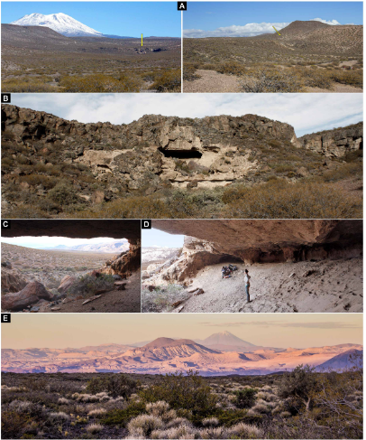
The majority of giant handaxes come from the Thames Valley or its southern tributaries, although examples are also known from Norfolk Yare, the Axe Valley and Solent River deposits. The majority of sites where they are found are close to primary chalk-flint outcrops, where large flint nodules were available. However, some were found in flint-poor areas, such as Wolvercote and Stanton Harcourt in Oxfordshire, whereas older archaeological sites, such as Boxgrove in West Sussex, and Elveden in Suffolk, are located near excellent sources of large flint nodules, but yield no giant handaxes. 

No giant handaxes available from Stoke Newington in London, one of the UK's best MIS 9 sites, although it is known that the site did yield such axes; as the original excavator of the site, Victorian archaeologist Worthington Smith, illustrated several giant handaxes in his book, Man, the primeval savage, but then gave these away to distinguished visitors to the site; these axes are thought to be either in private collections or lost. 

Geological map displaying the locations of sites with giant handaxes in relation to underlying bedrock geology, coloured as per the British Geological Society scheme. Colours for chalk bedrock are highlighted in the legend. Note that large clasts in overlying superficial deposits largely reflect local geology and ‘exotic’ raw materials would generally be smaller in size. Dale et al. (2024).

Of the forty two giant handaxes in the study, thirty five (or 83%) are pointed, typically conforming to the lanceolate (lance-shaped) or ficron (having a pointed planform shape with biconcave edges) type. These shapes are considered to be part of the same typological grouping as chisel-ended cleavers, a grouping which is thought by many archaeologists to be restricted to MIS 9. Although ficrons are associated with giant axes, not all ficron handaxes are giant; known ficrons range in size from 63 mm to 307 mm.

Examples of giant pointed and ficron handaxes: (A) the ‘Beast of Biddenham’ (length 253 mm); (B) a giant ficron from Canterbury West (length 285mm) (photographs courtesy of the British Museum (A) and The Seaside Museum, Herne Bay (B)). Dale et al. (2024).

Since the overwhelming majority of the giant axes date from MIS 9, Dale et al. examined axes from this stage for their symmetry. Handaxes from this interval were found to vary a great deal in their degree of symmetry, although there was a direct corelation between axe length and symetry, with longer axes tending to be more symmetrical than shorter ones. 

Splitting the axes into groups based upon their size emphasised this trend, with axes in larger categories being more symmetrical than those in smaller size categories. Examination of earlier axes suggested that this tendency for larger axes to be more symmetrical was also present in MIS 11, but not MIS 15 or 13, although the number of axes available from the earlier periods makes this result less reliable. 

However, this tendency for larger axes to be more symmetrical in MIS 11 and 9 deposits may be influenced by another trend, which is for axes in general to be much more symmetrical in MIS 13 and 11, compared to other periods, and in particular to MIS 9. Thus, the increased symmetry seen in the large MIS 9 axes is balanced by a decrease in the symmetry seen in smaller axes, with the smallest axes (less thn 100 mm in length) tending to be roughly and quickly made, with very low symmetry. 

Giant handaxes are often cited as a key feature of Hominin cognitive and cultural development. Dale et al.'s study demonstrates that these items became prevalent in Britain during MIS 9, i.e. immediately prior to the Lower-Middle Palaeolithic transition, 300 000 and 250 000 years ago. This interval has already been identified as one of significant technological innovation, beginning with a non-handaxe phase, which was then followed by a period with handaxes, then a final phase in which a hierachical core-working technology, known as the proto-Levallois was introduced. The linking of giant handaxes to this stage adds another element to this increasing cultural complexity.

The presence of giant handaxes is often independent of the availability of suitable manufacturing materials, with giant handaxes known from areas of Oxfordshire where there are no sources of suitable large flints. This implies that either the raw material or the finished axes were transported for at least 25-40 km to the sites where they were found. This phenomenon has also been observed in France, with a giant handaxe found at Caune de l’Arago in Pyrénées-Orientales Department, more than 30 km from any suitable source of material. This transportation of materials is another new innovation from this phase, with most previous Lower Palaeolithic sites using stone sourced less than 5 km from the location where it was discovered. The increased effort being put into moving giant axes to locations away from the materials from which they were made lends further support to the hypothesis that these were valuable items, although another possibility is that these tools had a long working life, and were subject to regular reworking to maintain a sharp edge, which would explain the plano-convex form of many handaxes, including those at Wolvercote in Oxfordshire. Under this hypothesis, many large handaxes would have been discarded prematurely, before being extensively reduced.

Many of the giant handaxes are ficrons, a type of axe otherwise rare in Britain. Large ficrons are particularly striking objects, apparently crafted with care to maintain the length of the axe while reducing the width of the upper and central portions of the axe. This may have been a way to correct for a lack of symmetry in the original platform (the rock from which the ficron was made), or a sign of the tool having an extended lifespan, with regular resharpening. Another hypothesis is that the width reduction may have been a way to reduce the weight of the tool part of a general Acheulian trend for longer tools to be narrower. The alternative is that the ficron-shape was desired from the outset, and that the extra effort put into producing an axe of this shape is an indicator of the significance of the object to the people who made it. Whatever the truth, there does appear to be a link between the high symetry, large size, and unusual shape of these giant ficrons which appears to show a degree of artistry transcending the merely functional.

It has often been speculated that giant handaxes had no practical function, but experimentation has shown that examples far larger than anything found in Britain can be used as tools. Even the largest giant axes can be used two handed, can be used for digging, or can be used as static cutting tools across which materials could be drawn. Despite this possible functionality, all the British giant handaxes are distinctively formed and highly symmetrical, making it hard to believe that aesthetic considerations played no part in their manufacture. 

The oldest known giant axe is 1.6 million years old, and came from the Olduvai FLK West site in Tanzania. This is long before anything else considered to be even possibly an expression of communal artistic standards, and therefore was presumably made by an individual for reasons that were important to them alone. A more communal approach to aesthetics begins to appear about 500 000 years ago, at which point tools also being to appear which have been shaped to make the most of features such as fossils on the rock cortex. Giant handaxes may also represent an aesthetic development, with the size and symmetry of stone tools being increased to create visually pleasing objects. This implies the people who made these tools were capable in taking pleasure in creating such objects, which would imply an increasing level of cognitive and social development.

Giant handaxes may also have had some symbolic purpose. The manufacture and then apparent discarding of objects which take a degree of forward planning and labour investment may have been a way of marking territory, or signposting important locations to other members of the community.

The ability to produce giant handaxes clearly predates MIS 9; they are known from earlier in the Lower Palaeolithic and across the Acheulean world. A 300 mm-long lanceolate giant handaxe from Caune de l’Arago is thought to date from MIS 14, and other examples from across northern France, at sites including St Acheul and Thennes in the Somme Valley, Vaudricourt in Pas-de-Calais, and Montguillain in Oise Department, have variously been dated to MIS 11 and 9, although none of these dates are considered to be particularly secure. Giant handaxes are also known from the Levant and Middle East, though these tend to be less accurately dated. A 220 mm long example from Qesem Cave in Israel is thought to be between 420 000 and 200 000 years old, while a 265 mm-long basalt handaxe was found at Wadi Dabsa in Saudi Arabia. A site at Porto Maior in north-west Spain was occupied for a long interval across MIS 8-7, by a people of apparent African affinities, who regularly produced giant handaxes, picks and cleavers. Giant handaxes have been found at 23 sites across Africa, including Olduvai in Tanzania, where the largest such axe is 330 mm long and 1.4 million years old, Isenya in Kenya, where the largest axe is 253 mm long and 700 000 years old, and Kalambo Falls in Zambia, where the largest axe is 350 mm long and 300 years old. However, the African Acheulian, with which many sites in southern Europe and the Middle East are also associated, has a greater emphasis on large cleavers, picks, and handaxes, together referred to as 'large cutting tools'.

The MIS 9 giant handaxes from Britain appear to show a different phenomenon, a discrete technological interval in which larger, more symmetrical tools suddenly appeared. In France, the MIS 9 sites in the Somme Valley are the closest available to compare, with the Cagny l’Epinette locality producing 33 handaxes, the largest of which is still less than 170 mm in length, while the Revelles site has produced 52 handaxes, none more that 190 mm long. Ferme de l’Epinette, a MIS 10 site in the Somme Valley has produced 31 handaxes, all less than 180 mm long, while the MIS 9 stage of the Soucy complex in the Paris Basin has produced 178 handaxes, the largest of which are 155 mm long, and no handaxe from the entire complex exceeds 180 mm. The Orgnac Cave site in the Ardèche Department has a sequence of archaeological layers running from MIS 10 to MIS 8, but has produced no handaxes more than 200 mm in length. The MIS 9 layers at Menez-Dregan in Brittany have produced 29 handaxes, all less than 160 mm in length, although this may be because the tools are made from sandstone and microgranite beach pebbles which would not lend themselves to making bigger tools. This lack of large rocks for use as a source of tools may also account for the generally small handaxes found at Atapuerca in Spain.

Thus the production of giant handaxes in Britain appears to be a geographically, as well as chronologically, restricted phenomenon. This fits in with a more modern understanding of the Acheulian Culture, which includes many such small-scale variations, rather than being a single long-lived and widespread monoculture, as was once perceived. 

See also...

Thursday, 22 February 2024

The oldest known rock art in Patagonia, and what it tells us about the people who made it.

Patagonia lies at the southern tip of the Americas, and was one of the last areas to have been settled by Humans, who did not arrive there until the end of the Pleistocene. The area has a unique environment, which would have presented challenges to the people settling there. It also has a climate particularly suitable for the preservation of archaeological remains, making it particularly interesting to archaeologists. The area has extensive rock art, but to date little of this has been accurately dated.

In a paper published in the journal Science Advances on 14 February 2024, Guadalupe Romero Villanueva of the Instituto Nacional de Antropología y Pensamiento LatinoamericanoMarcela Sepúlveda of the Department of Social Sciences at the Universidad de Tarapacá, José Cárcamo-Vega of the Laboratorio de Espectroscopía Vibracional at the Universidad de ChileAlexander Cherkinsky of the Center for Applied Isotope Studies at the University of GeorgiaMaría Eugenia de Porras of the Instituto Argentino de Nivología, Glaciología  y  Ciencias  Ambientales, and Ramiro Barberena of the Centro de Investigación, Innovación y Creación at the Universidad Católica de Temuco, and the Instituto Interdisciplinario  de  Ciencias Básicas at the Universidad Nacional de Cuyo, present dates for four pieces of rock art from the Cueva Huenul 1 archaeological site in Neuquén Province, in the northern part of Argentinian Patagonia, and discuss the implications of this for the early peopling of the region.

The Cueva Huenul 1 archaeological site is located a kilometre above sealevel, to the east of the Andes amid the inland deserts of northern Patagonia. The Andes present a major topographic barrier, preventing the prevailing westerly winds from carrying moisture from the Pacific to the South American Arid Diagonal, where the Cueva Huenul 1 site is located. Precipitation in the region is between 150 mm and 200 mm each year, 75% of which falls in the winter. Rainfall tends to be higher in the west, closer to the Andes, and dryer to the east. with more abundant vegetation in areas with higher rainfall.

Location  of  Cueva Huenul 1,  other  sites  with  rock  art  in  northern  Neuquén  Province (Argentina),  and  palaeoecological  sites  from  northwestern  Patagonia. María Eugenia de Porras in Villanueva et al. (2024).

The Cueva Huenul 1 site is a cave with a habitable area of 620 m³, formed by the erosion of ignimbrites of the Tilhué Formation beneath an overlying basalt layer of the El Puente Formation, which have not eroded and now form the ceiling of the cave. Excavations within this cave have produced over 5500  lithic artifacts, principally flaked stone objects, and 8800 bone specimens, mostly Guanaco, Lama guanicoe. The site also has a long, and well-defined dating sequence, spanning 12 000 years, with a number of discrete phases of activity identified. The microenvironment within the cave appears to have remained stable and dry over this period, allowing for the excellent preservation of items such as Animal dung, and plant remains. 

Cueva Huenul 1 environment and landscape. (A) emplacement of Cueva Huenul 1 (yellow arrow) in a volcanic landscape within the Monte desert. (B) to( D) Views of the cave’s geology and topography. (E) View from Cueva Huenul 1 of the volcanic landscape of northwestern Patagonia. Guadalupe Romero Villanueva in Villanueva et al. (2024).

Notably, the Cueva Huenul 1 site has yielded a remarkable quantity of art-related materials, including  perforated  shell  beads, decorated Guanaco bones, and pyro- engraved  gourds. Also found inside the cave was a pit-structure containing a large number of twigs from the desert shrub Senna  aphylla, which have been stained with red ochre. A large amount of pigments, of various colours and in varying states of preparation.

Cueva Huenul 1 site plan and special findings. (A) excavation units at ch1. (B and C) General and detailed view of pit structure filled with vegetal remains of Senna  aphylla stained with red ochre. (D) Pyro-engraved gourd. (E) Perforated shell bead. (F) decorated guanaco (Lama guanicoe) bone. (G) Pigments. each image has an individual metric scale. Guadalupe Romero Villanueva and Ramiro Barberena in Villanueva et al. (2024).

The site has a panoramic view of the surrounding landscape, although it is not visible from any other known archaeological site in the region, nor can any such site be seen from the cave. Other sites in the region include a series of smaller caves and rockshelters, most of which only appear to have been used within the last 2000 years. Some of these, such as El Ciénego and Paso de las Tropas, also have rock art, although it is less diverse in technical style and less formalised than the art at Cueva Huenul 1. The Cueva Yagui site, to the north of Cueva Huenul 1, also records a long timeline, in this case about 8 500 years, and appears to have been more intensely occupied, on the basis of stone tools, abundant ceramics, and faunal remains, with this occupation being particularly intense over the past 2000 years. Both the stratigraphic sequences and the styles of rock art suggest that Cueva Huenul 1, Cueva Yagui, and other sites appear to have been linked.

Cueva Huenul 1 hosts one of the most impressive collections of rock art in northwestern Patagonia, with central portion of the cave’s internal wall and part of the ceiling covered by 895 discrete pieces of rock art, which have been grouped into 466 identifiable motifs. Most of these motifs are geometric shapes rather than pictures, with strokes, dots, circles, and lines being common, and parallel lines, reticulates, polygons, and cruciforms also present, as well as some Human silhouettes and a face, and silhouettes of Guanaco and Choique, Rhea pennata, and some representations of dynamic group  activities. A range of colours are used in the cave art, although a haematite-derived red is the most common, along with different hues of white, yellow, and black.

Examples of the rock art of Cueva Huenul 1. Each tracing has a 10cm scale bar. Guadalupe Romero Villanueva in Villanueva et al. (2024).

A large number of motifs are superimposed over earlier artworks, and there appear to be three distinct degrees of weathering, as well as distinct artistic phases. The majority of the art is presumed to be of Late Holocene origin, based upon similarities to styles of art used at other localities. However, the long history of occupation at the site combined with presence of a clear artistic sequence, raises the possibility that some art at the site may be much older.

Four artworks at the Cueva Huenul 1 site were chosen to be dated. These were all classified as 'comb-shapes' based upon a shared basic morphology of a perpendicular horizontal line with several parallel vertical lines extending downwards from it. Within this simple pattern, however, the comb motifs can be divided into simple and complex forms. Three of the motifs examined, UT3- M48, UT5- S4- M7, and UT3- M37, were of the simple type, while the fourth, UT5-S2-M19, was of the complex form. All of the comb motifs are executed in a reddish black pigment. Most are isolated from other artworks, although one (UT5-S2-M19) is part of a complex series of superimposed images from different periods. 

Dated rock art paintings from Cueva Huenul 1. (A) Motif Ut3- M37. (B) Motif Ut3- M48. (C) Motif Ut5- S4- M7. Guadalupe Romero Villanueva in Villanueva et al. (2024).

By careful examination of the motifs, Villanueva et al. were able to establish that there was no potentially contaminating organic matter  either  on,  within,  or  below  the  paint  layer. Three layers were found to be present, the bedrock, the pigment layer, and an overlying layer of translucent particles forming a patina. The pigment layer was identified spectrographically as amorphous carbon; this was found not to contain any significant amount of phosphates, making it unlikely it was derived from carbonized bone.

Dated rock art motif UT5- S2- M19 from Cueva Huenul 1. (A) Original photograph and digital enhancement with DStretch of the complete rock art panel. (B) Original photograph and digital enhancement with DStretch of the dated black comb-shaped motif. (C) digital tracing of the complete rock art panel showing the dated black comb-shaped motif underlaying a series of superimpositions. Guadalupe Romero Villanueva in Villanueva et al. (2024).

Further examination of the samples by Scanning Electron Microscopy and Energy Dispersive X-Ray Analysis demonstrated the presence of plant cells within the pigment layer of all four examined motifs, as well as a composition consistent with a carbonaceous material mixed into an aluminosilicate matrix (i.e. a mixture of charcoal and clay), with the overlying layer of material rich in calcium and sulphur, probably indicating some form of salt. The precise origin of the wood used to make the charcoal was impossible to determine, although it is likely to have been one of the woody shrubs known to have been growing in the region in the Middle Holocene, such as Prosopis spp., Larrea sp., or Schinus sp..

Cross section microphotography of sample CH1-AMS1 embedded in resin showing three differentiated layers. From the bottom, the layers which can be distinguished are; the bedrock support, the black pictorial layer, and a thin layer of patina or varnish. Marcela Sepúlveda and Guadalupe Romero Villanueva in Villanueva et al. (2024).

Based upon this, Villanueva et al. conclude that the black pigment was formed by the incomplete burning of Plant matter, something which should lead a carbon¹⁴ signature. Since there are no long-lived trees in the region, material from which can give misleading date information, the charcoal can be assumed to have come from a short-lived woody C₃ shrub and/or a Cactus (which have their own Crassulacean acid metabolism resulting in a distinctive carbon isotope signature). It was possible to recover sufficient carbon from three of the motifs to be confident that the isotope signature recovered was accurate, while one sample, taken from motif UT5-S2-M19, yielded a much lower amount of carbon, raising concerns that contamination from later sources (this is the motif which is partially overlain by later artworks), leading to this data being excluded from the remainder of the study. The remaining three motifs were found to be between 7728 and 7565 years old (UT3- M48), between 6271 and 6239 years old (UT5- S4- M7), and between 5643 and 5629 years old (UT3- M37).

As well as the dates obtained for the rock art motifs, Villanueva et al. obtained 16 dates from archaeological remains at the site, in order to build up a stratigraphic sequence. This led them to conclude that there had been four stages of occupation at the site, over a period of about 18 000 years. 

The first phase is calculated to have lasted approximately 4683 years, from about 17 407 to about 12 934 years before the present. During this phase the cave was occupied by Giant Sloths, with no signs of Human activity. 

The second phase is calculated to have lasted approximately 1620 years, from about 11 721 to about 10 162 years before the present, and shows evidence of the first Human activity in the area, including Guanaco bones with cut marks, hearths with charcoal, and a grass bedding structure. 

There is then a significant hiatus in activity, with the third phase starting about 8171 years ago and lasting for approximately 3246 years, till about 5074 years before the present. This phase includes the emergence of rock art at the site, with all three dates obtained for the comb motifs falling within this interval, as well as the ochre covered Plant remains. Assuming that the average Human generation time was about 25 years, this would suggest a cultural tradition using similar symbolism which lasted for about 130 generations. 

The final phase of activity at the cave includes much more intensive activity, includuing the majority of the rock art, as well as cultural similarities to other sites in the region, and spans about 1500 years in the Late Holocene.

Climatically, the area had a sharper east-west variation in moisture during the Late Pleistocene and Early Holocene, until about 10 000 years ago, with the western Andes being wetter than today, while the eastern Andes were drier. The region to the east of the Andes, inclding the Cueva Huenul 1 site, was significantly more arid than today between about 10 400 and 9 400 years ago. From about 10 000 years ago onwards both the Andes and Eastern Patagonia became extremely arid.

The area reached peak aridity in the Middle Holocene, with widespread deserts and only patchy, fragmented areas of habitable land, which could have acted as stepping stones for the first Humans entering the environment. Large areas would have either too dry for occupation, or too unstable to be entered on more than a temporary basis. Nevertheless, Humans did enter the landscape during this time, probably relocating frequently, and needing to maintain social contact over large distances, while at the same time coming up with innovative technologies for subsistence.

By assembling a comprehensive database of radiocarbon dates for Human activity across the South American Arid Diagonal region, Villanueva et al. conclude that during the period 14 000 to 10 400 years before present the first Human population appeared and rapidly grew, expanding to occupy new niches. From about 10 800 to 7000 years ago a period of cultural stasis appeared, combined with a slowly declining population. The oldest rock art at Cueva Huenul 1 is slightly less that 8000 years old, coinciding with the later part of this period of apparent cultural stasis. The population is also thought to have remained fairly static or shrank across South America between about 9000 and about 5500 years ago. 

This suggests that during the Middle Holocene northwestern Patagonia was probably home to a small and scattered population of highly mobile hunter-gatherers, coping with an extremely arid climate with occasional wetter spells. This population was static or shrinking slightly, widely scattered, and having to cope with frequent but unpredictable extreme weather conditions.

The dating of the comb motifs in the rock art of Cueva Huenul 1 gives a date for the origins of rock art in northwestern Patagonia. The repeated nature of these motifs makes it unlikely that these marks were random, with similar marks being repeated several times over a period of about 3000 years, suggesting it was linked to a system for passing information between generations.

Transmission of knowledge can become linked to particular sites, which eventually become key locations for a culture, where people meet to re-enforce cultural identities and maintain extended social networks. Villanueva et al.  suggest that Cueva Huenul 1 first became such a culturally important site during the Late Pleistocene, being used regularly over a period of about 1400 years across the End Pleistocene and Early Holocene. Visits to the site continued into the Middle Holocene, though the behaviour of the visitors changed, with the appearance of activities such as marking the walls. During this phase, there is little sign of non-ritual activities, such as food-processing or tool-making. Villanueva et al. suggest that the transition of the space to a ritual centre where these profane activities were not carried out probably implies that the site was not, as previously assumed, abandoned for long periods during the Middle Holocene, but rather underwent a change of purpose connected to its new, sacred status. 

Villanueva et al. suggest the emergence of sites such as Cueva Huenul 1 which helped hold widely scattered cultures together would have been key to Human survival in the arid landscape of northwestern Patagonia. The emergence or rock art was probably a way of re-enforcing knowledge transfer across generations, building upon an earlier oral tradition. 

The population of many areas in South America apparently struggled to cope with conditions in the Middle Holocene, as increasing aridity fragmented the available liveable spaces, leading to a slowly dwindling population. The first rock art at Cueva Huenul 1 coincides with this period, possibly aiding social cohesion and helping  people to survive a particularly harsh period, before populations began to recover between 7000 and 5000 years ago. 

The dating of the rock art at Cueva Huenul 1 gives an insight into the context in which such art first appeared in Patagonia. Here, a style of art appears around 8000 years ago and persists for over 3000 years. This happened at a time when the climate was much drier and less predictable than today, at a time when Human populations were at best maintaining stasis, and were probably suffering frequent crashes. It this marginal, sparsely populated environment the rock art apparently helped to preserve collective knowledge across multiple generations. 

See also...